

Another Day of Gloom And Doom
Slow Improvement Comes Over the Memorial Day Holiday Weekend
It is another miserable day as low pressure sits south of Long Island and it is heading slowly east northeast, straddling the coastline along the way. Heavy rain over Central & Eastern Long Island, Eastern Connecticut and Southeastern New England will continue for awhile today. Lighter rain lies to the west in parts of New Jersey and Pennsylvania. We have some coastal flooding issues in and around New York City, Long Island and the Southern New England coast with tidal flooding at high tide.
SATELLITE WITH LIGHTNING STRIKES

WEATHER RADAR

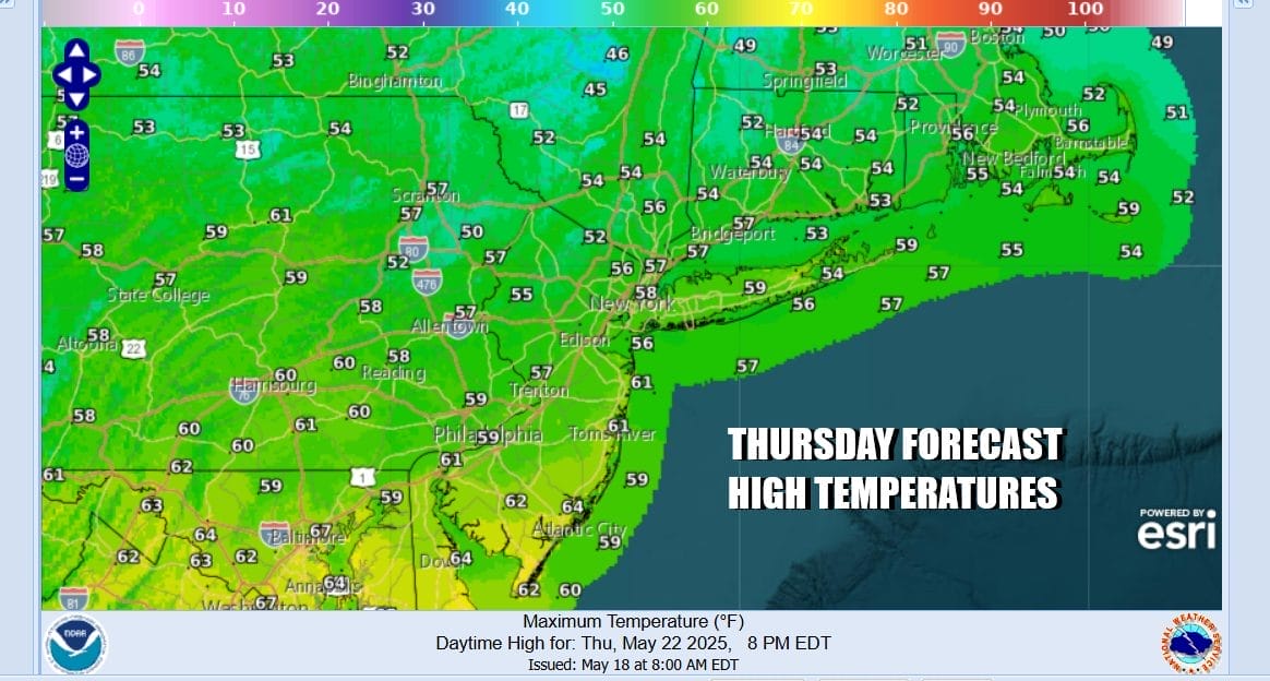
The east and northeast wind continues through the day and temperatures will not be getting much above the upper 40s and lower 50s all day. Rain will taper off from west to east later in the day and this evening but there will still be some light rain around overnight into Friday. Improvement is going to come slow as the storm center crawls its way to the Gulf of Maine and a cold upper trough remains over the Northeast US.
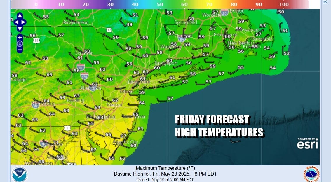
Lots of clouds continues over Eastern Pennsylvania to Southern New England Friday and there will be patchy areas of showers around. However there will be dry stretches too and some areas may not see much rain at all. Friday highs will be in the upper 50s and lower 60s. The trend to slow improvement will continue over the Memorial Day holiday weekend with clouds and some sun Saturday. There still could the risk for a passing scattered shower or two with highs reaching into the 60s.

There still could the risk for a passing scattered shower or two with highs reaching into the 60s. We will take things a little higher Sunday which could turn into a partly to mostly sunny day with little to no shower risk. Highs Sunday will be in the mid to upper 60s. Monday will be the best weather day of the three day weekend with sunshine for most of the day. Some clouds however could start to arrive from the southwest. Monday highs will reach back into the 70s in most places.
BE SURE TO DOWNLOAD THE FREE METEOROLOGIST JOE CIOFFI WEATHER APP &
ANGRY BEN’S FREE WEATHER APP “THE ANGRY WEATHERMAN!
MANY THANKS TO TROPICAL TIDBITS FOR THE USE OF MAPS
Please note that with regards to any severe weather, tropical storms, or hurricanes, should a storm be threatening, please consult your local National Weather Service office or your local government officials about what action you should be taking to protect life and property.


