
Another Cold March Day But
Temperatures Will Moderate Next Few Days

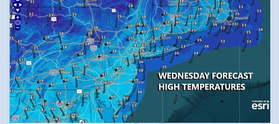
We hit bottom with this current cold air mass this morning as temperatures hit their lows in the upper teens to mid 20s across Eastern Pennsylvania to Southern New England. We can now move ahead to a day of sunshine and nothing more than some passing clouds as weak disturbances move along in the northwest flow aloft. One such disturbance in the Great Lakes and Ohio Valley weakens as it moves eastward and is of now real consequence. Temperatures this afternoon should be able to rise into the upper 30s and lower 40s in most places. Radars are nice and quiet and we expect to see no issues. Tonight should be a little less cold with nothing more than some passing clouds. Most lows Thursday morning will be in the 20s to around 30 degrees.
SATELLITE WITH LIGHTNING STRIKES

WEATHER RADAR

As often happens after a major storm we enter a period where adverse weather is minimal and that is the case over the next 7 days or so. We see no major weather systems, not just in the Eastern US but across the country weather will be on the quiet side. The northwest flow from Canada will bring several cold fronts through with one passing every 2 to 3 days or so. The first of these fronts approaches Friday.

There is little in the way of moisture available for tapping as moisture sources like the Atlantic Ocean for example are cut off. The only thing these weather fronts will do is produce a few showers when they go by with a minimal amount of precipitation being produced. We are talking minor inconveniences in an overall dry and mostly tranquil weather pattern going forward.
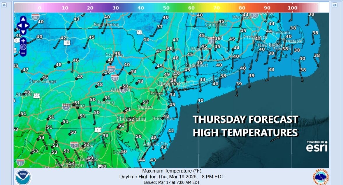
Thursday is Saint Joseph’s Day and it will be a mainly sunny day as temperatures recover to the upper 40s and lower 50s after a cold start. This is pretty much close to average for mid March. Friday we will see sunshine giving way to arriving clouds with high temperatures reaching the 50s just about everywhere. There is the chance for a few showers later Friday afternoon into the evening as a cold front passes.
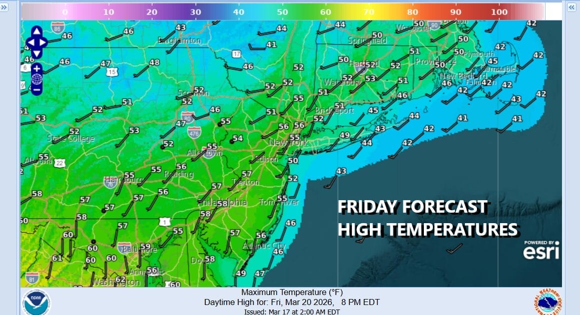
This isn’t much of a cold front that is moving through. The air behind it is actually warmer than the air ahead of it. Saturday we should see sunshine with highs reaching the 60s away from the ocean. Sunday we will see sun and arriving clouds with highs in the 60s again and the risk there could be a few showers late Sunday afternoon and evening. This will be followed by a cold air mass and below average temperatures for the start of next week. Again no major storms are on the horizon anytime soon.
BE SURE TO DOWNLOAD THE FREE METEOROLOGIST JOE CIOFFI WEATHER APP &
ANGRY BEN’S FREE WEATHER APP “THE ANGRY WEATHERMAN!
MANY THANKS TO TROPICAL TIDBITS FOR THE USE OF MAPS
Please note that with regards to any severe weather, tropical storms, or hurricanes, should a storm be threatening, please consult your local National Weather Service office or your local government officials about what action you should be taking to protect life and property.


