

USE THE COUPON CODE “summer2026” AND GET 10 PERCENT OFF ON ANY PURCHASE

Afternoon Showers Possible Rain Likely Friday
Plus The Weekend Outlook
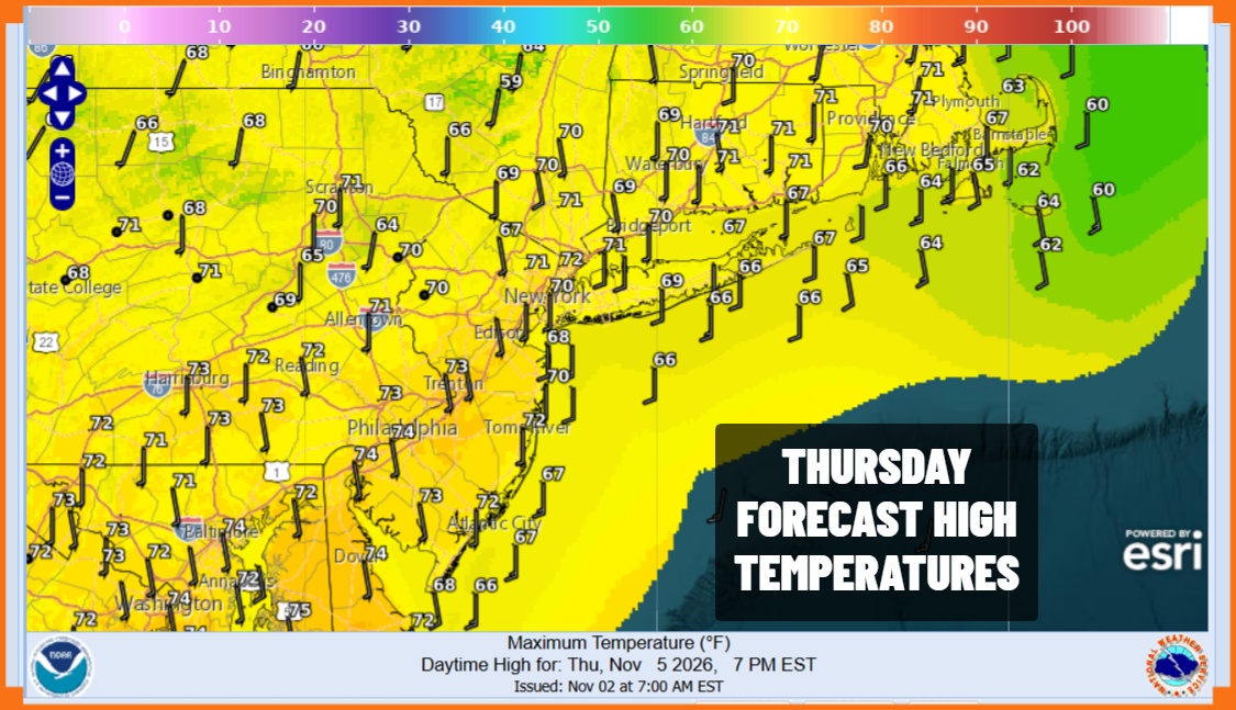
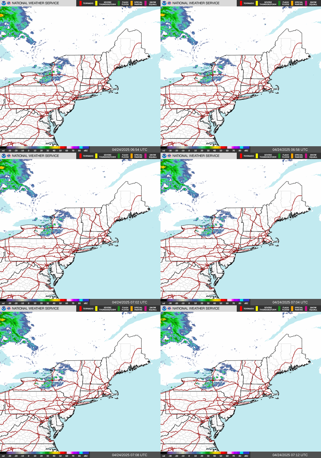
We have another warm day ahead of us but unlike yesterday which was a sunny warm fall day, this one will feature more cloud cover and muggy conditions. For the first time in nearly 3 weeks we have a cold front approaching that not only has clouds ahead of it but it actually has showers ahead of it as well. We are going to see those showers today though they will tend to be patchy as evident on the radar loops. Also the area will be weakening as it moves east so rainfall amounts today won’t amount to much. Highs this afternoon will be in the mostly in the lower 70s.
SATELLITE WITH LIGHTNING STRIKES

WEATHER RADAR
The front stalls tonight just offshore and we will see a series of waves develop on the front until one wave becomes the dominant player. Rain will probably stop this evening but then redevelop overnight into Friday. However note that the area of rain is shaped like a stick and is quite narrow. This means the further north and west you go from the immediate coast, rainfall will be less.
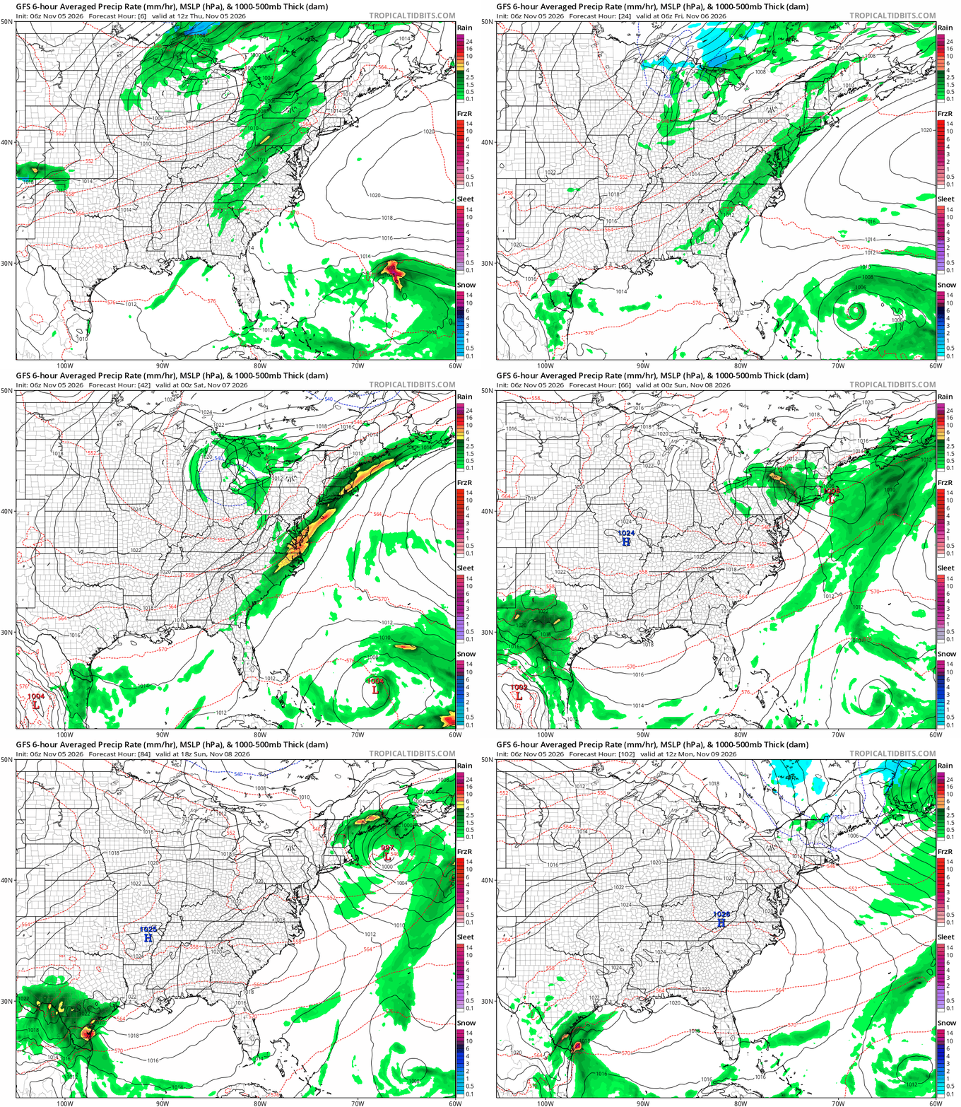
Once the offshore wave begins to organize the rain area will pull away to the east. Areas in Western New Jersey and points west probably don’t see much if any rain while Coastal New Jersey, Long Island, Southern Connecticut and points east could pick up an inch or two of rain with the heaviest rain in the most eastern points of this zone.
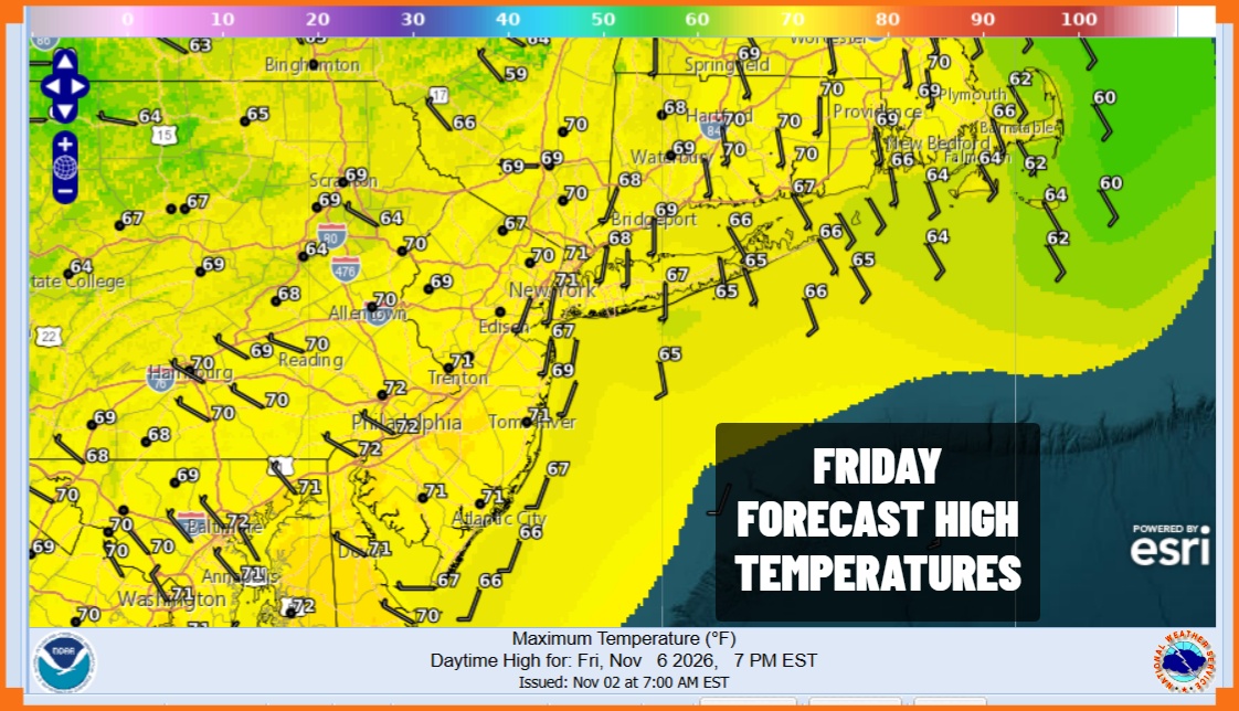
Friday temperatures will be in the 60s to near 70 degrees. While most of the rain will be ending from west to east Friday evening we will have lots of leftover clouds around through Saturday. An upper low in Upstate New York will move southeast so there will be the risk for showers, mainly from Northern New Jersey and New York City north and east. Saturday temperatures will be in the cooler lower 60s in most places. Sunday we see sunshine coming back but it will be cool with most highs in the upper 50s to around 60 degrees.
MANY THANKS TO TROPICAL TIDBITS FOR THE USE OF MAPS
Please note that with regards to any severe weather, tropical storms, or hurricanes, should a storm be threatening, please consult your local National Weather Service office or your local government officials about what action you should be taking to protect life and property.
