
A Week of Blue Skies & Sunshine, No Rain, Chilly Nights Pleasant Days
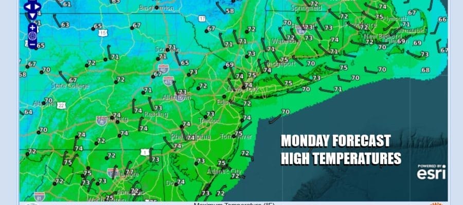
Autumn like conditions cover the Northeast and Mid Atlantic states and this new air mass will be with us through Wednesday. Satellite loops show mainly sunny skies with just some high clouds hanging around near the coast. This morning was a cool one with lows that bottomed this morning in the 40s inland and low to mid 50s at the coast. High temperatures will be mostly in the lower 70s this afternoon under mostly sunny skies. Radars are quiet and are enjoying a nice vacation that may last awhile.
SATELLITE WITH LIGHTNING STRIKES

WEATHER RADAR

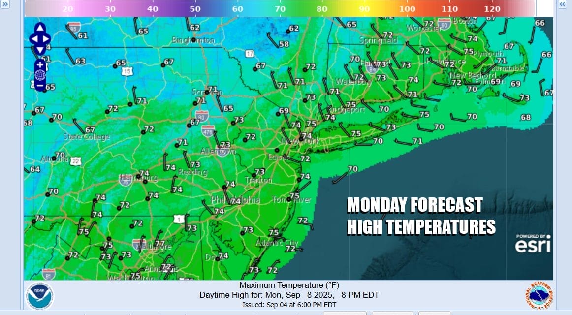
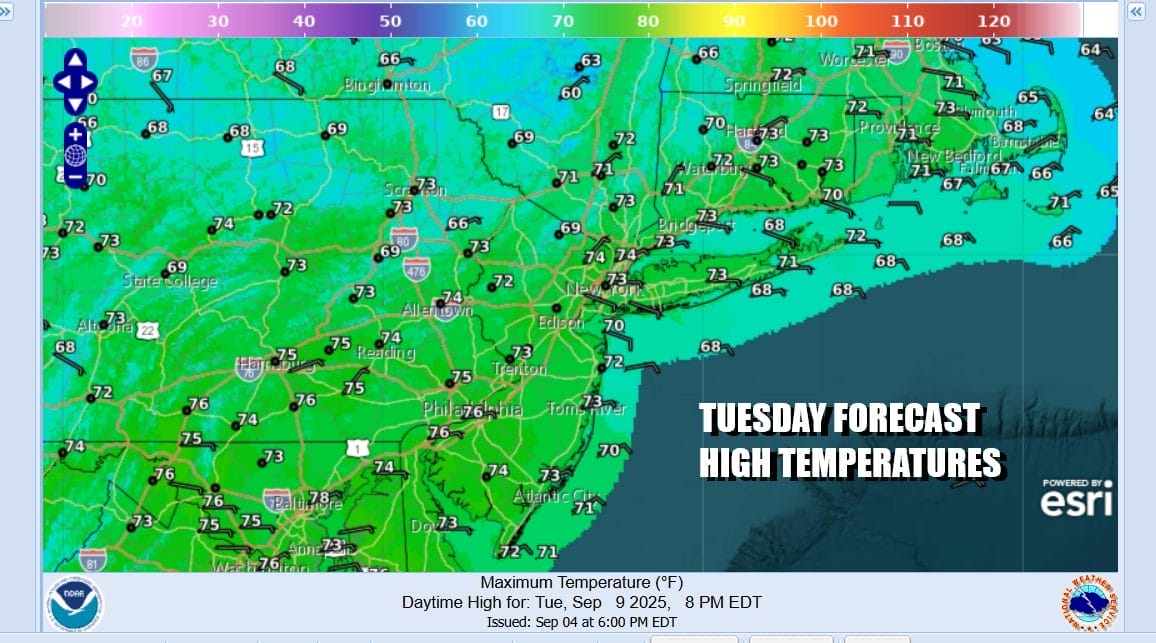
Tonight is going to be another night of clear skies and very cool conditions most lows away from warmer urban areas and the coast will be in the 40s. There might even be a few 30s in the coldest locations. Most coastal areas will be in the 50s. Tuesday will be mostly sunny with highs again in the lower 70s in most places followed by another Tuesday night into Wednesday with lows similar to Tuesday.
The old frontal boundary is sitting offshore and a wave is developing on that front that will head to the northeast offshore. However we could see some clouds thrown back in coastal areas Tuesday night and Wednesday and there is a low chance that some rain could come close. We will monitor this situation in case we have to adjust the forecast

If that wave becomes an issue then we could see a cloud-ish day Wednesday and temperatures near the coast will not get out of the 60s. Inland could be more of a mix of sun and clouds with high temperatures reaching the low and middle 70s. The European model keeps rain offshore while the GFS model brings some rain to the coast today. Again we will monitor this and adjust accordingly.

Thursday looks to be the one warm day this week with highs reaching the upper 70s to around 80 degrees or so. As one high moves out another one builds in the Eastern Canada so that will turn the winds northeast Friday and knock the temperatures down some. Skies both days will be partly to mostly sunny. Friday highs will be in the low to mid 70s with an ocean wind. The weekend should be dry through the daytime Sunday with the chance for showers Sunday night or Monday as a cold front approaches.
BE SURE TO DOWNLOAD THE FREE METEOROLOGIST JOE CIOFFI WEATHER APP \\\&
ANGRY BEN’S FREE WEATHER APP “THE ANGRY WEATHERMAN!
MANY THANKS TO TROPICAL TIDBITS FOR THE USE OF MAPS
Please note that with regards to any severe weather, tropical storms, or hurricanes, should a storm be threatening, please consult your local National Weather Service office or your local government officials about what action you should be taking to protect life and property.


