

USE THE COUPON CODE “summer2026” AND GET 10 PERCENT OFF ON ANY PURCHASE

Mostly Dry Labor Day Weekend Lower Humidity But Still Some Shower Risk
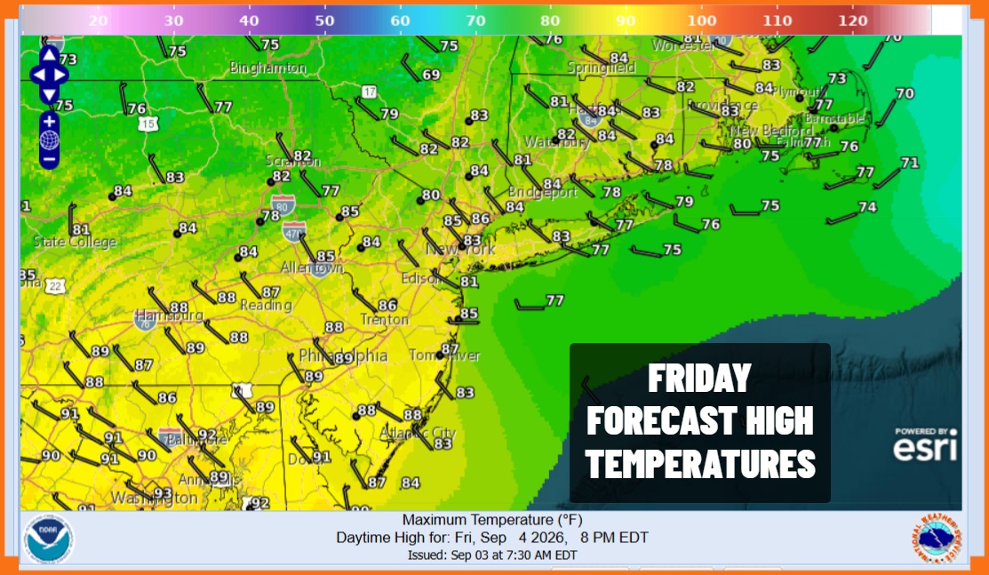
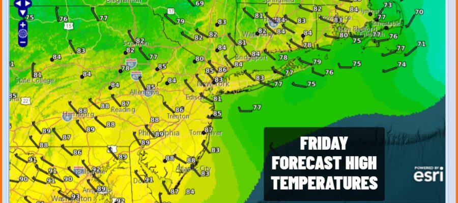
We had some thunderstorms move through overnight but they are now offshore and done. The good news is that we are going to start to see some changes today. Firstly the seemingly endless waves of thunderstorms and severe weather shifts well to the south across Maryland and Virginia today. The second thing is that we are going to see an upper air storm system shift to Atlantic Canada and that will begin a flow of drier air as winds turn more north. The drop in humidity will begin rather slowly today as we look for clouds and some sunshine. Central and South Jersey and points south could see a scattered shower or thunderstorm this afternoon and evening but from Northern New Jersey north and east we are not expecting any showers or storms today. Highs will be in the middle 80s in most places and closer to 90 degrees in South Jersey.
SATELLITE WITH LIGHTNING STRIKES

WEATHER RADAR

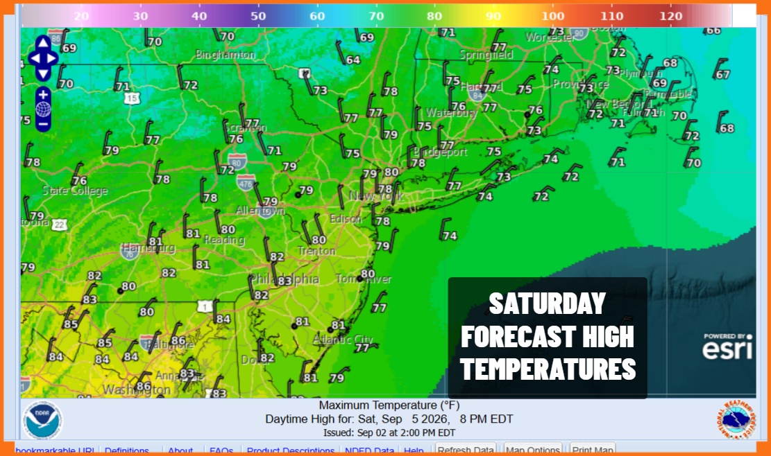
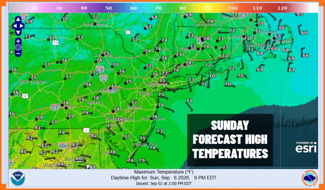
The trend of lower humiditorky will accelerate Saturday as northerly allow the dry air to sink southward. Dew points will drop nicely into the 50s except perhaps in South Jersey and Southern Pennsylvania where it might be closer to 60. We will see sunshine but we probably see clouds bubble up especially north and northeast of New York City. I can’t rule out the chance for a light instability shower. Highs will be in the upper 70s and lower 80s in most places. The same forecast holds for Sunday.
Monday Labor Day will be nice and sunny with no rain in the forecast. Highs again will be in the upper 70s to lower 80s. The next cold front is not likely to arrive until Thursday and it might come through dry. Humidity levels will come up some Wednesday into Thursday before another dry air mass takes over for next weekend. Overall we seem to be going into a drier less active pattern over the next couple of weeks. The tropics are utterly silent as we are in the most active period of hurricane season. So far so good. Have a great weekend.
MANY THANKS TO TROPICAL TIDBITS FOR THE USE OF MAPS
Please note that with regards to any severe weather, tropical storms, or hurricanes, should a storm be threatening, please consult your local National Weather Service office or your local government officials about what action you should be taking to protect life and property.
