

USE THE COUPON CODE “SPRING2026” AND GET 10 PERCENT OFF ON ANY PURCHASE

Weather Conditions Will Improve This Afternoon
Across Eastern Pennsylvania to Southern New England
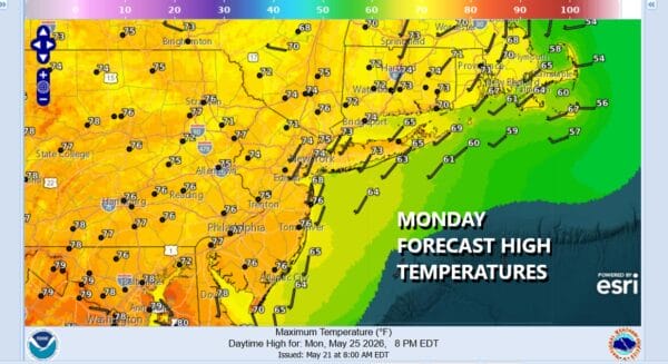
It is the final day of the Memorial Day holiday weekend which has been rather awful weatherwise. Two days of east wind, rain, and onshore flow with raw temperatures have now given way to a cold front and upper trough producing showers. However this front is moving along from west to east and we expect to see showers exit and weather conditions improving with decreasing clouds this afternoon and perhaps some sunshine breaking through. High temperatures today will reach the upper 60s and lower 70s. Satellite and radar loops show clouds and showers moving along from west to east.
SATELLITE WITH LIGHTNING STRIKES

WEATHER RADAR

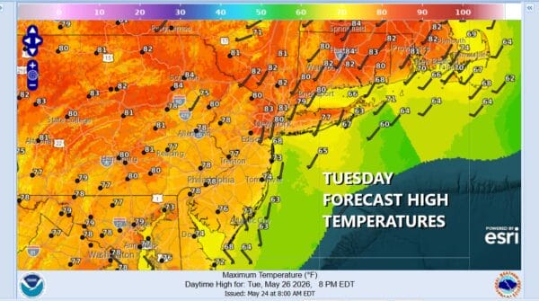
Of course with the weekend over weather conditions are bound to improve and skies should slowly partially clear tonight. Overnight lows will be in the mid 50s to inland and near 60 warmer urban areas and the coast. Weak high pressure builds in for Tuesday as rain shifts to the Mid Atlantic states and points south into the Southeast. Skies Tuesday will be no worse than partly sunny. Most highs will be in the upper 70s and lower 80s.
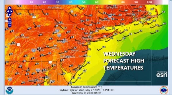
To east over Atlantic Canada strong low pressure aloft will develop and sit there for at least several days. This is going to create a northerly flow aloft, bringing a cold front southward. There won’t be much with the cold front other than some clouds and perhaps a few odd showers here in there. Otherwise Wednesday ahead of the front will be no worse than partly sunny. Most high temperatures will reach into the 80s.
We are likely to see slightly cooler and drier conditions for Thursday and Friday. Both days look to be no worse than partly sunny. There will be some issues with cold unstable air aloft so I will throw the chance for the odd inland shower Thursday and possibly Friday though I don’t think it makes too much of a difference. Thursday highs will be in the upper 70s and lower 80s. Friday highs will be mostly in the 70s. Another shot of cooler Canadian air will come from Eastern Canada next weekend.
