
USE THE COUPON CODE “SPRING2025” AND GET 10 PERCENT OFF ON ANY PURCHASE

Best Weather Day of the Week But
The Curse of the Onshore Flow Looms
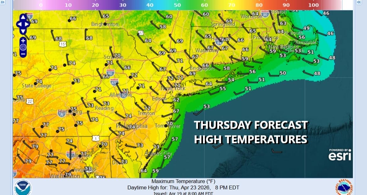
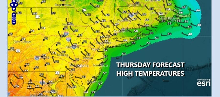
Today will go down as the best weather day of the week. Rain from yesterday is long gone. The cold from early in the week is gone too. This leaves us in a weak zone of high pressure, a mostly land based wind, and a good deal of sunshine. Most areas will see temperatures reach into the 70s this afternoon. The except will be the immediate coast where local sea breezes are going to develop. Radars are nice and quiet and we do not expect any rain today. However we do have a back door cold front that will pass this evening and that will bring in an ocean wind for the next few days. Lows Friday morning will be in the 40s inland and lower 50s in warmer urban locations.
SATELLITE WITH LIGHTNING STRIKES

WEATHER RADAR

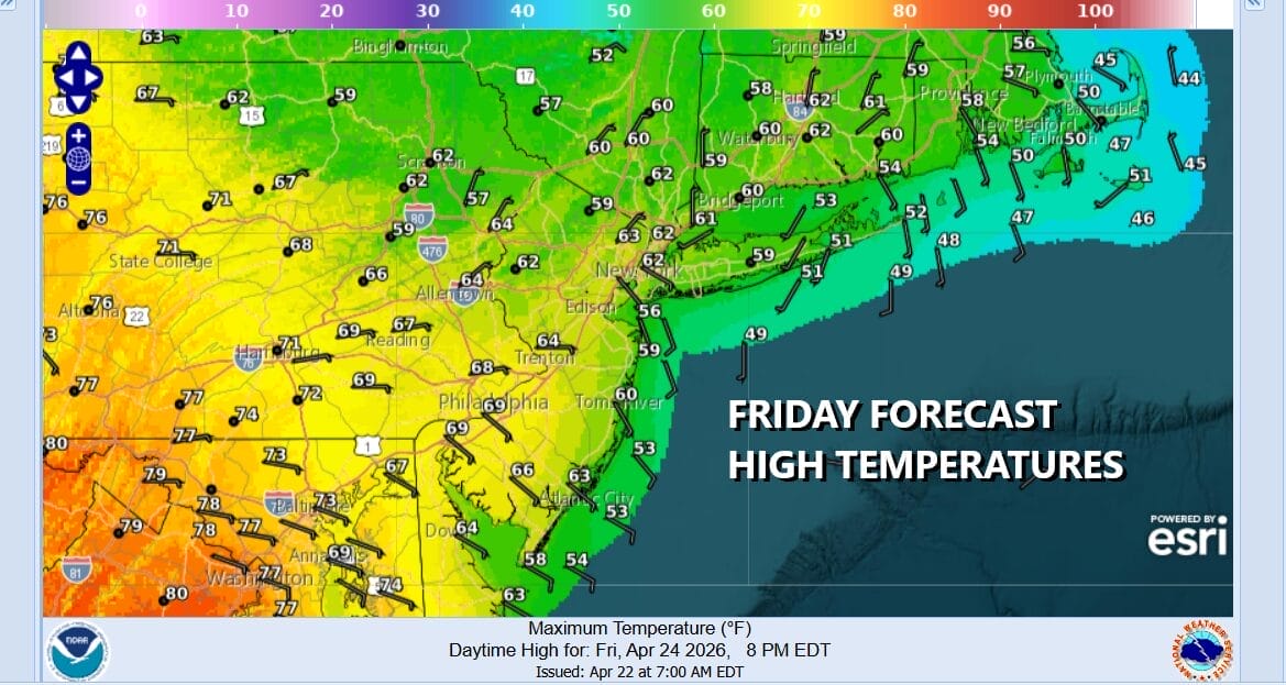
Friday is going to be a dry day but we will start to see some clouds developing as the cold front drops south and stalls just to our south. The flow will be more onshore so that means cooler temperatures than Thursday. Highs will be in the 50s along coastal counties and low to middle 60s inland. The curse of the onshore flow will begin to strengthen Friday night as low pressure develops on the frontal boundary.
The low will be tracking from Michigan to Northwest Pennsylvania and then head southeast to off the Delaware coast Saturday night. Rain will overspread the area Saturday morning and continue into Saturday night. It will make for a gloom and doom type of day with temperatures pretty much kept in check in the low to mid 50s area wide.

It appears that the rain area will pull out during the early morning hours Sunday from west to east. Three quarters of an inch to an inch or rain is possible. The issue for Sunday will be the onshore flow continuing and how long will it take for clouds to start thinning out. It may take much of the day for dry air to filter in so for now we will call Sunday mostly cloudy. Temperatures will be in the 50s to around 60 degrees for the highs. Next week brings two strong weather fronts with a chance for showers and maybe a thunderstorm late Tuesday into early Wednesday and another cold front with showers and possible thunderstorms Friday. In between the system we should see dry conditions with seasonal temperatures.
BE SURE TO DOWNLOAD THE FREE METEOROLOGIST JOE CIOFFI WEATHER APP &
ANGRY BEN’S FREE WEATHER APP “THE ANGRY WEATHERMAN!
MANY THANKS TO TROPICAL TIDBITS FOR THE USE OF MAPS
Please note that with regards to any severe weather, tropical storms, or hurricanes, should a storm be threatening, please consult your local National Weather Service office or your local government officials about what action you should be taking to protect life and property.


