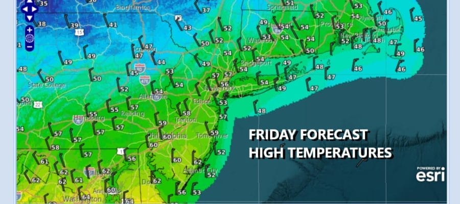

Slow Improvement As Cold Front Exits
Followed By A Chilly Weekend
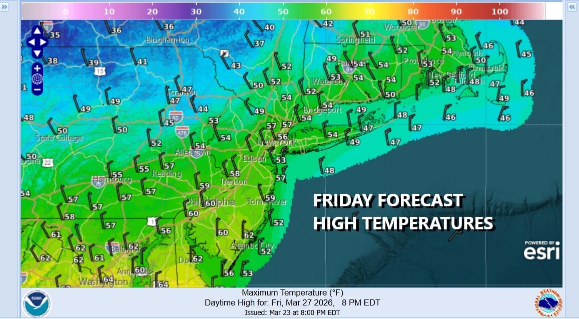
A cold front has passed through and is dropping southward through New Jersey and Pennsylvania, heading for Maryland and Virginia. The radar shows that the northern edge of the rain cuts off across Central New Jersey and we expect to see this rain area continue to shift southward. However as far as sky conditions are concerned, clouds will be a problem for awhile today as the loop is showing dry air to the north taking its time moving southward. Eventually it gets here in northern areas north of New York City later today and then in Southern New Jersey and points south sometime late in the afternoon or evening. Temperatures today will probably be in the 50s though we could see some 40s in areas to the north.
SATELLITE WITH LIGHTNING STRIKES

WEATHER RADAR

Colder dry air on gusty northwest winds arrives tonight and by Saturday morning we will be bottoming in the mid 20s to lower 30s. The weekend starts off with a cold breezy Saturday. Expect sunshine along with a few clouds. Temperatures however are going to have a tough time getting much above 40 to 45 degrees.

Another cold night follows under clear skies and less wind. Sunday morning lows again will be in the mid 20s to lower 30s. The core of this cold shot will move out Sunday and it will be a day where skies should be partly to mostly sunny all day long. However temperatures will be slow to recover. We should be able to make it into the 50s in most places. No rain issues are forecast for the entire weekend.

A warmer pattern overall will set up for next week but there will be some issues to contend with. Monday we will see sunshine giving way to arriving clouds. Temperatures will be back into the 60s away from the ocean. Then a warm front approaches with perhaps a few showers late Monday night into Tuesday morning followed by warmer air for later Tuesday and Wednesday. Another cold front will arrive with the risk for showers late Wednesday. There will likely be onshore flow and rain issues for late week ahead of Easter weekend.
BE SURE TO DOWNLOAD THE FREE METEOROLOGIST JOE CIOFFI WEATHER APP &
ANGRY BEN’S FREE WEATHER APP “THE ANGRY WEATHERMAN!
MANY THANKS TO TROPICAL TIDBITS FOR THE USE OF MAPS
Please note that with regards to any severe weather, tropical storms, or hurricanes, should a storm be threatening, please consult your local National Weather Service office or your local government officials about what action you should be taking to protect life and property.


