
Warmest Day of the Week Before Showers Arrive Tonight & Last Into At Least Part of Friday
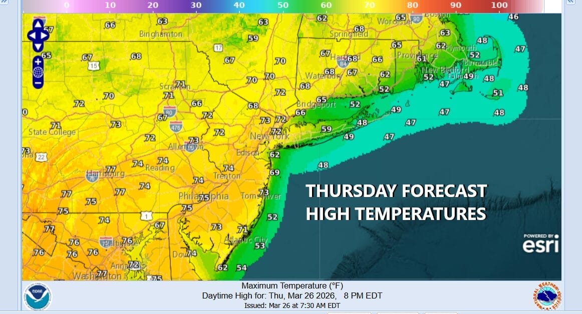
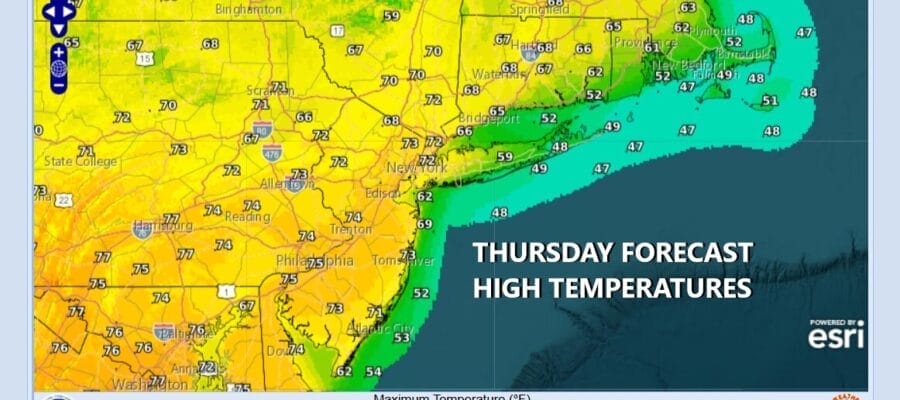
Warmer temperatures are in the cards today as a warm front has passed overnight and is now to the north and we have a southwest flow of warmer air ahead of an arriving cold front for tonight. The dayside today will be dry with sunshine giving way to arriving clouds later on as the front nears. High temperatures away from the ocean will be in the upper 60s and lower 70s but along the coast look for that ocean sea breeze to develop and that knocks coastal temperatures on south and east facing shorelines back into the 50s and even some 40s right on the beaches.
SATELLITE WITH LIGHTNING STRIKES

WEATHER RADAR

There is nothing close precipitation wise as what is in Southeastern New England exits. Late this afternoon and evening we will see showers developing in Upstate New York and across Pennsylvania. Severe thunderstorm risk will be west of Interstate 81 in Pennsylvania. Tonight we will get into some showers and a possible rumble or two of thunder as the front passes. Much of the rain will be done before daybreak.

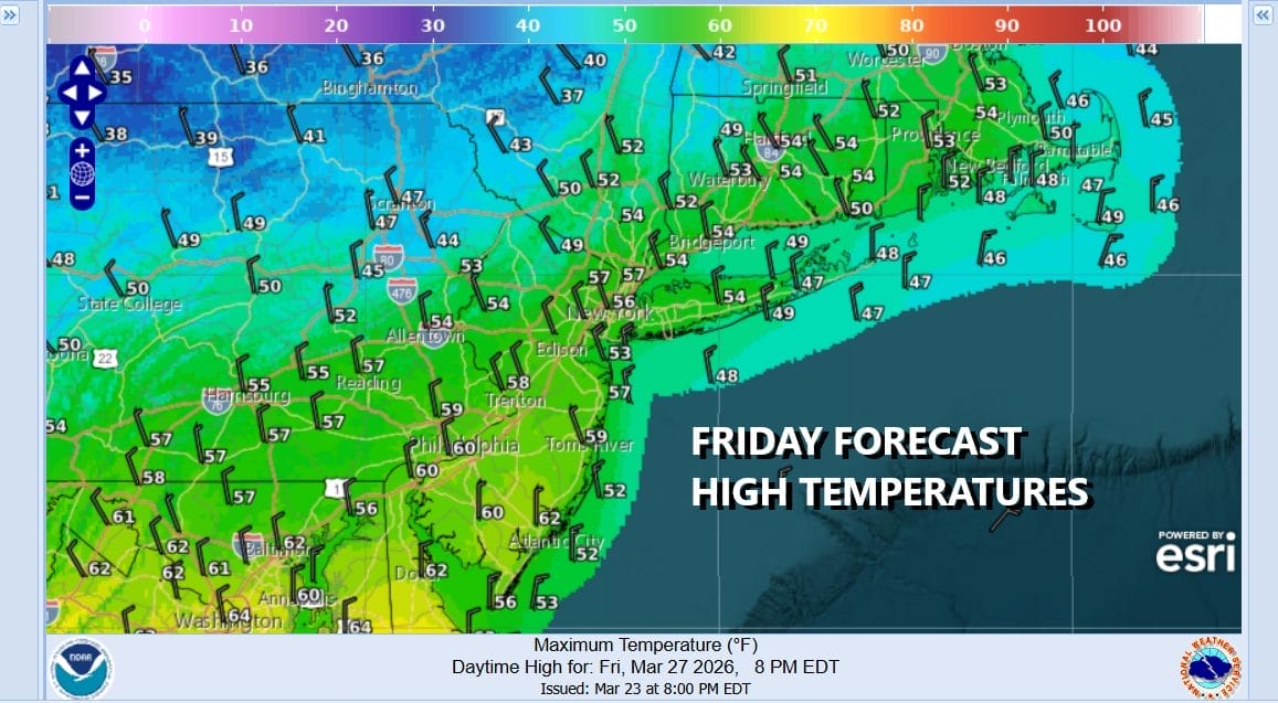
There could be some lingering rain in Central and South Jersey into the afternoon. Clearing of skies will be slow to occur though we might see it develop across Southeastern New York and Southern New England late in the day. We have to wait for a wave to develop on the front to take it out far enough east. Clouds and lingering temperatures will top in the 50s and colder air arrives later in the day Friday and Friday night.
By Saturday morning low temperatures will be in the mid 20s to lower 30s as skies clear Friday night. Saturday dayside will be a cold day. We will see some sunshine along with some instability clouds as an upper trough passes. Gusty winds will make highs in the low to mid 40s feel about 10 degrees colder.

Skies will clear Saturday night and once again by Sunday morning, lows will be in the mid 20s inland and lower 30s coast and warmer urban locations. Sunday we will see sunshine and it will be cold however temperatures should be able to nudge higher and reach the upper 40s to some lower 50s.

A warmer weather pattern develops next week with above average temperatures beginning Monday. Monday looks to be a dry day but a warm front could bring a few showers Monday night into early Tuesday. Wednesday we will see an approaching cold front and another round of showers and perhaps a thunderstorm or two late Wednesday and Wednesday night. Depending on wind direction and how much sun we see, we should at least see temperatures back into the 60s for highs beginning Monday.
BE SURE TO DOWNLOAD THE FREE METEOROLOGIST JOE CIOFFI WEATHER APP &
ANGRY BEN’S FREE WEATHER APP “THE ANGRY WEATHERMAN!
MANY THANKS TO TROPICAL TIDBITS FOR THE USE OF MAPS
Please note that with regards to any severe weather, tropical storms, or hurricanes, should a storm be threatening, please consult your local National Weather Service office or your local government officials about what action you should be taking to protect life and property.


