
Rain Ends Late Today With Some Snow In The Mix Fast Moving Weather Pattern Continues
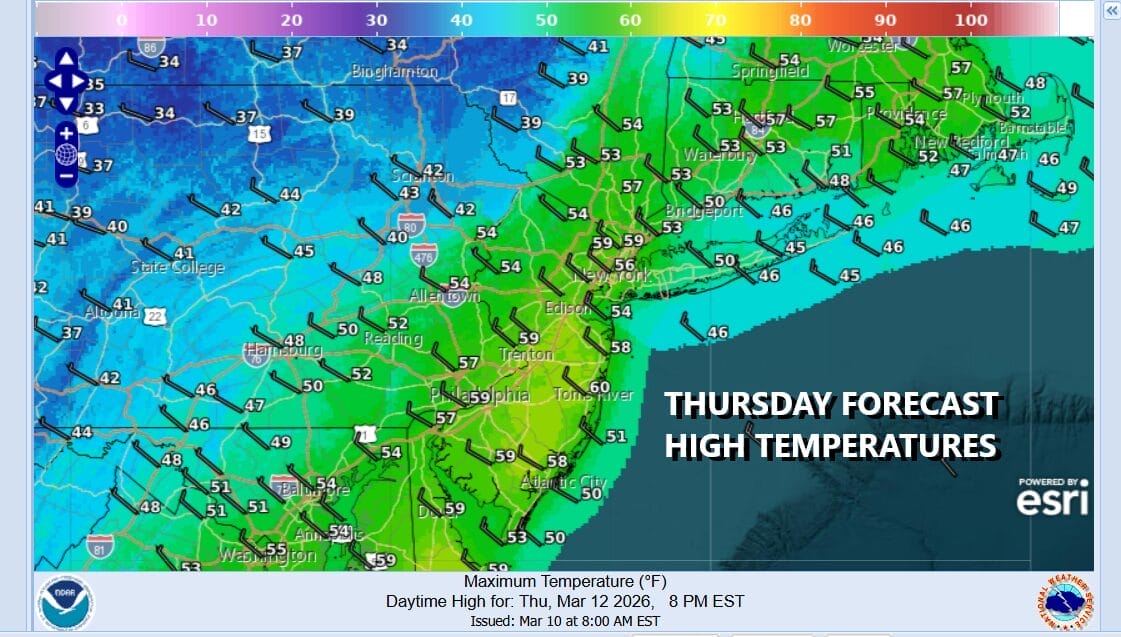
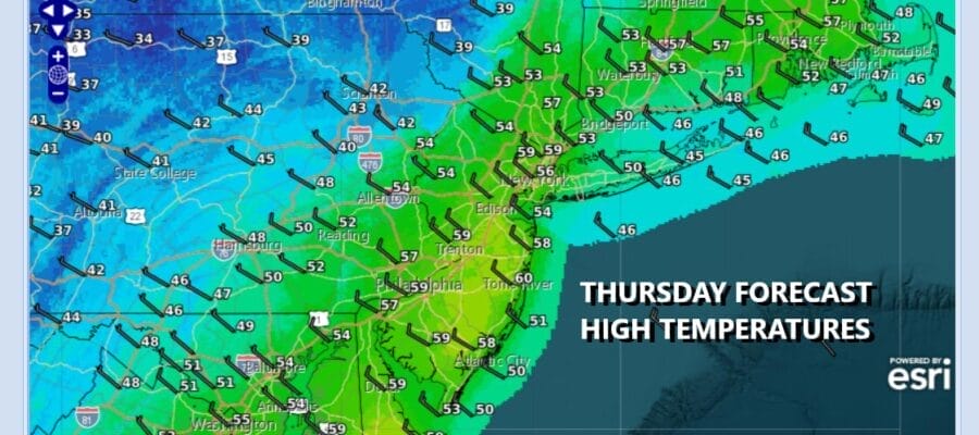
March is certainly know for volatile weather with wild swings from one end of the spectrum to the other. We are seeing such a swing today and Friday as a cold front passes. A wave will develop on the front today so we have more work to do as far as rain is concerned. There is colder air aloft and at the surface moving in so the highs of the day already have occurred and temperatures will fall to the upper 30s and lower 40s by late afternoon. Before the rain ends some areas could change over to some wet snow for a few hours but given the temperatures, accumulations are not going to be an issue.
SATELLITE WITH LIGHTNING STRIKES

WEATHER RADAR

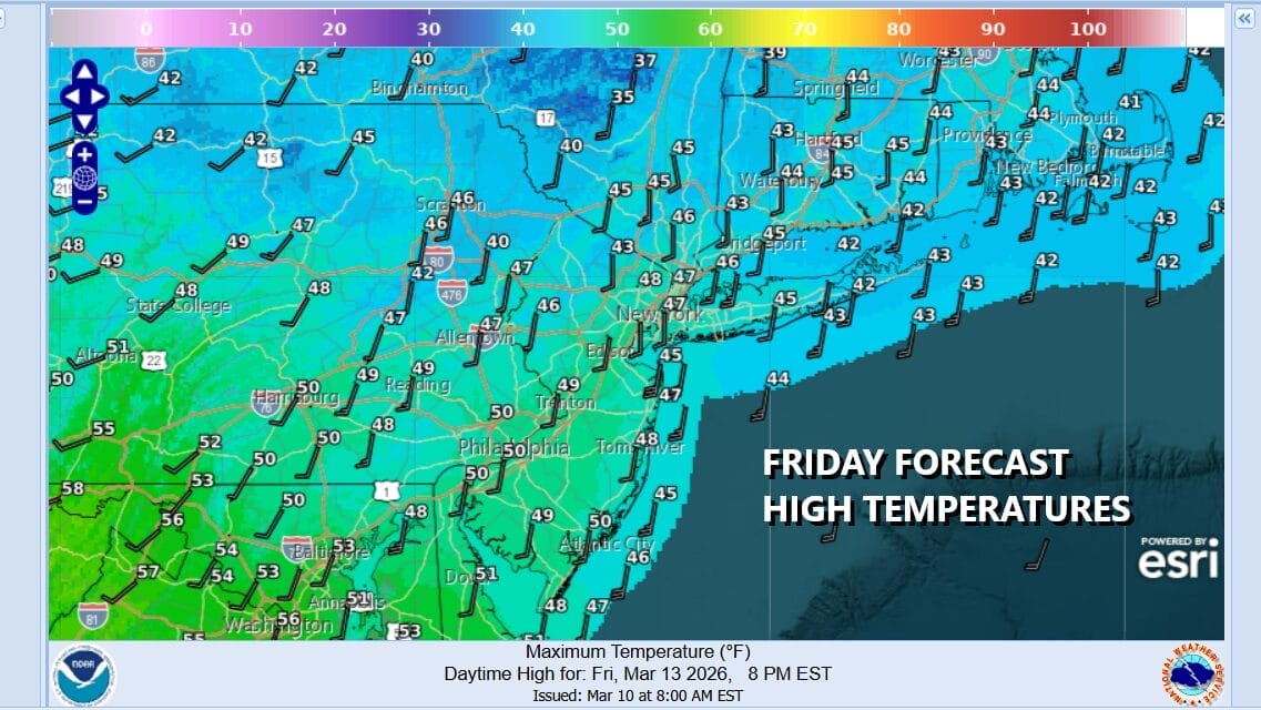
Once the rain ends (or whatever is falling) weather conditions will improve tonight as skies clear. Friday morning lows will be in the upper 20s and lower 30s. The next storm system moving across the Great Lakes will be moving quickly eastward so our winds go from northwest to south in a hurry Friday. Look for sunshine and some clouds with high temperatures mostly in the 40s.
The weekend will be split in two with Saturday being the better of the two. Low pressure moves across Southern Canada and a cold front passes Saturday with little fanfare other than a brief shower. Otherwise Saturday we will see clouds with some sun in the mix and highs will be back in the 50s.

Then after that system goes by, the next one develops in the Plains and heads to the Great Lakes and becomes a major storm Sunday night and Monday with a powerful cold front that will trail southward and sweep across the Eastern US. Expect clouds to develop with an increasing south wind. We think that the dayside Sunday will be mostly dry but showery rains and some thunderstorms will develop Sunday night and we will see showery rains and some thunderstorms Monday. Once the front passes, a very cold air mass will be coming in for Tuesday and Wednesday of next week with temperatures that will be running 10 to 15 degrees below average.
BE SURE TO DOWNLOAD THE FREE METEOROLOGIST JOE CIOFFI WEATHER APP &
ANGRY BEN’S FREE WEATHER APP “THE ANGRY WEATHERMAN!
MANY THANKS TO TROPICAL TIDBITS FOR THE USE OF MAPS
Please note that with regards to any severe weather, tropical storms, or hurricanes, should a storm be threatening, please consult your local National Weather Service office or your local government officials about what action you should be taking to protect life and property.


