
Coastal Storm Well Offshore But Gusty Winds
& Cold Temperatures Into Monday
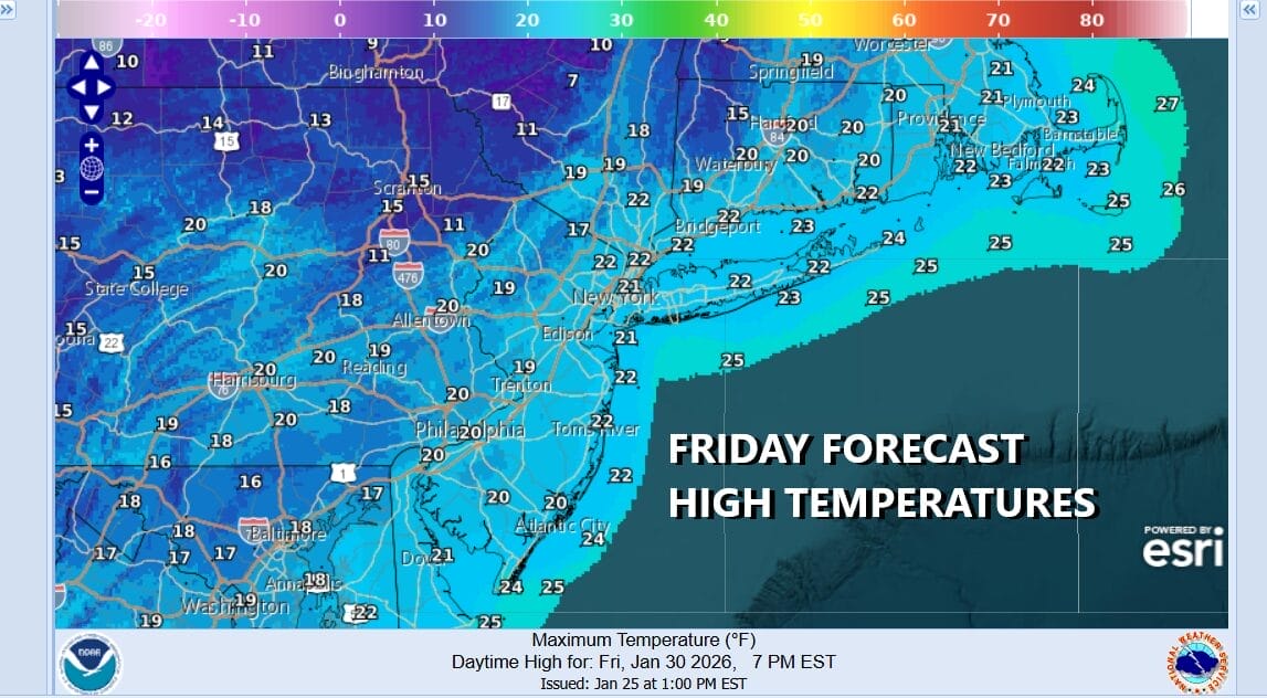
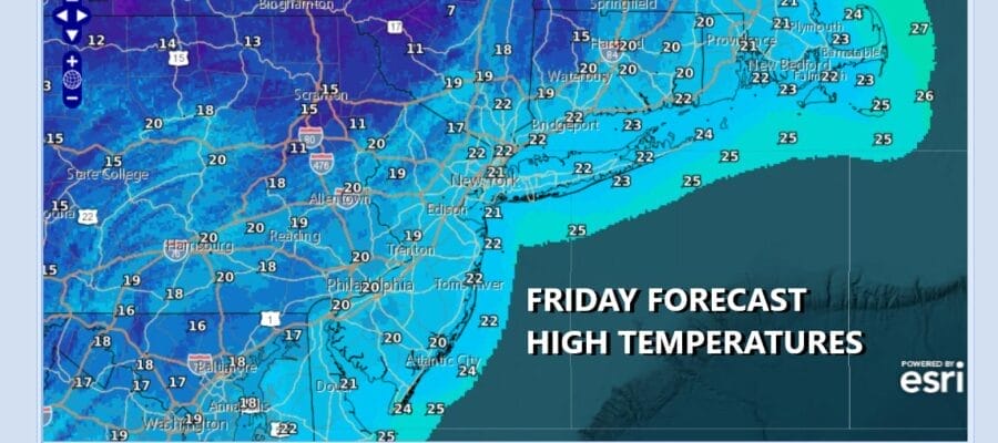
Once again we come off a bitter cold night with morning lows in the single digits and low teens. The inland cold spots came in with the obligatory below zero readings. Once again it will be another day of totally ineffective sunshine and high temperatures only reaching the upper teens and lower 20s. Radars are nice and quiet and we expect them to stay that way through Saturday. Tonight into Saturday morning we will take that trip down to single digits to near 10 or so in the warmest urban areas and below zero in the coldest spots inland.
SATELLITE WITH LIGHTNING STRIKES

WEATHER RADAR

To the south the well advertised coastal storm will come together off the Carolina coast and this is going to bring a solid 6 to 10 inch snow fall to the Carolinas and parts of Northeast Georgia and Eastern Tennessee. This storm is going to strengthen into a powerful Atlantic Ocean cyclone Saturday night into Sunday.

The storm will be moving more to the east than to the north which means that the heavy accumulating snow will miss the Northern Mid Atlantic and the Northeast. The exceptions to this will be coastal Delaware, the coastal counties of New Jersey (mainly east of the Garden State Parkway), Suffolk County on Long Island and Southeastern Connecticut. These areas could see a brushing of snow Sunday and worst case scenario is a coating to an inch or so. Most of the models pitch a shut out for everyone but we think it is wise to mention the possibility. Southeastern New England especially Cape Cod and the islands are likely to see heavier snow and blizzard conditions Sunday.
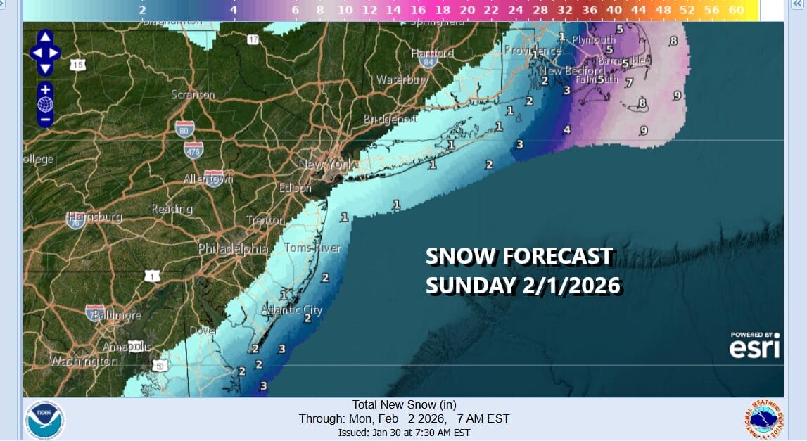
Saturday we will see ineffective sunshine again with highs just in the upper teens to lower 20s. Clouds will increase later in the day and at night. Sunday will be generally a cloudy day with highs reaching into the 20s. Look for the chance for a little snow along the coastal areas as mentioned earlier. Once the storm departs it is back to cold weather to start next week though temperatures should moderate somewhat Monday and Tuesday when we could approach the freezing mark.
BE SURE TO DOWNLOAD THE FREE METEOROLOGIST JOE CIOFFI WEATHER APP &
ANGRY BEN’S FREE WEATHER APP “THE ANGRY WEATHERMAN!
MANY THANKS TO TROPICAL TIDBITS FOR THE USE OF MAPS
Please note that with regards to any severe weather, tropical storms, or hurricanes, should a storm be threatening, please consult your local National Weather Service office or your local government officials about what action you should be taking to protect life and property.


