Warm Thursday in the 40s Ahead of Arctic Air & Accumulating Snow Sunday
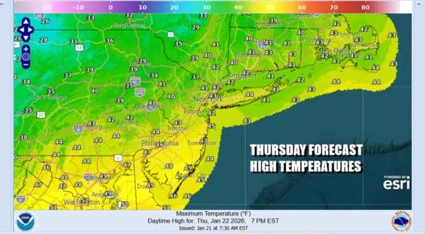
A warm front passed by last night and this will lead us to the warmest weather day of the week. It will also be the last warm day (above average) for quite a while as a very cold weather pattern is setting up for at least the next 10 days or so and we have snow risks along the way. However today is a day for some sunshine and temperatures that will reach the middle to upper 40s this afternoon. A weak weather front will be going by with little fanfare. A second front with arctic air will come through for Friday and the decent into the arctic wasteland begins. Friday morning lows will be down in the mid to upper 20s.
SATELLITE WITH LIGHTNING STRIKES
WEATHER RADAR
Friday will be a cold and windy day as arctic air begins to arrive. Initially temperatures will hold during the day and we will have some sunshine in the mix. Gusty winds will knock off about 5 to 10 degrees to the temperatures in terms of how it feels and temperatures won’t be going anywhere with most highs in the lower 30s for much of the day.
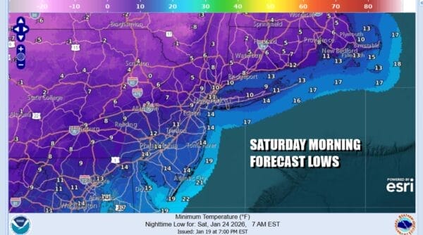
Bitter cold air will be coming southward Friday night under clear skies and by Saturday morning you will be waking up to temperatures in the single digits to lower teens. Saturday dayside you can expect to see sunshine giving way to arriving clouds. High temperatures will just be in the upper teens to low 20s.
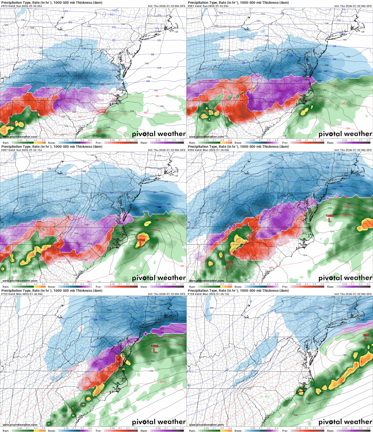
After watching developments over the last couple of day, it has now become obvious that a major winter storm is going to impacting weather across much of the US from New Mexico to Georgia and then northward to New York, New Jersey & Pennsylvania. Winter Storm Watches have been posted for nearly 23 states including Pennsylvania, New Jersey and much of New York State with additional watches coming for the Hudson Valley, New Jersey and Long Island. A stalled frontal boundary across the Deep South will produce a wave of low pressure that will redevelop along the coastal Carolinas and then creep northeastward. We expect to see a swath of 6 to 10 inches from Northern Virginia to Southern New England including coastal areas of Long Island and New Jersey. Snow develops in Virginia Maryland & Delaware during Saturday night and then moves northeast into New England during Sunday morning.
Low track is critical for final amounts. They could be higher if colder models like the GFS, ICON & UKMET. If the low winds up off the coast of Delaware or south, then we will see higher snow amounts. The warm European is further north near Atlantic City. This brings a change to rain to Central and South Jersey and Eastern Long Island and some mixing in the big cities like Philadelphia and New York. However there will still be a heavy snowfall even if it changes in those areas mentioned above. Monitor the situation closely by keeping close tabs on the latest forecasts from the National Weather Service through the weekend.
BE SURE TO DOWNLOAD THE FREE METEOROLOGIST JOE CIOFFI WEATHER APP &
ANGRY BEN’S FREE WEATHER APP “THE ANGRY WEATHERMAN!
MANY THANKS TO TROPICAL TIDBITS FOR THE USE OF MAPS
Please note that with regards to any severe weather, tropical storms, or hurricanes, should a storm be threatening, please consult your local National Weather Service office or your local government officials about what action you should be taking to protect life and property.


