
Very Cold Weather Continues Arctic Air Arrives Friday
Ahead of Next Storm System

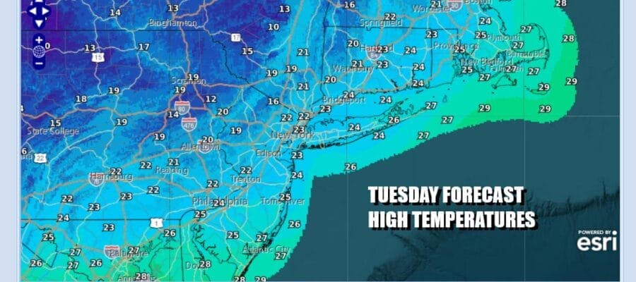
We hit bottom in the single digits to mid teens this morning across Eastern Pennsylvania to Southern New England as arctic air has settled into the Northeast and Mid Atlantic states. This is only the beginning because an even colder arctic air mass is on its way for the end of the week and into the weekend. We will see a fair amount of sunshine today but it will be breezy and cold with high temperatures just reaching the upper teens and lower 20s in most places. Southern New Jersey and points southward could see middle 20s for highs. This leads to a very cold night tonight under clear skies. By morning lows across the entire area will be in the single digits to lower teens in some of the warmer urban locations.
SATELLITE WITH LIGHTNING STRIKES

WEATHER RADAR

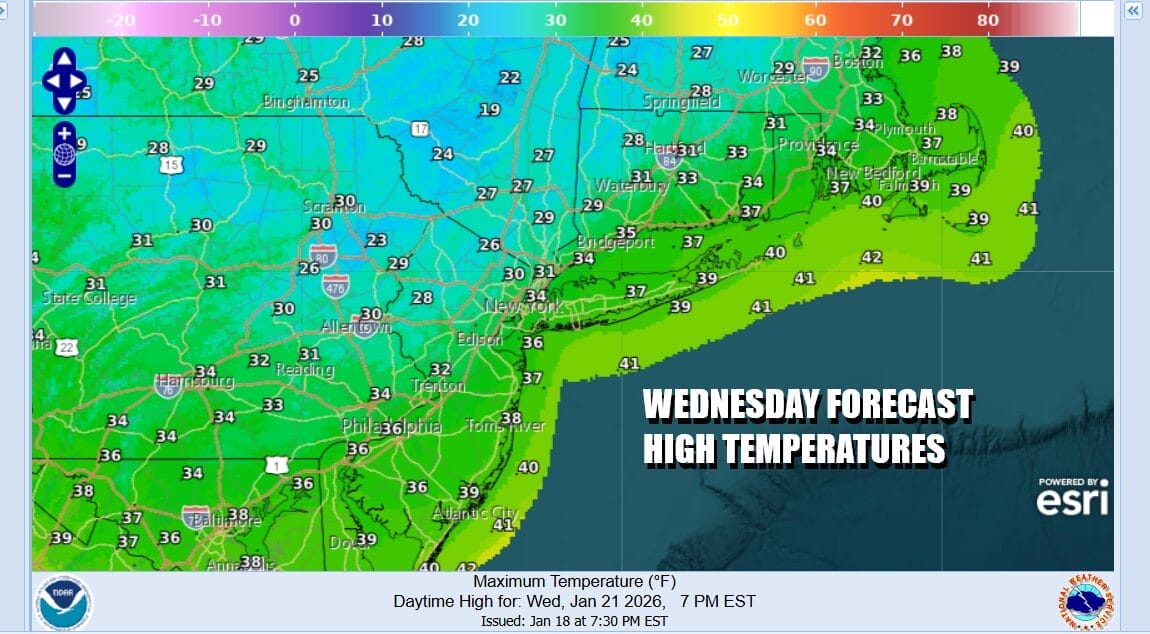
This first arctic air mass will settle overhead Wednesday which will be a day with some sunshine. However temperatures should moderate some ahead of the next arctic cold front that will push its way through Thursday. We will see highs Wednesday afternoon reach the low and middle 30s. A warm front will be going by across Upstate New York and New England but the precipitation with that will go to our north.
Another arctic front will approach and move through Thursday and ahead of this we will see temperatures reaching into the 40s with some sun and clouds but the warm-up Thursday is short lived. Colder air will begin to arrive ahead of what is the coldest air mass of the winter season so far. The coldest air will be with us Friday night right through Sunday. This arctic front will settle across the Deep South from the Carolinas to Texas and this opens the door for precipitation to develop in the Southern Plains Friday and gradually spreading eastward through the Lower Ohio Valley and Deep South later Friday and Saturday.
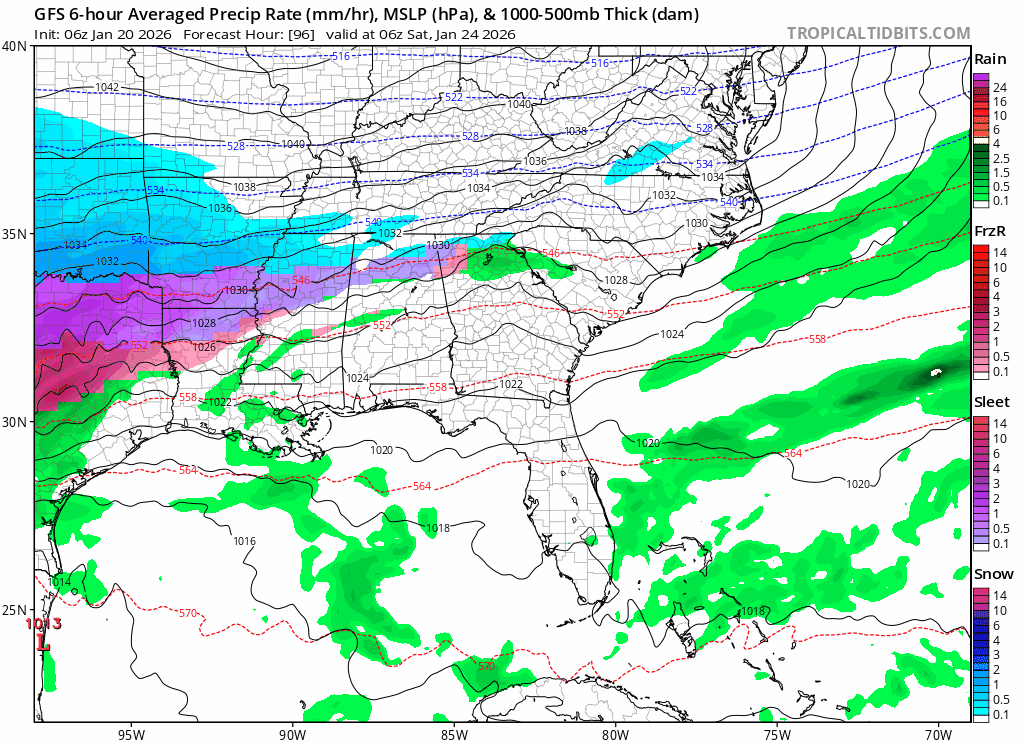
Meanwhile in the Northeast we have bitter cold air coming in over the weekend and we talking about highs just in the single digits and low teens! A strong upper trough will dig and try to lift the surface low up and northward Sunday. The slower movement of the surface low and the more consolidated look of the surface and upper air makes this more concerning for coastal areas. Snow probably holds off until later Sunday.

The Weather Prediction Center seems to have picked up on this idea and has increased the risk for at least 3 inches (that is the parameter they use) to 30 to 50 percent up and down the entire I-95 corridor. 10 to 30 percent has pushed further north into Upstate New York and interior New England.
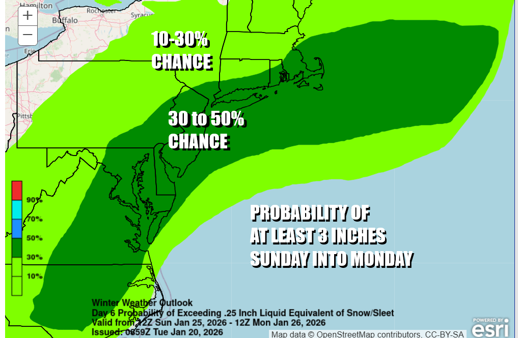
The degree of uncertainty as far as specifics is high but when you have all of the major and some not so major weather models all doing roughly the same thing, it is a pretty good bet that something is going to happen with this storm across the Northeast and Mid Atlantic states. Saturday is not an issue and much of Sunday may wind up being dry as weather models slow things down going forward. We will have much more on this tonight on the Joe & Joe Weather Show Podcast at 7:35pm on Youtube.
BE SURE TO DOWNLOAD THE FREE METEOROLOGIST JOE CIOFFI WEATHER APP &
ANGRY BEN’S FREE WEATHER APP “THE ANGRY WEATHERMAN!
MANY THANKS TO TROPICAL TIDBITS FOR THE USE OF MAPS
Please note that with regards to any severe weather, tropical storms, or hurricanes, should a storm be threatening, please consult your local National Weather Service office or your local government officials about what action you should be taking to protect life and property.


