
Week Ahead Focus On Possible Offshore Developing
Storm System

A cold front has passed offshore and we have an upper trough that is approaching this afternoon. Snow showers and some snow squalls have broken out ahead of that upper trough and we could see some rain and snow showers late this afternoon into this evening. Temperatures are in the low to mid 40s ahead of the trough and we expect that with temperatures above freezing, there should not be any issues as this upper trough passes through. Once the trough passes, skies will clear out tonight. Gusty northwest winds will pick up to 20 to 30 mph at times and temperatures by Monday morning will bottom mostly in the 20s.
SATELLITE WITH LIGHTNING STRIKES

WEATHER RADAR

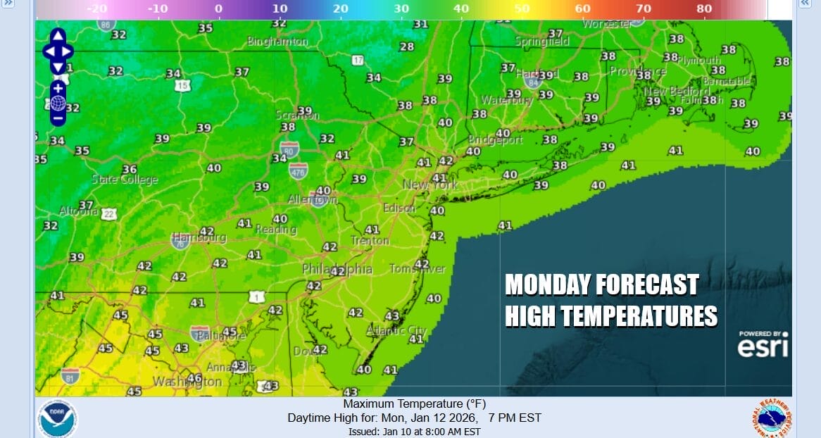
The first part of the week will be on the warm side of normal expect for Monday which will be close to average. Winds will ease somewhat and shift to a more west southwest direction. Skies should be no worse than partly sunny and as for temperatures, highs Monday afternoon will be in the upper 30s and lower 40s.
We do not see any issues for Tuesday and we are in between shots of cold air so that leaves us with another day of no worse than partly sunny skies. Tuesday highs will reach the low and middle 40s in most places. A disturbance will be going by well to the north of us so then a few clouds Tuesday should be a decent day.
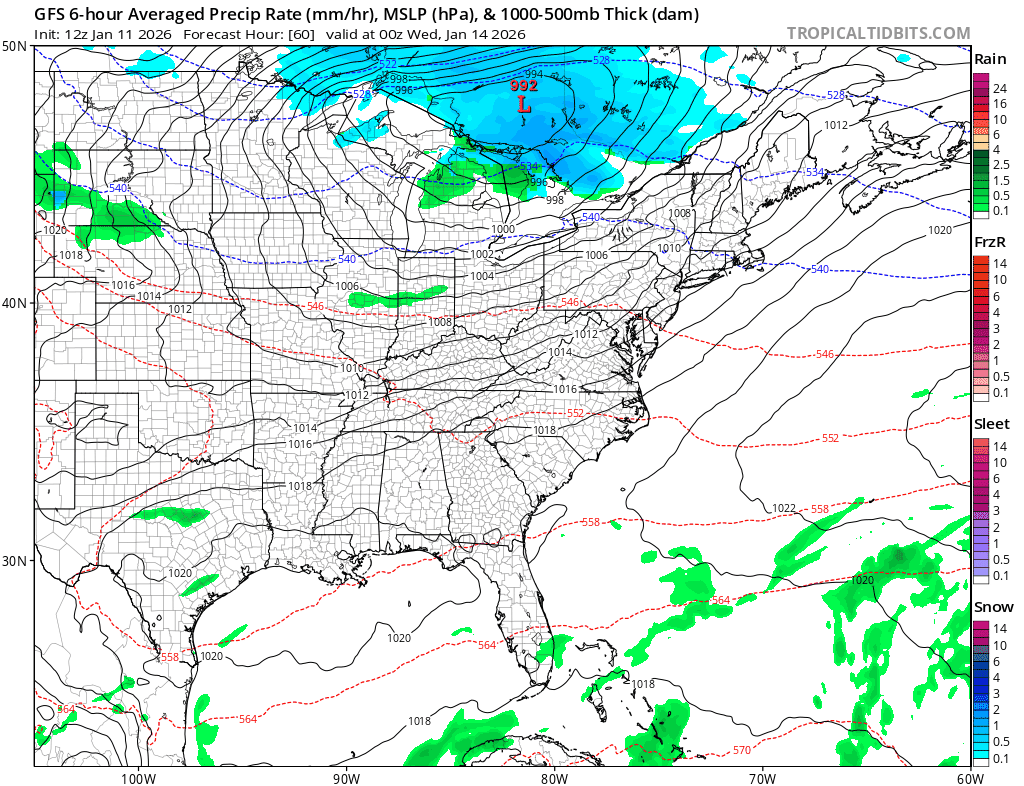
Attention Wednesday turns to an arctic boundary that will be heading east across the Great Lakes and extending south into the Appalachians. There isn’t much moisture with this front other than clouds and maybe a late showers. However energy dropping southward from the Great Lakes will cause a storm to form somewhere in the Mid Atlantic area and then get pushed to the east northeast. While the upper air dynamics with this system are somewhat impressive, they don’t seem to be impressive enough. Low pressure forms offshore and doesn’t really get going until it is too far out to the east. The upper features might generate some snow showers or a period of snow Thursday as the colder air moves in. For now seeing models backing away from a big snow event is encouraging and we will see if models continue to take this route over the next day or 2. Unlike the last couple of days the GFS model which was showing a sizeable snowfall has backed away from this and a big storm doesn’t have support coming from the European model or other models as of today’s runs. We will keep an eye on this but it seems that the odds of any kind of significant snowfall have diminished. Another arctic boundary and wave development will set up next weekend but that is a long way away at this point.
BE SURE TO DOWNLOAD THE FREE METEOROLOGIST JOE CIOFFI WEATHER APP &
ANGRY BEN’S FREE WEATHER APP “THE ANGRY WEATHERMAN!
MANY THANKS TO TROPICAL TIDBITS FOR THE USE OF MAPS
Please note that with regards to any severe weather, tropical storms, or hurricanes, should a storm be threatening, please consult your local National Weather Service office or your local government officials about what action you should be taking to protect life and property.


