
Cold Front Brings Showers Wednesday Followed By More Cold Air
Watching The Weekend For Snow

Another cold night has passed us and we hit bottom in the teens and single digits this morning. The core of the cold air is overhead today and we should see a good deal more in the way of sunshine today. However it won’t be much of a warm up as highs will reach the low and middle 30s. Winds will turn to the southwest and that should usher in some warmer air so tonight won’t be as cold. Most lows tonight into Wednesday morning will be in the middle 20s to lower 30s. Radars are nice and quiet for today and tonight.
SATELLITE WITH LIGHTNING STRIKES

WEATHER RADAR

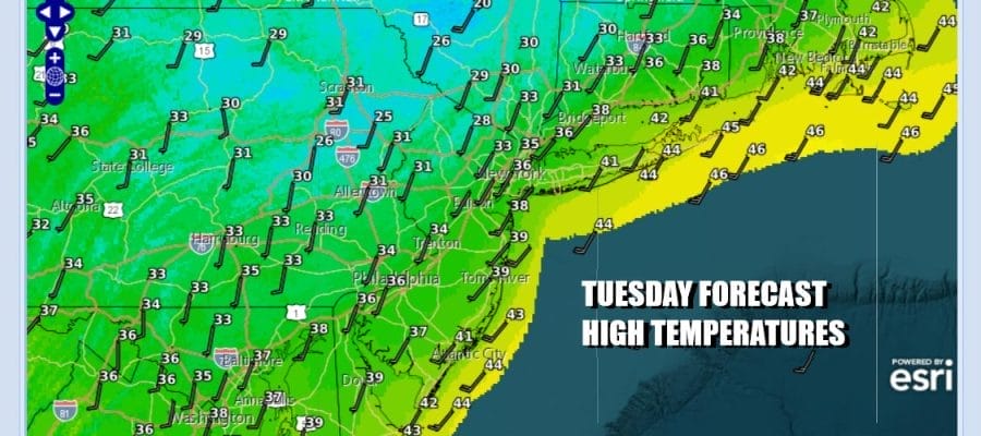
Wednesday’s cold front will have a little more in the way of moisture to deal with so we will see clouds increase quickly and there will be some showers around, mainly in the afternoon and evening. Rainfall won’t amount to much, generally a quarter or even a tenth of an inch or less. Temperatures will be able to climb though and most highs should reach the mid to upper 40s before the front passes.

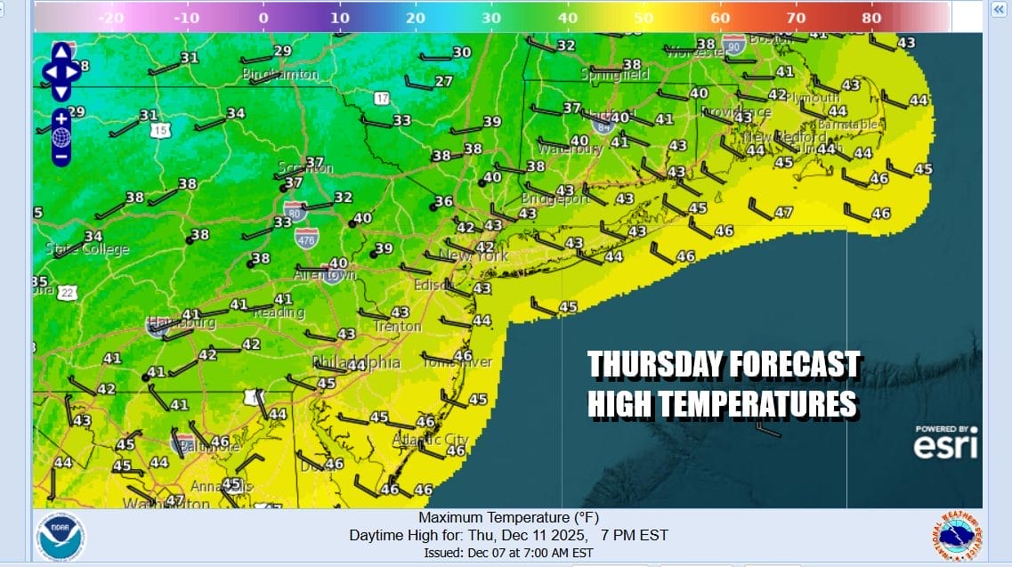
Thursday brings the next round of colder air from Canada. We will likely see high temperatures leftover from the overnight and during the day Thursday we will settle in the 30s to around 40 at best. We will gusty northwest winds and some sunshine but we should be done with any precipitation. Temperatures overnight into Friday morning will drop in the upper teens and mid 20s.
Friday should be day of sunshine, a gusty northwest wind and most highs in the low to middle 30s. Then we head into the weekend where we have another arctic boundary that will be moving through Friday night into Saturday morning and settling somewhere to the south. A wave is going to develop on the frontal boundary with snow north of where that boundary sets up and rain to the south.

The track of the wave will hinge on how dominant the northern jet stream is or isn’t. It could be stronger and overwhelm cold air suppressing the low track further south, or it could be a little weaker allow for more northerly track and that would mean snow inland and rain or snow coast. There is limited amount of space for this low to develop as it races along but it does appear that something is going to happen ahead of the arrival of another shot of very cold air for early next week. For now we have a mix of sun and clouds forecast for Saturday. There is a lead upper trough moving through and that could set off some scattered snow showers. Highs will be in the 30s. Then we get into the stronger wave and arctic boundary for later Saturday night into part of Sunday. For now we will forecast the chance for some snow across Eastern Pennsylvania to Southern New England followed by a very cold air mass to kick off next week. The pattern looks to moderate later next week with milder temperatures coming. This looks to be temporary and the current pattern is simply pausing to reload for the ride through late month.
BE SURE TO DOWNLOAD THE FREE METEOROLOGIST JOE CIOFFI WEATHER APP \&
ANGRY BEN’S FREE WEATHER APP “THE ANGRY WEATHERMAN!
MANY THANKS TO TROPICAL TIDBITS FOR THE USE OF MAPS
Please note that with regards to any severe weather, tropical storms, or hurricanes, should a storm be threatening, please consult your local National Weather Service office or your local government officials about what action you should be taking to protect life and property.


