

Snow Well Inland Cold Rain Coast
Very Cold Air Arrives Thursday Night Into Saturday Morning

Now that precipitation is moving into the Northeast you can see I have posted my final call snow forecast which is for little or nothing at the coast as it is mostly rain. Inland north, northeast and northwest of Interstate 84 is where we will see anything significant as far as accumulating snow is concerned. The highest amounts will be from the Catskills northeast into Central and Northern New England where we will see snow fall amounts of 4 to 6 inches or more.
SATELLITE WITH LIGHTNING STRIKES

WEATHER RADAR

Satellite and radars show clouds and precipitation spreading northward with snow across Ohio and much of Pennsylvania and rain to the south in Maryland and Virginia. Snow is also spreading across Upstate NY and this is what usually happens when we expect to see mostly rain at the coast and a change to rain spreading to some inland areas. Temperatures today will be mostly in the 30s ranging from lower 30s where we see snow and upper 30s to around 40 in areas closer to the coast.

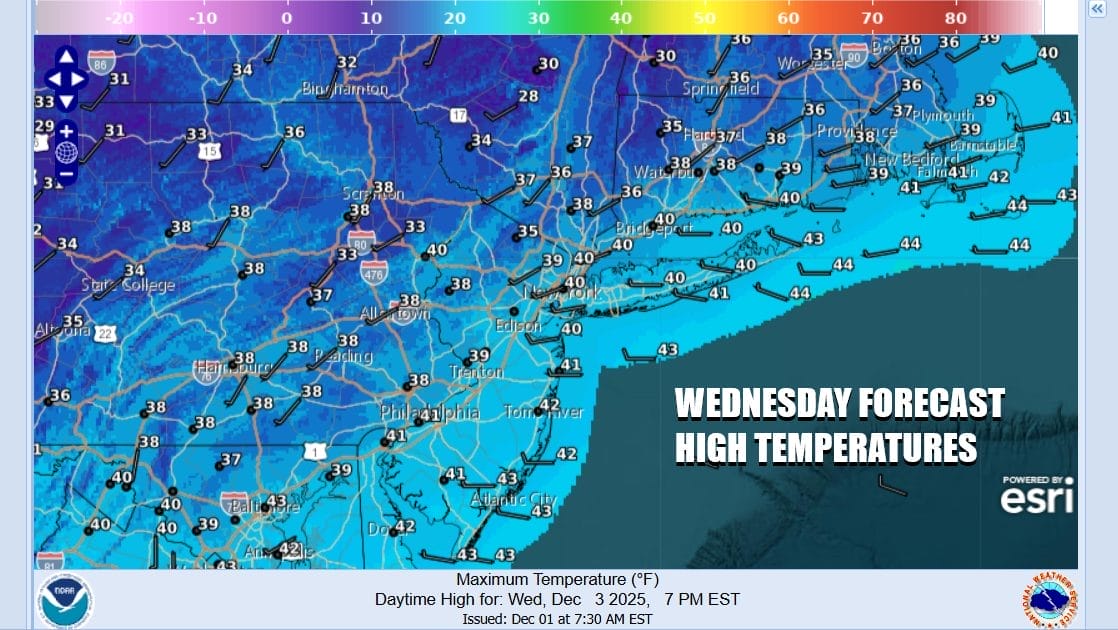
Precipitation in whatever form will come to an end this evening and then we will see skies gradually clear. Temperatures will be heading into the 20s by Wednesday morning so look for some slick spots developing overnight. Wednesday should be a nice quiet day with some sunshine. High temperatures will generally be in the upper 30s and lower 40s.
An arctic boundary or a cold front will be racing southeastward from the Great Lakes and Upstate New York. Ahead of the front we will see some sun and clouds and when the front passes, there could be a snow shower or even a snow squall that goes by. Temperatures Thursday will be in the upper 30s and lower 40s but then drop to the teens to near 20 degrees in most areas by Friday morning. This will be the coldest air mass of the season so far.
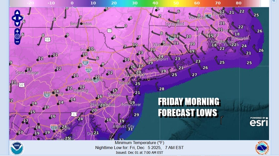
Friday we will see very cold temperatures with some sunshine giving way to some arriving clouds with most highs not out of the 20s. Weak low pressure could sneak in clouds and maybe a little bit of snow Friday night into Saturday morning as it goes by. Otherwise we will likely be dry and cold through the upcoming weekend. No major snow or rain systems seem to be in the cards going into the start of next week.
BE SURE TO DOWNLOAD THE FREE METEOROLOGIST JOE CIOFFI WEATHER APP &
ANGRY BEN’S FREE WEATHER APP “THE ANGRY WEATHERMAN!
MANY THANKS TO TROPICAL TIDBITS FOR THE USE OF MAPS
Please note that with regards to any severe weather, tropical storms, or hurricanes, should a storm be threatening, please consult your local National Weather Service office or your local government officials about what action you should be taking to protect life and property.


