

A Mainly Sunny & Dry Weekend Other Than An Isolated Shower Sunday PM
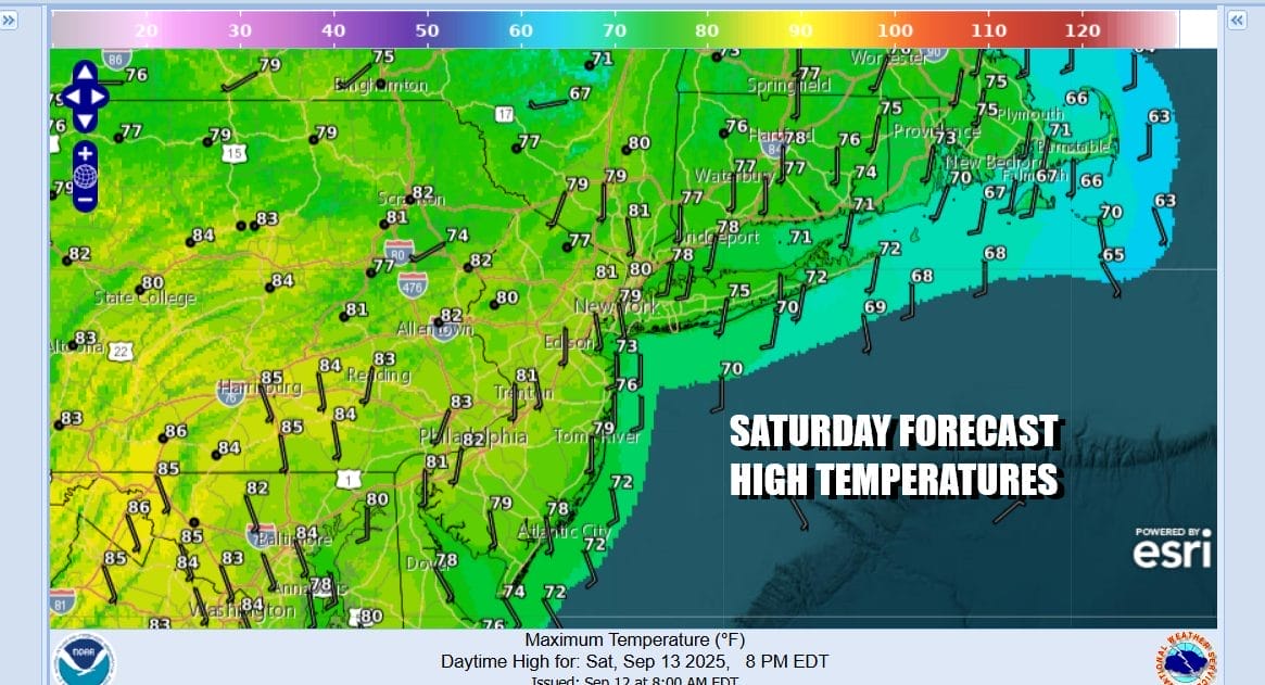
It is as dry and calm a pattern as we can see and there is still no sign of this breaking down anytime soon. Today we begin the first half of the weekend with sunshine and rather warm temperatures. Most highs will be in the upper 70s and lower 80s. Temperatures of course will be a little cooler along south and east facing shorelines thanks to an ocean breeze. It will be followed by a night of mainly clear skies and lows mostly in the 50s inland and lower 60s coast and warmer urban locations.
SATELLITE WITH LIGHTNING STRIKES

WEATHER RADAR

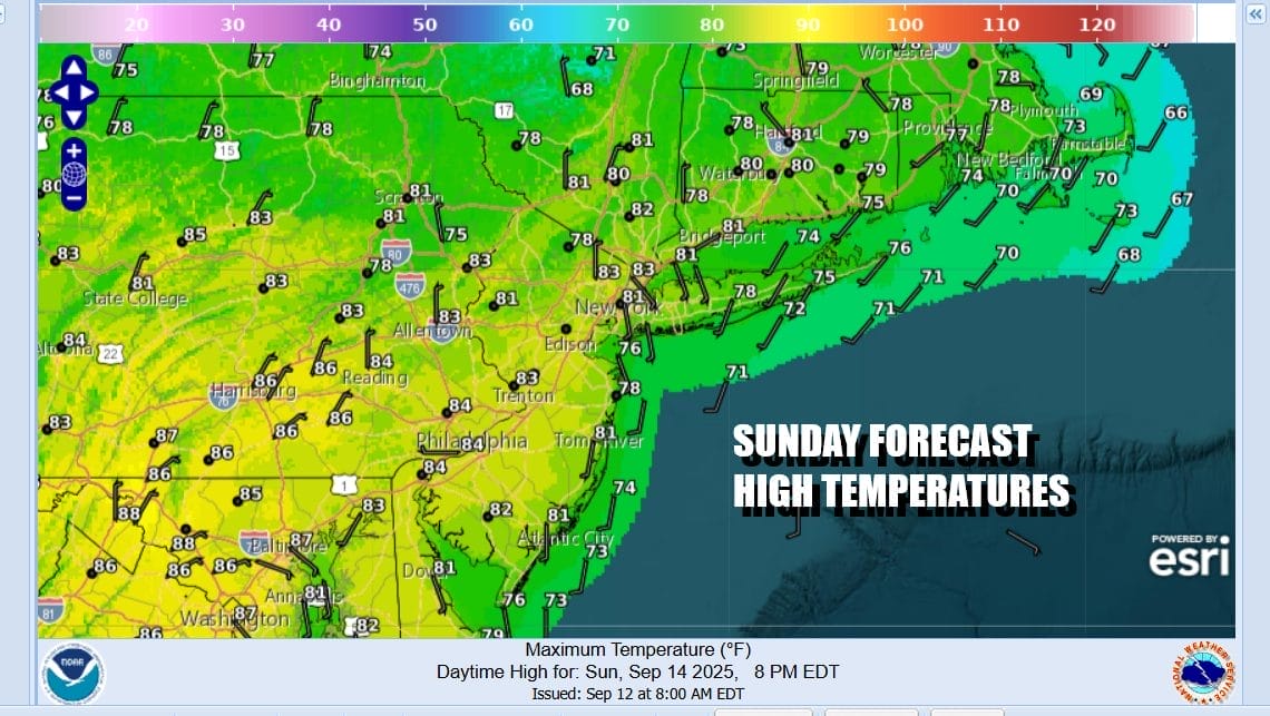
There is a weak weather front that is moving across Upstate New York and Northern New England today and we see some showers there. However as the front moves southward it will weaken and not have much with it once it goes by. This leaves us with a partly to mostly sunny day for Sunday. We are just going to thrown in the slight chance for a passing showers later Sunday afternoon and I think the best chances for this would be across Southern New England and points northward. High temperatures Sunday will be in the upper 70s and lower 80s.
Moving into next week we see very little in the way of changes. There is an area of lower than normal pressures that weather models are picking up on off the Southeast US coast. Low pressure tries to form here but without much success. It may and try to sneak up the coast with a small area of rain mid and late week but it could just as easily linger off the coast or even find it’s way to the northeast and stay offshore.

The best course of action therefore is the concept of the trend being your friend and keeping things dry and on the warm side of average until we see solid evidence of this pattern breaking down. It certainly looks to hold for all of next week. Monday and Tuesday will both be partly to mostly sunny days with high temperatures in the upper 70s to lower 80s with the exception being south and east facing shore lines which will be a few degrees lower. If low pressure to the south remains a non issue, then we could see partly to mostly sunny days through at least Friday and the next chance for any rain would be with a weather front that will approach next Sunday! The tropics are dead as a doornail and severe weather is virtually non-existent as are any major or even minor storm systems.
BE SURE TO DOWNLOAD THE FREE METEOROLOGIST JOE CIOFFI WEATHER APP &
ANGRY BEN’S FREE WEATHER APP “THE ANGRY WEATHERMAN!
MANY THANKS TO TROPICAL TIDBITS FOR THE USE OF MAPS
Please note that with regards to any severe weather, tropical storms, or hurricanes, should a storm be threatening, please consult your local National Weather Service office or your local government officials about what action you should be taking to protect life and property.


