Scattered Showers or a Thunderstorm Hot Humid Sunday
But Much Cooler Next Week
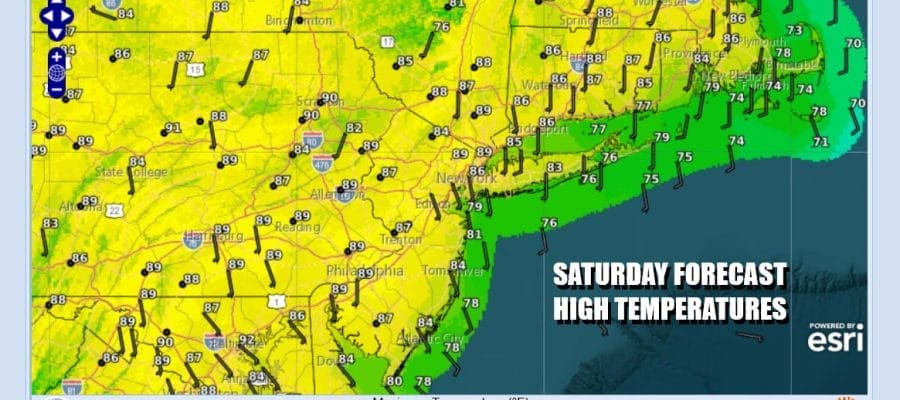
This is a weekend of transition from an onshore flow today to a southwest flow tomorrow. We also have a cold front approaching. However there isn’t much going on in the way of shower or thunderstorm risk this weekend. We can’t rule it out completely but for the most part for most of you, the weekend will be rain free. Regional radar does show some scattered stuff around but overall today we will have clouds and some sun. Most highs will be in the mid to upper 80s except cooler of course at the beaches. A very warm and humid night lies ahead with low clouds and lows in the upper 60s to mid 70s.
SATELLITE WITH LIGHTNING STRIKES
WEATHER RADAR
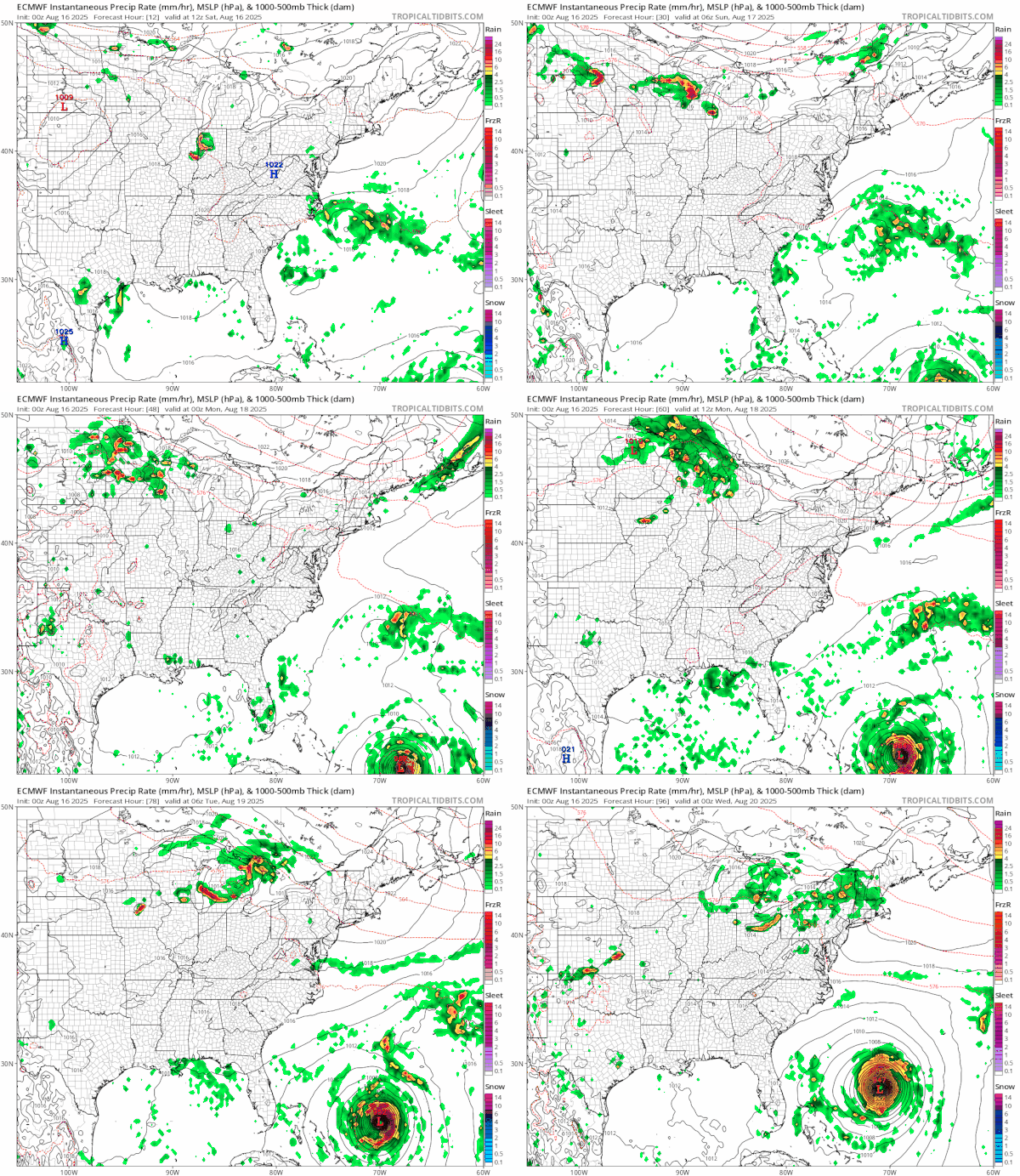
As mentioned earlier we have an approaching cold front for Sunday but not much moisture aloft is with it. Shower and thunderstorm risk Sunday will likely be well to the north in Upstate NY and New England. Once the front passes we are setting up for a cooler first half of next week. A large high will build southward into Eastern Canada and New England and that means a onshore flow once again takes hold.
You can also see Major Hurricane Erin on the lower right of the European model forecast loop. It will be moving northward offshore next week and once it reaches the latitude of the Carolinas it will turn northeast and east. There is no risk to the US East Coast other than developing rough ocean seas at the beaches this week along with rip currents and the potential for coastal flooding and beach erosion.
Back to the outlook for Sunday, look for some sunshine, hot humid conditions as highs reach the upper 80s and lower 90s. We will cover for the chance for a scattered shower or thunderstorm late in the day into Sunday evening but we regard the risk as low. The cold front drops southward setting us up for northeast winds, cooler temperatures, and somewhat lower humidity beginning Monday.
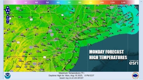
We are looking for some sunshine Monday but the onshore flow will do a very good job of keeping temperatures from getting out of the 70s. There may be a few clouds around but this time around the onshore flow is going to start bringing in ocean low clouds Monday night and Tuesday making the middle part of the week more of a gloom and doom type of scenario with clouds all day long, an ocean wind, and temperatures not getting out of the 70s for both Tuesday and Wednesday.
BE SURE TO DOWNLOAD THE FREE METEOROLOGIST JOE CIOFFI WEATHER APP \&
ANGRY BEN’S FREE WEATHER APP “THE ANGRY WEATHERMAN!
MANY THANKS TO TROPICAL TIDBITS FOR THE USE OF MAPS
Please note that with regards to any severe weather, tropical storms, or hurricanes, should a storm be threatening, please consult your local National Weather Service office or your local government officials about what action you should be taking to protect life and property.


