
Onshore Flow Weakens Temperatures Rise
Thunderstorm Risks Go Up Later This Week
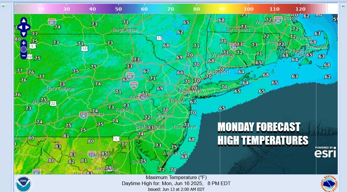
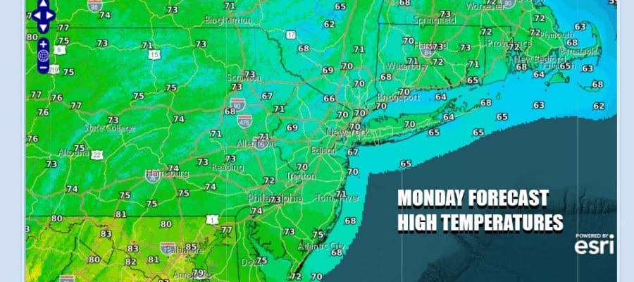
We are so close yet so far with regards to improving weather conditions. Dry air likes just to the north in New England and satellite loops clearly show the line of overcast skies cuts across Southern New England and the Lower Hudson Valley. Sometimes dry air can bleed southward in these instances but the clouds to the south are a bit stubborn and the onshore flow does continue today. We are talking mostly cloudy skies for today. We will throw in the slight chance for some light rain or drizzle as any heavier downpours will remain mostly to the south across Virginia and Maryland. High temperatures today will be in the upper 60s and lower 70s ain most places.
SATELLITE WITH LIGHTNING STRIKES

WEATHER RADAR

Over the next couple of days we are going to see a slow relaxation in the onshore flow and by midweek winds will be turning from east to south and then southwest. As this happens the atmosphere will grow warmer and it will also grow a little more unstable as temperatures rise. This will lead to more sun each day but it will also mean that the risk for some scattered showers and thunderstorms will start to rise especially for areas inland.

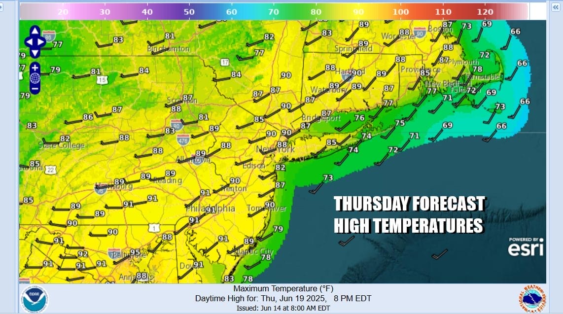
All of this will probably come to a head Thursday as we set up for the hottest day of the year so far. We also will see an approaching weather front that will likely set off some stronger thunderstorms late Thursday. The Storm Prediction Center already is indicating a potential for severe thunderstorms in their long range forecast for Thursday and the European model loop shows a line of storms developing ahead of a front Thursday afternoon and evening.
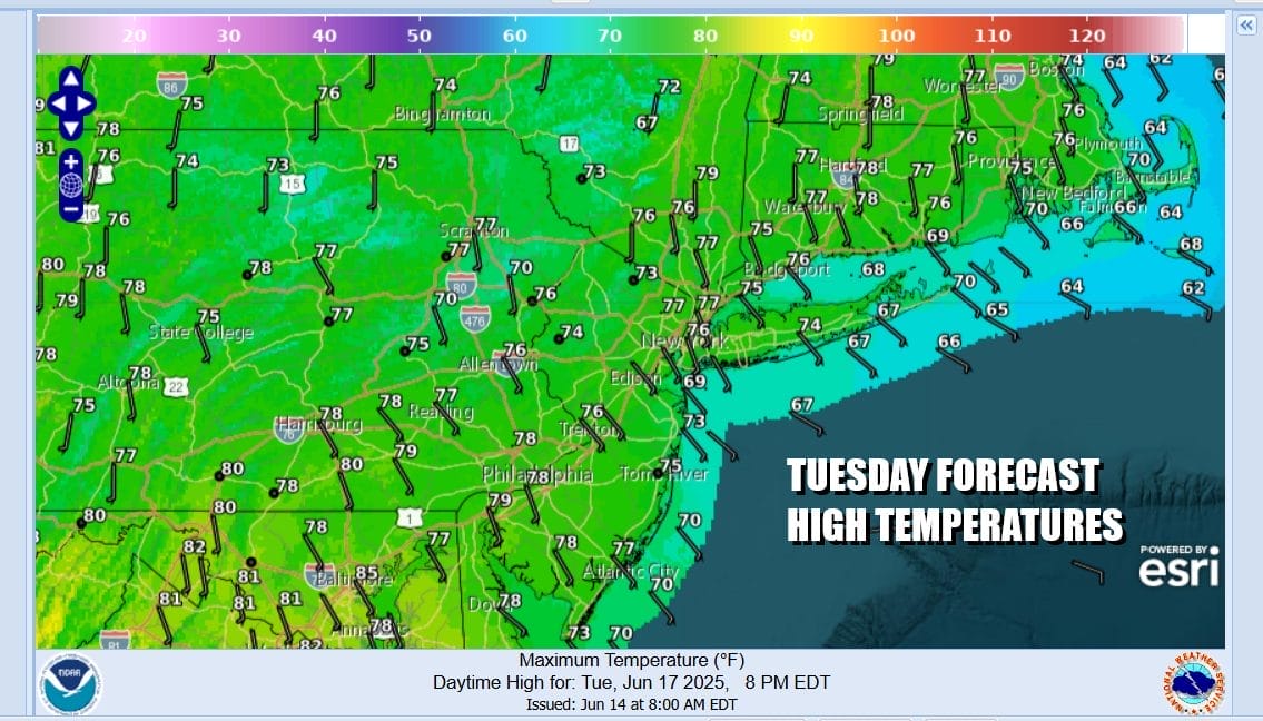
In the meantime it will be like slowly climbing up a flight of stairs temperature wise. More sun, less cloud cover and a wind that will be more southeast and south should allow for temperatures to rise to the mid and upper 70s Tuesday. We will throw in the chance for a shower or thunderstorm inland. Wednesday it goes even higher with more of a south southwest wind, some sunshine, and the risk for scattered afternoon and evening thunderstorms. Highs Wednesday will reach the 80s just about everywhere.

Let’s move ahead to Thursday where we will see the hottest temperatures of the week. Sunshine will take highs to the lower 90s in most places. Even the coast we will see temperatures run through the 80s before any local sea breeze develops. We will be watching for thunderstorms to develop in the mid to late afternoon and as mentioned earlier, there is severe weather risk for late Thursday from New Jersey south to Virginia and North Carolina.
We should see some improvement Friday but we will be watching for an upper trough that could set off some thunderstorms late in the day. Much of Friday however will be dry with highs in the 80s. We have a chance for a rain free warm and humid weekend so we will keep our fingers crossed that we can break this raining on the weekend streak that has been the dominant pattern for the last couple of months.
BE SURE TO DOWNLOAD THE FREE METEOROLOGIST JOE CIOFFI WEATHER APP &
ANGRY BEN’S FREE WEATHER APP “THE ANGRY WEATHERMAN!
MANY THANKS TO TROPICAL TIDBITS FOR THE USE OF MAPS
Please note that with regards to any severe weather, tropical storms, or hurricanes, should a storm be threatening, please consult your local National Weather Service office or your local government officials about what action you should be taking to protect life and property.