
Warming Temperatures Next Several Days
No Rain Until Late Friday At The Earliest
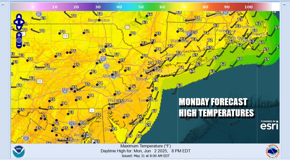
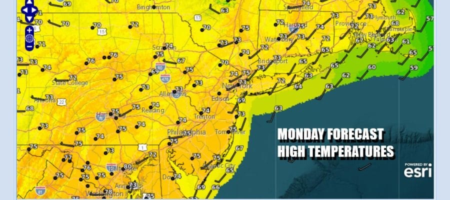
A summery weather pattern is taking hold but first we have an upper trough over New England that exits to the east. Once that happens upper air winds will turn west and southwest. This should cut us off from the wild fire smoke from Canada so that is a plus. That might take another day or so to play out. In the meantime today we are going to see mainly sunny skies. Most highs this afternoon will be in the low to mid 70s with no weather issues developing on local radars.
SATELLITE WITH LIGHTNING STRIKES

WEATHER RADAR

High pressure overhead today will be moving offshore and sitting off the Mid Atlantic coast for the rest of the week. This upper high will keep weather fronts at bay. A west to southwest wind develops and that brings warmer air into the Northeast and Mid Atlantic states. Above average temperatures begin Tuesday and last into the weekend.

A weather front Thursday drops to Upstate NY but showers and thunderstorms with that front will be along and mainly north of the Interstate 90 corridor. Late Friday into Saturday we have another front approaching. This might set off some showers and thunderstorms Friday night and again late Saturday. The front should move along and weather conditions will improve Sunday.

Tuesday will be a mostly sunny day and highs will generally reach the lower 80s inland. Coastal areas and south & east facing shorelines will likely be in the 70s for highs. Then temperatures will turn higher Wednesday. Skies will be partly to mostly sunny. Highs will reach the mid to upper 80s inland. Temperatures will be a little cooler at the coast.
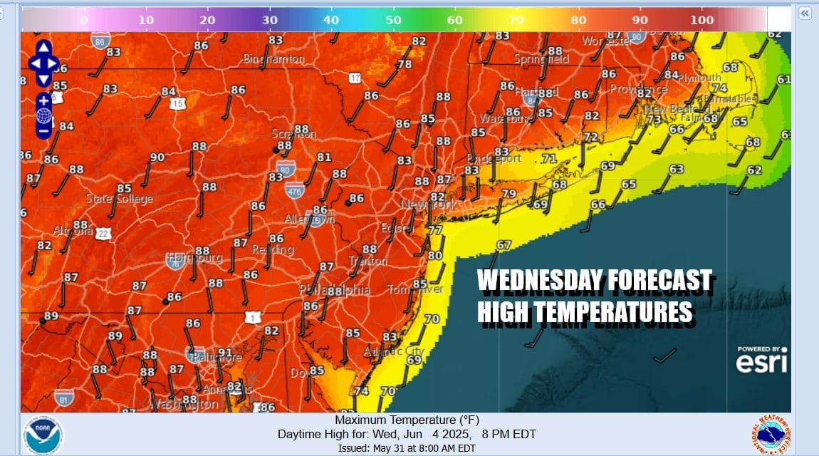
At least through Wednesday, dew points will be mostly reasonable but the will start to edge up Thursday and temperatures also will hit their highs of the week. It will be another day of partly to mostly sunny skies. Showers and thunderstorms in Upstate NY will remain there and they will not be an issue. Most highs Thursday will be in the mid to upper 80s with some warm spots possibly touching 90 degrees. Friday will be very warm with highs in the 80s and dry during the day. Then we get into showers and some thunderstorms Friday night and a higher chance later Saturday.
BE SURE TO DOWNLOAD THE FREE METEOROLOGIST JOE CIOFFI WEATHER APP &
ANGRY BEN’S FREE WEATHER APP “THE ANGRY WEATHERMAN!
MANY THANKS TO TROPICAL TIDBITS FOR THE USE OF MAPS
Please note that with regards to any severe weather, tropical storms, or hurricanes, should a storm be threatening, please consult your local National Weather Service office or your local government officials about what action you should gh be taking to protect life and property.


