
Showers Thunderstorms Severe Weather Risk Late Today
Improving Weather Sunday Warmer Next Week
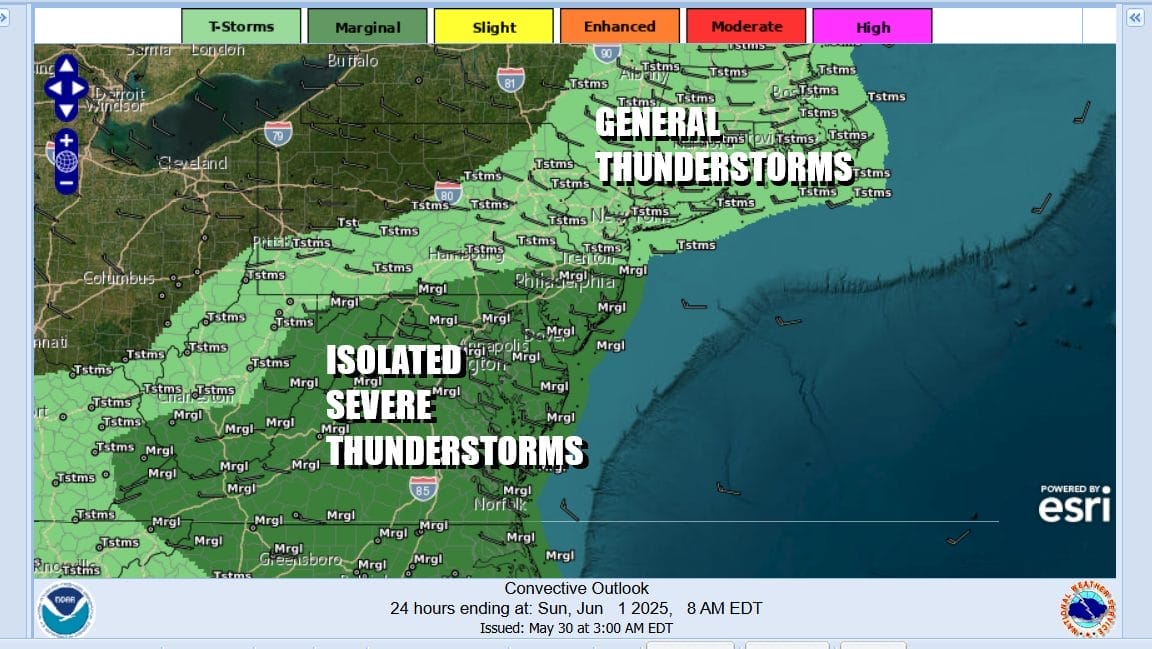
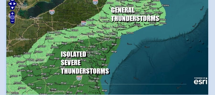
Overnight rainfall has moved into Upstate NY and New England. The satellite and radar loops show a rather impressive looking system that will move slowly north and northeast today. Now we have the trough that is to the west in New York State and Pennsylvania and that could set off some more showers and thunderstorms later today into this evening. The Storm Prediction Center is indicating a marginal risk for isolated severe thunderstorms, mainly from Central New Jersey and Southern Pennsylvania southward.
SATELLITE WITH LIGHTNING STRIKES

WEATHER RADAR

In the meantime today if we get a little daytime heating in the mix that will increase the chances for stronger storms so we will be watching things closely this afternoon. In between what is left of the rain from overnight and what happens later today we will have cloudy to possibly partly sunny skies in some places though it probably won’t last long. Highs today will be mainly in the 70s.

Once this weather system plays through this evening, skies should partially clear out tonight with Sunday morning lows in the mid 40s to lower 50s. Sunday it is looking like a partly sunny day. We are going to leave the mention of any showers out of the forecast for now. Even if they were to happen they will be few and far between. Highs will be in the coolish upper 60s and lower 70s with a prominent northwest breeze.

The weather pattern across the US is changing, or at least it is relaxing away from the troughing that has been in the Eastern US leading to weather system after weather system moving along keeping things wet, gloomy and rather stormy. Instead we have ridging building in the Eastern US especially from Northern New York and New England & Eastern Canada.

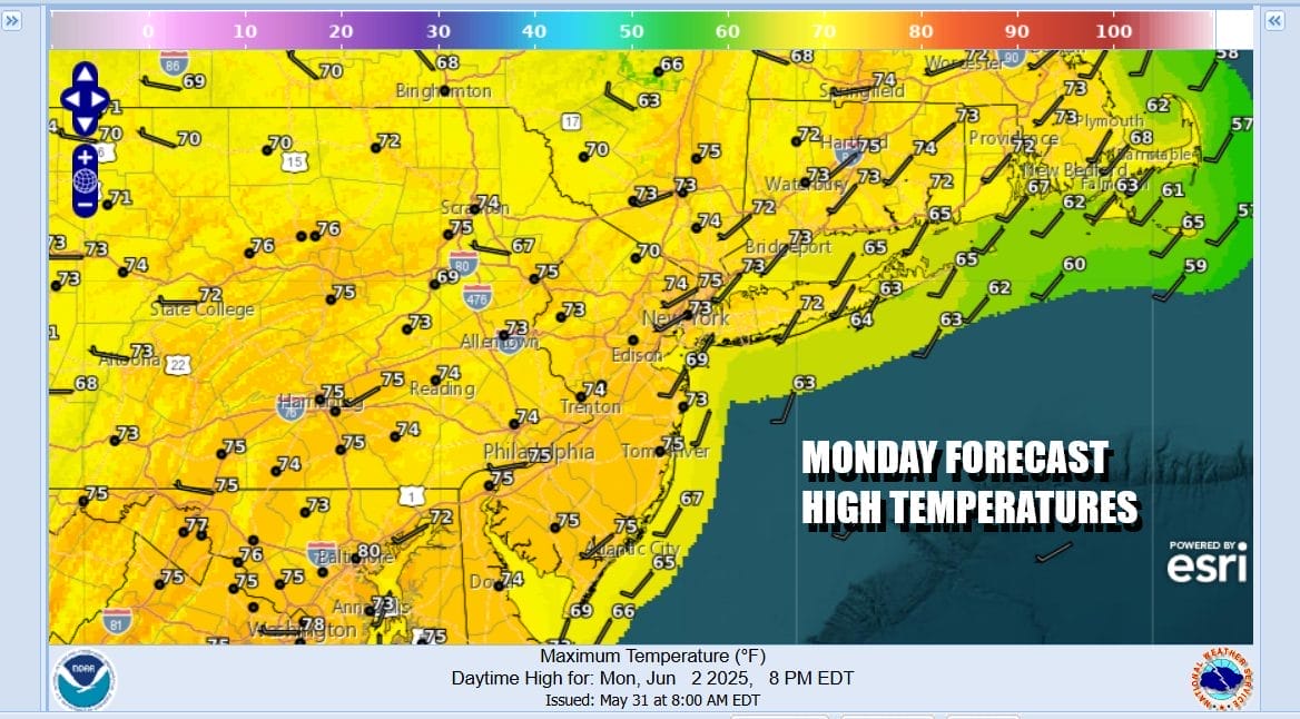
This new pattern means a shift to above average temperatures in the Northeast and Mid Atlantic and we will begin our first stretch of 80 degree plus highs that will last at least several days. Monday will be a partly to mostly sunny day. Most high temperatures Monday will be in the 70s
Warmer temperatures arrive for Tuesday Wednesday and Thursday. Each day should be no worse than partly sunny. Tuesday highs will be in the low to middle 80s. Wednesday and Thursday highs will be in the mid to upper 80s. There is a front that gets close Thursday which might mean the chance for late day thunderstorms especially north of NYC. There will likely be a higher chance for showers and thunderstorms late Friday into Saturday as another weather front approaches.
BE SURE TO DOWNLOAD THE FREE METEOROLOGIST JOE CIOFFI WEATHER APP &
ANGRY BEN’S FREE WEATHER APP “THE ANGRY WEATHERMAN!
MANY THANKS TO TROPICAL TIDBITS FOR THE USE OF MAPS
Please note that with regards to any severe weather, tropical storms, or hurricanes, should a storm be threatening, please consult your local National Weather Service office or your local government officials about what action you should be taking to protect life and property.


