
Severe Weather Risk Next 2 Days As Weather Fronts Head For the East Coast
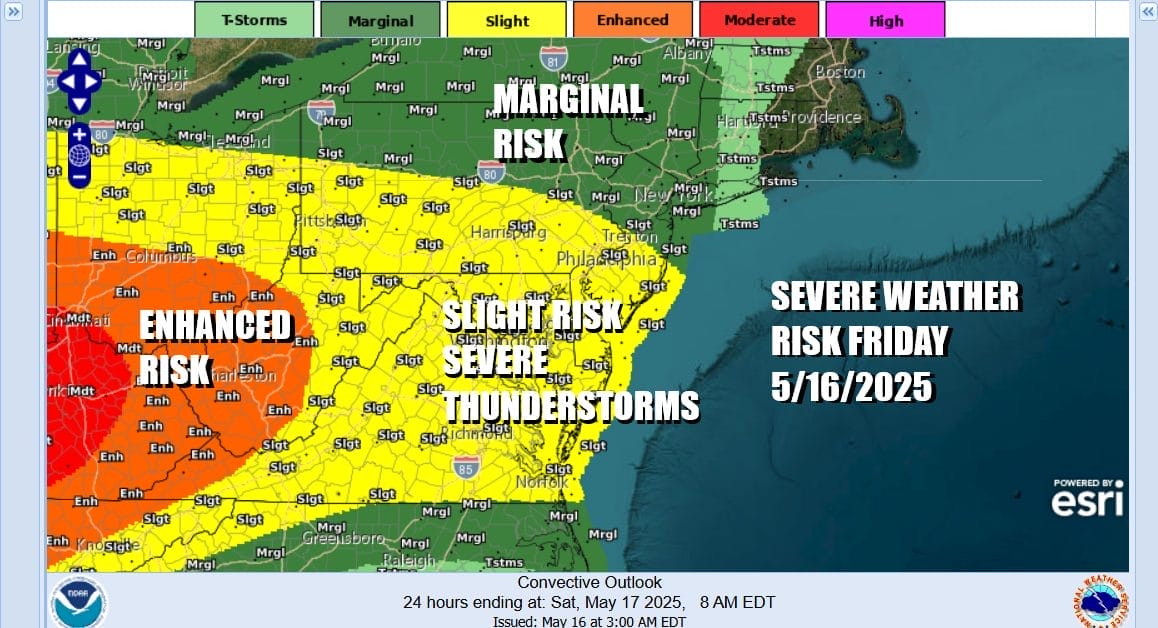
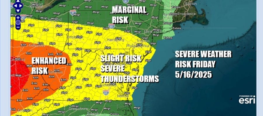
We have weather issues ahead for Friday and Saturday as two weather fronts will approach and pass through. The first one will be today and the Storm Prediction Center is indicating a slight risk or (15 percent chance) of severe thunderstorms for a large area in the Northeast and Mid Atlantic states. It covers all of Virginia, Maryland, Delaware, the southern halves of New Jersey and Pennsylvania while we have a marginal risk for isolated severe thunderstorms further north into Northern Pennsylvania, Northern New Jersey, much of Upstate NY, Westernmost New England and Western Long Island. This includes New York City as well as Philadelphia, Baltimore and Washington DC.
SATELLITE WITH LIGHTNING STRIKES

WEATHER RADAR

We are already seeing a very active area of thunderstorms on the radars this morning over Western NY and Northern Pennsylvania moving eastward. We expect additional clusters of thunderstorms to develop later today into tonight thanks to ample daytime heating. Ahead of this look for clouds and some sun with highs reaching the upper 70s to lower 80s.

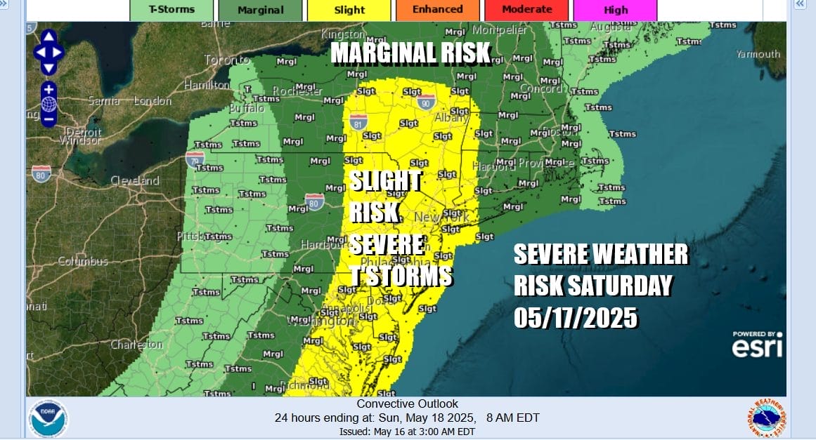
The highest risk time is likely to be later this afternoon into tonight but we need to watch this bowing line of thunderstorms moving eastward ahead of it. Showers and thunderstorms will be around tonight and could be come more numerous Saturday morning into the afternoon. The Storm Prediction Center is indicating severe weather risk for Saturday extending further north in New York State to the Upper Hudson Valley. To the south it covers New York City and Western Long Island, all of New Jersey and Eastern Pennsylvania southward into Maryland, Delaware and Virginia.
Most of the shower and thunderstorm activity will be in the morning until early afternoon and then the front exits. We should see drying and improving weather conditions from west to east as some sunshine returns. Temperatures Saturday will be on the warm side with most highs reaching the 80s.

Sunday will be a breezy and cooler day but we will have strong low pressure sitting in the Gulf of Maine so look for breezy conditions with gusty northwest winds. While we may have some sunshine, we will also have instability clouds developing and there is the risk for a few widely scattered showers or an isolated thunderstorm. Sunday highs will be in the upper 60s to mid 70s.

Next week will be one where temperatures will be cooler than average. We will be dry Monday and Tuesday but we will see rain and cool conditions continue Wednesday. Thursday low pressure will develop to the south and track just offshore which sets up for a windy soaking rain as the low moves up the coast. This system could linger into Friday but it moves along, we could see some slow improvement over the Memorial Day holiday weekend.
BE SURE TO DOWNLOAD THE FREE METEOROLOGIST JOE CIOFFI WEATHER APP &
ANGRY BEN’S FREE WEATHER APP “THE ANGRY WEATHERMAN!
MANY THANKS TO TROPICAL TIDBITS FOR THE USE OF MAPS
Please note that with regards to any severe weather, tropical storms, or hurricanes, should a storm be threatening, please consult your local National Weather Service office or your local government officials about what action you should be taking to protect life and property.


