
Sunshine Continues Through Friday
Cold Front Brings Showers Thunderstorms Friday Night Into Saturday

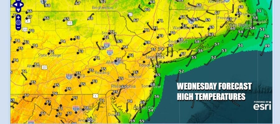
We could get used to the idea of sunshine, much less wind, and warm temperatures as we experience the second of 4 days of reasonable spring weather. A stalled frontal boundary lies well to the south and a weak pressure pattern over the Great Lakes and Northeast is keeping things under control. This will be another day with sunshine along with just a few patchy clouds. Radars will be quiet. Winds will be reasonable. Highs today will be mostly in the 70s with local sea breezes at the coast. Tonight we should see nothing more than a few passing clouds. Lows will be in the 40s inland and low to middle 50s along the coast.
SATELLITE WITH LIGHTNING STRIKES

WEATHER RADAR

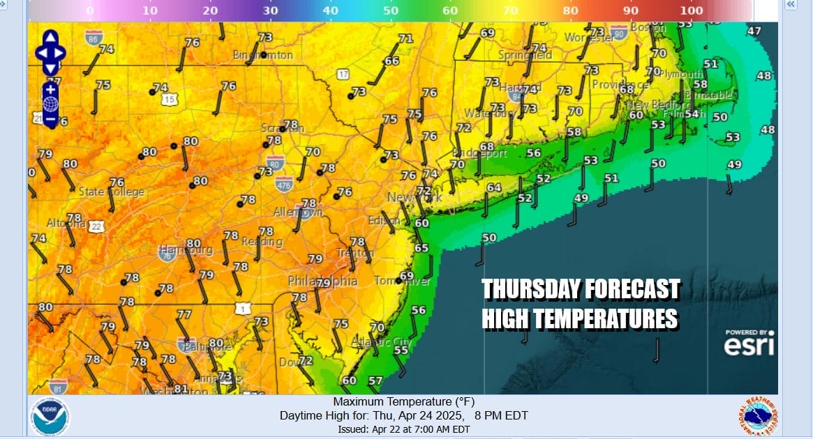
Not much will change Thursday as the weak pressure pattern remains and shower and thunderstorm activity stay well to the west and to the south. Thursday brings another day of no worse than partly sunny skies. Highs again will be in the 70s except cooler temperatures are likely at the coast with local sea breezes.
Friday we start to turn attention to the west. Low pressure develops in Iowa and heads east across the Great Lakes and then reaches New England Saturday. There will be a trailing cold front from this low that will approach Friday night. We also will have a bit of a warm front to the south that will need to play through. This warm front/cold front combination will bring some showers Friday night and the risk for showers and some stronger thunderstorms during the day Saturday.

The front will keep on moving so that once it passes offshore later Saturday we will see improving weather conditions Saturday night and Sunday. Sunday will be the better of the two weekend days for sure. Ahead of all this Friday we will sunshine with arriving clouds with highs in the 70s to near 80 degrees. Showers Friday night and showers and thunderstorms will be around much of Saturday. Highs Saturday will be in the 60s to the north and 70s to the south depending on where the warm front is. Sunday should be a mostly sunny cooler day with highs in the 60s.
BE SURE TO DOWNLOAD THE FREE METEOROLOGIST JOE CIOFFI WEATHER APP &
ANGRY BEN’S FREE WEATHER APP “THE ANGRY WEATHERMAN!
MANY THANKS TO TROPICAL TIDBITS FOR THE USE OF MAPS
Please note that with regards to any severe weather, tropical storms, or hurricanes, should a storm be threatening, please consult your local National Weather Service office or your local government officials about what action you should be taking to protect life and property.


