USE THE COUPON CODE “summer2026” AND GET 10 PERCENT OFF ON ANY PURCHASE
Weak Weather Fronts Ahead Chance For Showers Friday
Ahead of Chilly Weekend Airmass
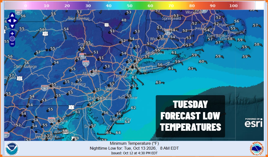
After the Sunday rains moved out we managed a decent weather day on this Columbus Day. Sunshine broke through the clouds. A storm system offshore is moving away quickly to the east. Skies should partially clear tonight though we do see some clouds on the satellite loops going into this evening. However radars are quiet locally so we will have no issues overnight. Low temperatures Tuesday morning will be in the 50s to around 60 degrees in most places.
SATELLITE WITH LIGHTNING STRIKES
WEATHER RADAR
We do have a weak cold front approaching late today and tonight across the Northeast. Most of the showers with this front will pass to our north. Ahead of the front we will see warmer temperatures Tuesday with a mix of sun and clouds along with a southwest wind. High temperatures will be in the low to middle 70s.
The front will pass offshore Wednesday morning but we will have a west wind. Initially that will make for warmer conditions during the day Wednesday before cooler air arrives Wednesday night. Skies Wednesday should be no worse than partly sunny and it will be warm with highs in the upper 70s to lower 80s.
We will cool off Wednesday night with lows in the 50s to around 60 degrees. Thursday high pressure builds across New England and that will turn the wind to the east northeast leading to cooler temperatures. High Thursday will be in the 60s. Another weather system approaches and it will be a warm front first followed by a cold front later on Friday. This leads to some showers Thursday night into Friday morning, followed by a break and then another chance for showers Friday afternoon as the cold front passes.
Temperatures Friday will be in the 70s until the front passes. Then the coldest air mass of the Autumn season so far arrives in time for the weekend. It will be dry next weekend but it will be quite chilly. Saturday highs in spite of some sunshine will only be in the 50s and there will be a gusty northwest wind as well. Sunday morning lows will be quite cold with lows in the 30s in most areas and we could see the first freezes of the season inland. Sunday will be dry but chilly with sunshine and less wind with highs in the 50s.
MANY THANKS TO TROPICAL TIDBITS FOR THE USE OF MAPS
Please note that with regards to any severe weather, tropical storms, or hurricanes, should a storm be threatening, please consult your local National Weather Service office or your local government officials about what action you should be taking to protect life and property.