USE THE COUPON CODE “SPRING2026” AND GET 10 PERCENT OFF ON ANY PURCHASE
Heat Returns Tuesday Through Thursday
With Little Rain In The Forecast
Ahead of another stretch of hot humid weather at least we have one more day of reasonable summer temperatures and humidity. Today will be a day of sunshine and while temperatures are going to move higher to the mid to upper 80s this afternoon, humidity levels will stay in check for one last day and then move up tomorrow and Wednesday. High pressure is holding on but it will move out to the east. Tonight will be warm and more humid with most lows in the mid 60s to near 70 by Tuesday morning. Radars are nice and quiet and no rain is in the forecast.
SATELLITE WITH LIGHTNING STRIKES
WEATHER RADAR
The latest heat ridge is building and will reach peak strength Tuesday into Wednesday across the Plains and Western Great Lakes. Unlike the last heat ridge which build up in the Tennessee Valley and Mid Atlantic, this one is only going to nudge into the Northeast and Mid Atlantic so we are basically on the eastern edge of it. The result is sunshine and hot conditions beginning Tuesday. The humidity is going to rise but not to the extent we might see in a more tropical air mass. Highs Tuesday will reach the lower 90s.
Also the upper ridge will keep disturbances from moving into the Eastern US for the time being which means no thunderstorms are in the forecast for Tuesday and also for Wednesday. A weather front approaching will bend the winds more westerly so we will see Wednesday as the hottest day of the week. Highs will reach the mid to upper 90s. It will be humid but again dew points are not going to surge into the low and mid 70s.
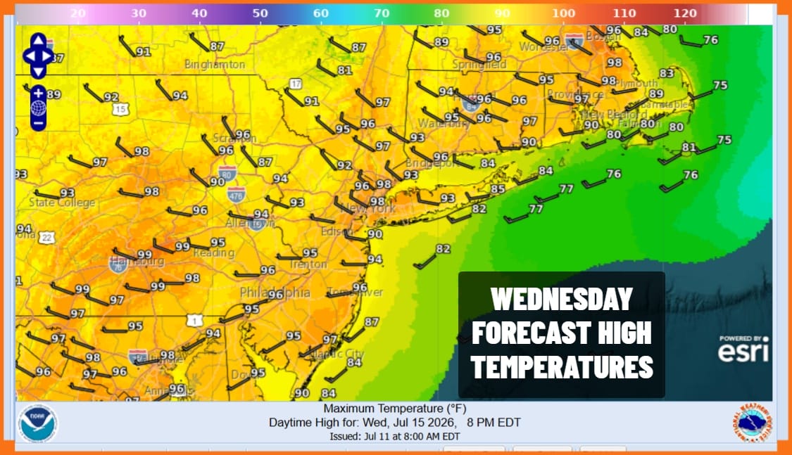
This front will probably set off some thunderstorms well to the north so it is likely to move through dry. Thursday we will see sunshine with highs reaching the lower 90s but it will actually be less humid as northwest winds bring down drier air so dew points will actually drop Thursday into the lower 60s making it more comfortable and certainly not overbearing. Friday we will have some sunshine and highs will be back in the 80s with reasonable humidity. No rain is forecast for Thursday and Friday.
DOWNLOAD THE UPSIDE APP & EARN CASH AT GAS STATIONS, RESTAURANTS, & SUPERMARKETS
BE SURE TO DOWNLOAD THE FREE METEOROLOGIST JOE CIOFFI WEATHER APP &
ANGRY BEN’S FREE WEATHER APP “THE ANGRY WEATHERMAN!
MANY THANKS TO TROPICAL TIDBITS FOR THE USE OF MAPS
Please note that with regards to any severe weather, tropical storms, or hurricanes, should a storm be threatening, please consult your local National Weather Service office or your local government officials about what action you should be taking to protect life and property.