USE THE COUPON CODE “summer2026” AND GET 10 PERCENT OFF ON ANY PURCHASE
Very Warm With Record Highs Rain Set To Develop Friday Into Friday Night
We have a warm weather day ahead with the potential for record high temperatures in some places across Eastern Pennsylvania to Southern New England. An east west Atlantic ridge continues to keep skies mainly sunny while forcing moisture to move over the top across Southeast Canada and Northern New England. Satellite loops show this formation well. Also coming into the scene on loops is clouds and showers from a cold front but that front is west. Enjoy the November warmth with high temperatures today expected to reach the low and middle 70s. A warm night lies ahead with clear skies for much of the overnight. Some clouds will likely come in before daybreak. Lows overnight will be in the 50s except low 60s in warm urban areas and along the coast. Radars remain silent today.
SATELLITE WITH LIGHTNING STRIKES
WEATHER RADAR
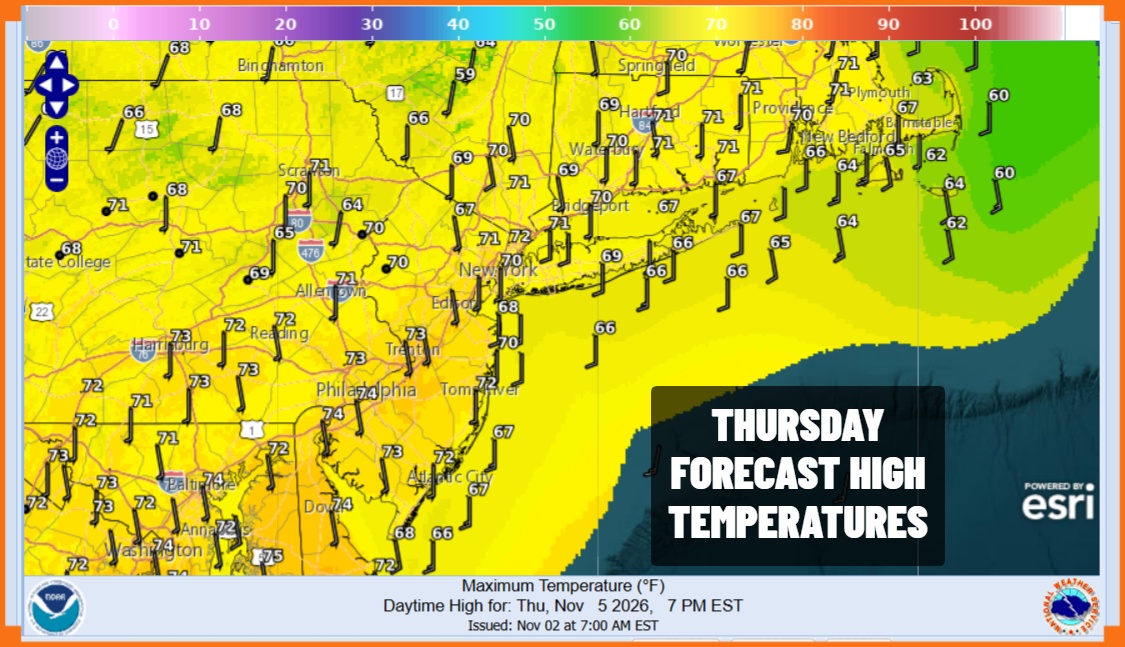
Warm weather continues Thursday however we will have clouds. A cold front approaches and while there will be numerous showers ahead of the front, most of them will go north and what is left will be on the weak side. Some showers are possible Thursday afternoon and evening. It will be warm but the cloud cover holds the temperatures down and highs will be in the upper 60s and lower 70s.
The front will stall overhead Thursday night. We will have to wait for a wave to develop on the front and there will be a narrow stick like area of rain that will run from Southeast Massachusetts to Southeast Virginia. A wave develops on the front and the rain area bulges back westward. The cutoff line for the rain lies just inland of the coast so it seems that only coastal areas like Long Island, New York City, and coastal New Jersey see rain from this and much less north and northwest of the coast.
Latest model runs suggest a slightly eastward bias which lessens the risk for heavy rain however that could easily go in the other direction and produce a couple of inches of rain in some areas at or just inland of the coast so we are going to keep an open mind on this. Friday highs will be in the upper 60s and lower 70s. Once the wave goes by the rain will end during the overnight hours Friday however we have an strong upper low to deal with for Saturday and that means clouds, showers, and cooler temperatures in the 60s. We may have to wait until Sunday to see genuine weather improvement.
MANY THANKS TO TROPICAL TIDBITS FOR THE USE OF MAPS
Please note that with regards to any severe weather, tropical storms, or hurricanes, should a storm be threatening, please consult your local National Weather Service office or your local government officials about what action you should be taking to protect life and property.