USE THE COUPON CODE “summer2026” AND GET 10 PERCENT OFF ON ANY PURCHASE
Warm Week Ahead Showers May Finally Arrive Thursday
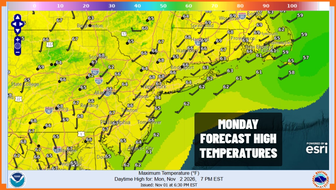
We are back to work today on standard time and after bottoming this morning in the low and mid 40s coast and warmer urban areas, 20s and 30s inland, temperatures are set to bounce higher. Satellite loops show mainly clear skies in the Northeast though there are areas of clouds to the west that will come into the mix. Overall it is a partly to mostly sunny Monday. Temperatures today will climb to the mid and even upper 60s this afternoon. Radars remain quiet as they have been for the last 16 days.
SATELLITE WITH LIGHTNING STRIKES
WEATHER RADAR
Night’s are going to start warming up as well and the long November nights probably means that we could start seeing areas of patchy fog developing during the overnight periods. Tuesday morning lows will be mostly in the 40s with a few 30s in cold spots. Tuesday we will see sunshine and warmer temperatures with highs reaching the upper 60s and lower 70s in most places.
Once again we will see some patchy fog developing Tuesday night into Wednesday morning with lows in the 40s inland and low 50s coast and warmer urban areas. Wednesday looks to be no worse than partly sunny and afternoon highs will reach into the lower and even a few middle 70s in some warm spots.
While we remain dry through Wednesday storminess continues in the Rockies and Plains as strong low pressure heads for the Western Great Lakes. The trailing north south cold front will begin to make some progress eastward and should be close enough Thursday for arriving clouds and the risk for showers late in the day Thursday. The front will be slowing down thanks to high pressure offshore and a storm that develops in the Atlantic northeast of the Bahamas. The stalled front probably means that we will see some showers and perhaps a thunderstorm or two Friday. We do expect to see the front begin to shift eastward so that weather conditions will improve over the weekend.
MANY THANKS TO TROPICAL TIDBITS FOR THE USE OF MAPS
Please note that with regards to any severe weather, tropical storms, or hurricanes, should a storm be threatening, please consult your local National Weather Service office or your local government officials about what action you should be taking to protect life and property.