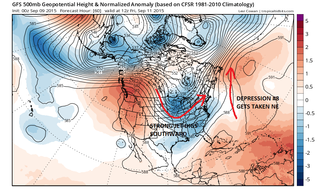
Satellite pictures overnight show the area of disturbed weather southeast of Bermuda has become the season’s eighth tropical depression and it is likely to becom a tropical storm later today or tonight. You can see it on the satellite loop here along with what is left of Tropical Storm Grace in the Central Tropical Atlantic.
SUMMARY OF 500 AM AST…0900 UTC..INFORMATION
LOCATION…30.9N 61.4W
ABOUT 220 MI…355 KM ESE OF BERMUDA
MAXIMUM SUSTAINED WINDS…35 MPH…55 KM/H
PRESENT MOVEMENT…STATIONARY
MINIMUM CENTRAL PRESSURE…1011 MB…29.86 INCHES
Conditions are marginally favorable for strengthening over the next 2 days or so. The most likely track is to the north and eventually to the northeast and gone as it winds up getting absorbed by a strong gale center in the north Atlantic so we won’t waste too much time here with this system.
The upper flow is responding to a deep digging trough over the Great Lakes while the depression finds itself ahead of that trough in an increasing southwest flow aloft.
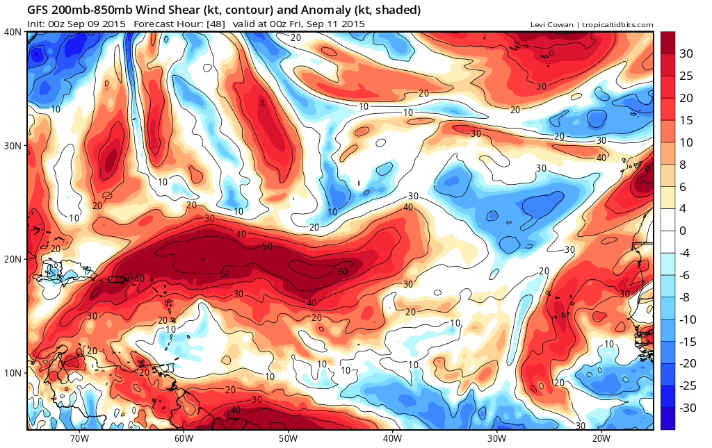
Meanwhile Grace hasn’t much left to it other than a few thunderstorms that pop up around a low level circulation. Hostile conditions aloft are about to become more hostile over time.
SUMMARY OF 500 AM AST...0900 UTC...INFORMATION
----------------------------------------------
LOCATION...14.3N 47.2W
ABOUT 945 MI...1520 KM E OF THE LESSER ANTILLES
MAXIMUM SUSTAINED WINDS...30 MPH...45 KM/H
PRESENT MOVEMENT...W OR 270 DEGREES AT 17 MPH...28 KM/H
MINIMUM CENTRAL PRESSURE...1007 MB...29.74 INCHES
Grace should be just a remnant low once it hits the evens stronger shear that lies ahead of it.
For more of Meteorologist Joe Cioffi’s weather, download his weather app for all platforms.