USE THE COUPON CODE “summer2026” AND GET 10 PERCENT OFF ON ANY PURCHASE
Slow Improvement Continues Today Low Shower Risk, Better Day Wednesday
Satellite loops this morning show low pressure offshore to the northeast and an associated upper trough that is yet to pass. This leaves us somewhat humid today across Eastern Pennsylvania to Southern New England. Slightly drier air lies across Upstate New York and Northern New England. That dry air will seep southward once the upper trough passes through late today. A mix of sun and clouds will be the story today and we will throw in the chance for a passing shower along the coastal plain this afternoon though not everyone will see them. I don’t think we have to worry about thunderstorms. Skies should partially clear tonight with most lows in the 60s to around 70 degrees.
SATELLITE WITH LIGHTNING STRIKES
WEATHER RADAR
Moving on to Wednesday that slightly drier air should bring dew points down into the low and mid 60s and north of New York City dew points could go below 60. It will feel a little less humid but not much. A front to the northwest is approaching late Wednesday but showers with that front should fall apart before reaching our area. This leaves us in a mix of sun and clouds with highs in the 80s.
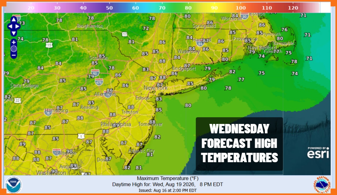
This front is going to stall out overhead Wednesday night and that could set off some showers and thunderstorms on Thursday. That should be enough to push the front eastward late Thursday into Thursday. night. In the meantime any sun will be limited and high temperatures Thursday will be in the 80s with higher humidity.
The work week will finish off with some sunshine Friday and highs will be in the low to mid 80s. Over the weekend we are going to be dealing with a slow moving cold front and low pressure over the Great Lakes. This will leave us in mostly cloudy conditions Saturday and there might be some showery rains around. We expect to see more in the way of downpours and perhaps a thunderstorm or two Sunday as the front and low pressure draws colder. Temperatures over the weekend will be lower with highs in the upper 70s and lower 80s both weekend days.
MANY THANKS TO TROPICAL TIDBITS FOR THE USE OF MAPS
Please note that with regards to any severe weather, tropical storms, or hurricanes, should a storm be threatening, please consult your local National Weather Service office or your local government officials about what action you should be taking to protect life and property.