Woke up to the strange sound of something hitting against the window and lo and behold yes it was rain! The first round of downpours with the cold front moved through and there is more to go as the wave develops this afternoon and tonight and brings with it a pretty good shot of widespread rain on the order of 1 to 2 inches. Some places have gotten over an inch of rain just from the first shot of downpours so if you get at least the same with the next round you got your 2 inches. Check the latest radars on this page and you can see the moisture beginning to take shape to the southwest. This will be the area that moves in later today. We also will not get out of the 70s today for the first time in 2 months. New York City has seen 80 degrees everyday for the last 60 days or more in a row. That streak will end today.
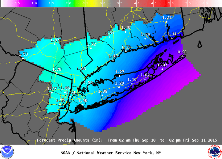
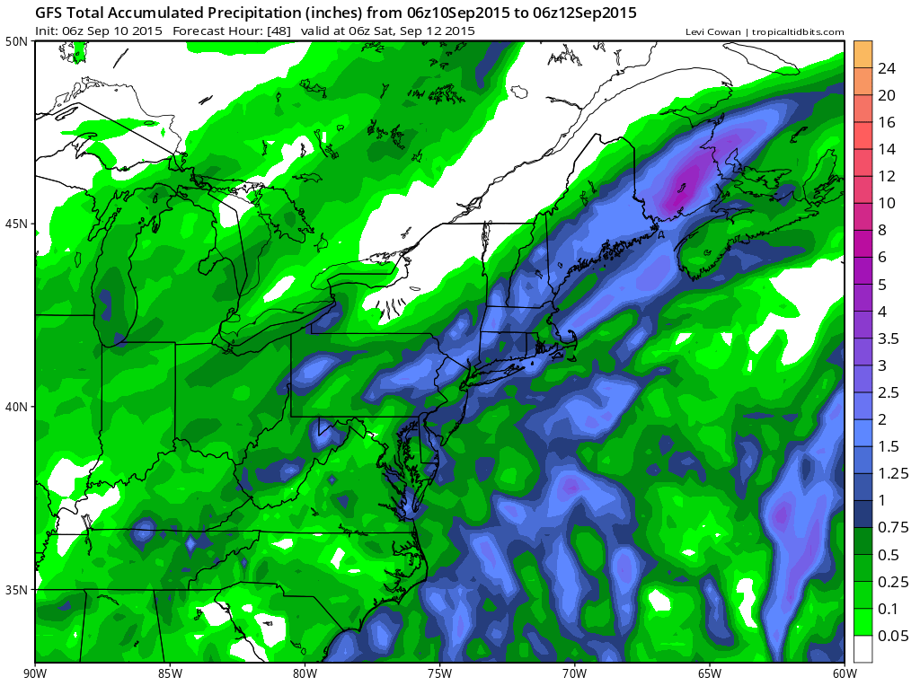
This is the latest weather service rainfall map for the NYC NE NJ Long Island, Southern Connecticut and Hudson Valley and below is the gfs model run. Pretty much the same idea here all the way around. 1 to 2 inch rains go all the way back to Eastern Pennsylvania and cover all of southern New England.