Just A Low Chance of Isolated Showers As Nice Early Autumn Weather Continues
We are moving along on this nice weather weekend. Today we see a weak weather front and upper trough dropping southeastward through New York state and New England. There really isn’t much with it other than a few clouds and perhaps the energy to set off a couple of isolated widely scattered showers mainly from NYC north and northeast. Otherwise today will be no worse than partly sunny and afternoon highs will be in the upper 70s and lower 80s. We will keep an eye on radars later today but we are not expecting very much.
SATELLITE WITH LIGHTNING STRIKES
WEATHER RADAR
Once the front and trough pass through we are expecting skies to clear out overnight with most lows in the lower 60s across warmer urban and coastal areas while inland areas will be in the 50s. Monday is setting up to be a mostly sunny and warm day. High temperatures will be in the upper 70s and lower 80s though an ocean wind will keep south and east facing shorelines a few degrees lower.
In theory much of this week will be dry but we have some complications developing for midweek. Higher pressures across Upstate New York and New England as well as Atlantic Canada mean lower than normal pressures off the Southeast US coast. As a result a low will form there on an old frontal boundary. We saw this happen last week and ultimately that wave moved out to the northeast with little consequence to weather across Eastern Pennsylvania to Southern New England.
Models do show a low forming off the coast of North Carolina and then gradually moving inland into Southern Virginia. Bands of rain move into the Coastal North Carolina northward to the Delmarva. The low weakens but some of the rain finds its way northward Wednesday into Thursday. We have to put in the chance for at least some showers in the forecast but areas from Southern New Jersey southward could see more in the way of showery rains. We will need to monitor this over the next few days.
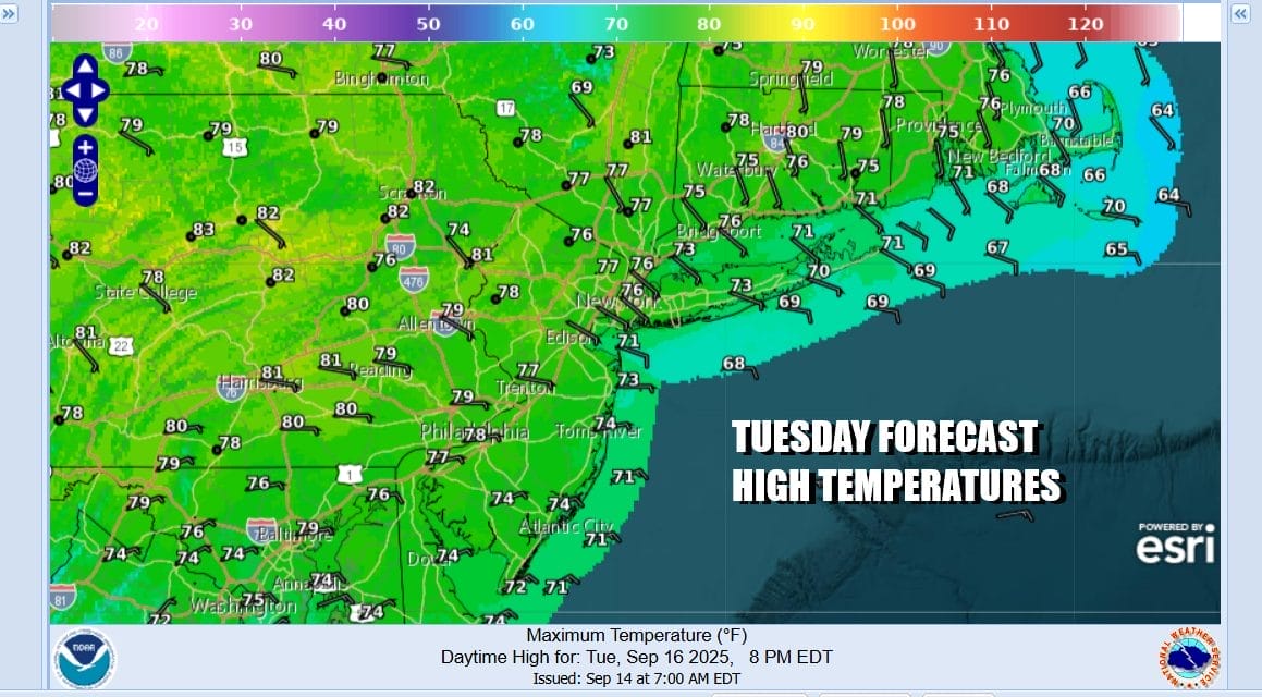
In the meantime it leaves us with a partly to mostly sunny and warmish Monday with highs in the upper 70s to lower 80s. Again it will be cooler along south and east facing shorelines of New Jersey and Long Island. Tuesday look for high pressure to keep skies mostly sunny though temperatures could be a little lower thanks to a northeast to east wind. Highs will be in the middle to upper 70s.
BE SURE TO DOWNLOAD THE FREE METEOROLOGIST JOE CIOFFI WEATHER APP &
ANGRY BEN’S FREE WEATHER APP “THE ANGRY WEATHERMAN!
MANY THANKS TO TROPICAL TIDBITS FOR THE USE OF MAPS
Please note that with regards to any severe weather, tropical storms, or hurricanes, should a storm be threatening, please consult your local National Weather Service office or your local government officials about what action you should be taking to protect life and property.