JOESTRADAMUS: LONG RANGE MODEL TODAY BY STEVE STUCKER!
JOESTRADAMUS always welcomes a good laugh and what better than another run of the long range models and another run of model volatility with some silliness throw in for laughs. Today’s gfs run shows another one of these seemingly endless pattern flips that have lately gotten the heat haters out there jumping for joy. However before on goes dancing in the streets at the arrival of genuine cool air for the last week of September Joestradamus cautions that while at first glance it might seem plausible that a deep trough could set up in the east (beyond day 10 no less) there is a huge credibility issue the model has which must be recognized.
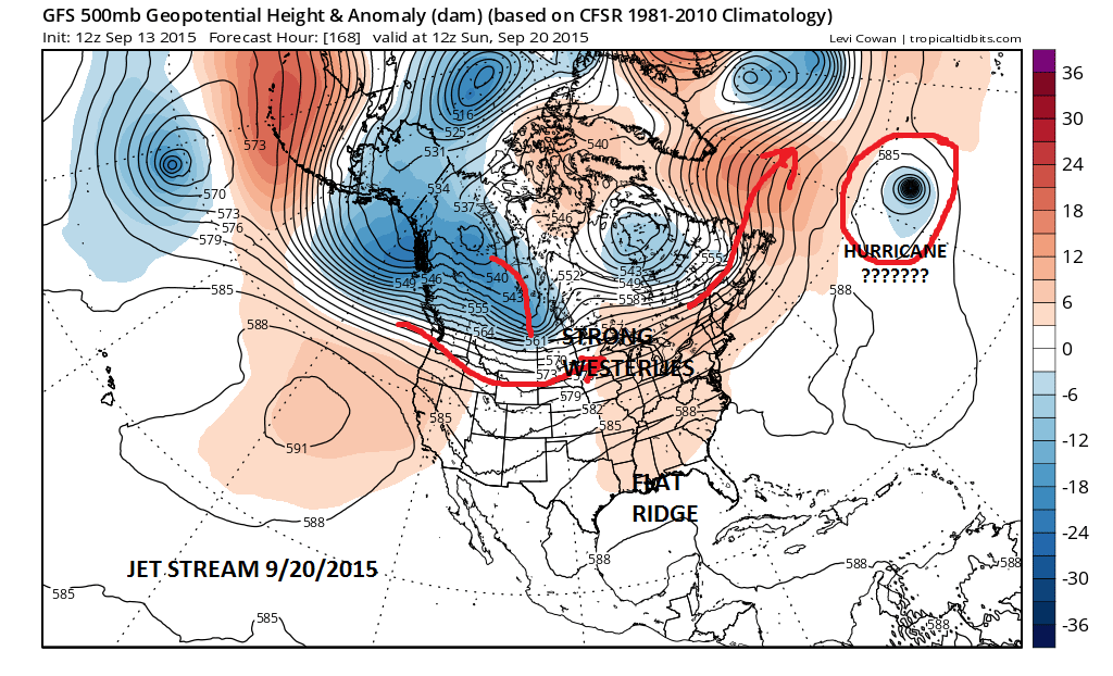
Im going to jump to a week from today because until then nothing much really happens here. The next frontal passage is due next Saturday night at it comes when the westerlies to the north settle just to our south as the ridge in the east flattens. This allows a cold front to pass through and we turn cooler though probably a little above normal in the process. What stands out in the Atlantic is what appears to be a tropical system of some sort; probably a hurricane and it could perhaps be the system that is poised to develop in the tropical Atlantic over the next few days. See my post on this on thetropical weather page.
It is entirely plausible that there could very well be a hurricane in that position. Notice that it is sitting just south of the strong westerly winds aloft in the north Atlantic. It seems to me that those westerlies are far enough south to pick this hurricane up and energize the low that is southeast of Iceland.
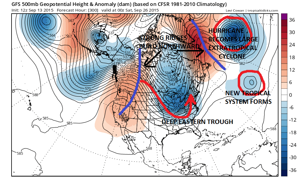
What the GFS does with this hurricane is that it stalls it out for 3 days along 40N near the Azores!!! Now while it is technically not impossible it seems to be highly unlikely that this hurricane marches to 40 north and then somehow come to a grinding halt for 3 days as the westerlies to the north lift up. The model then finally takes that hurricane and it transitions into a large extratropical cyclone. This is important because that cyclone then changes the entire complex picture across the Atlantic.
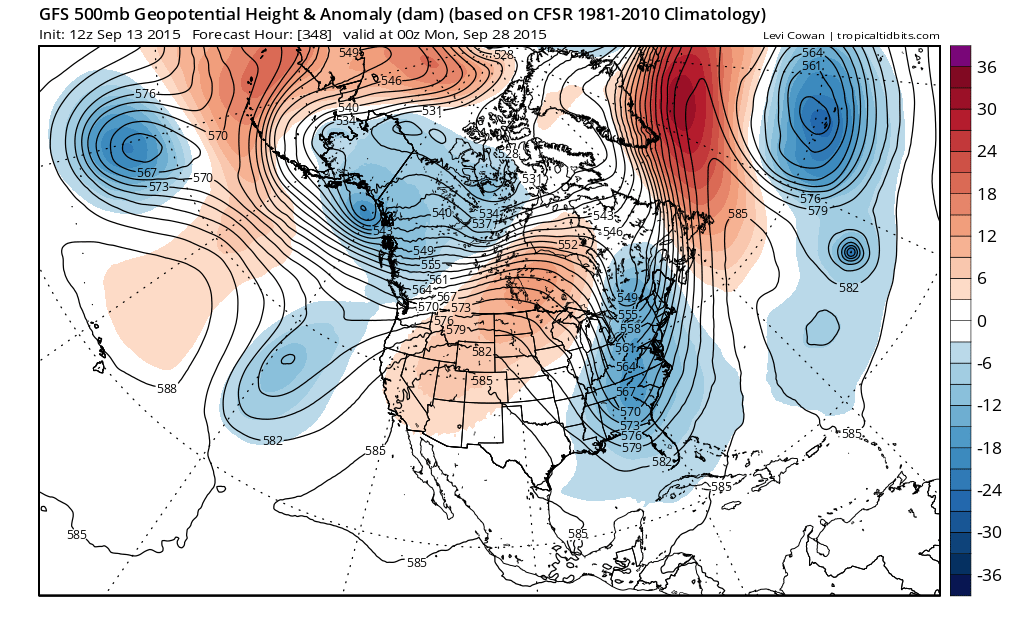
In response to the deep cyclone (or perhaps the reverse) a strong ridge develops over Greenland, which supports a deep trough in the east and a ridge in the western United States. Or it could be viewed in reverse where the strong system that comes into the northwest and drives the trough which drives the ridge which drives the extratropical cyclone! To top it off we have what appears to be another tropical cyclone in the Atlantic which is set to do something to the upper air picture in the North Atlantic which would cause the east coast trough to stall out. This is exactly the outcome to today’s model run as we jump to day 12 above to day 14.
What should we make of all this? This is where I recall the movie Airplane where Lloyd Bridges holding a weather map from a an old fax machine asks one of the airline workers played brilliantly by Steve Stucker, “What do you make of this?
Litter box liner also comes to mind. The fact is that this run of the GFS sits in the area known as fantasy land. A lot of things have to happen for this come about not the least of which is a hurricane stalling out for 3 days in the north Atlantic in a season where u can’t get even a tropical storm to survive more than a day or 2. Trying to derive clue from other models at this stage seems also to be a wasted exercise. What is more likely to happen is that a flatter less dynamic flow will continue to dominate the weather scene for the next 2 weeks. This is what the European shows today. The European shows no tropical cyclone, no North Atlantic cyclone of consequence, a ridge in the east and a trough in the west! At least this is the case through day 10.
Of course it is only logical that now that I have completely discounted the possibility that it will in fact become reality or something close to it. Confidence factor today is very very low!