USE THE COUPON CODE “summer2026” AND GET 10 PERCENT OFF ON ANY PURCHASE
Dry Today But Showers Thunderstorms Thursday With Severe Weather Risk
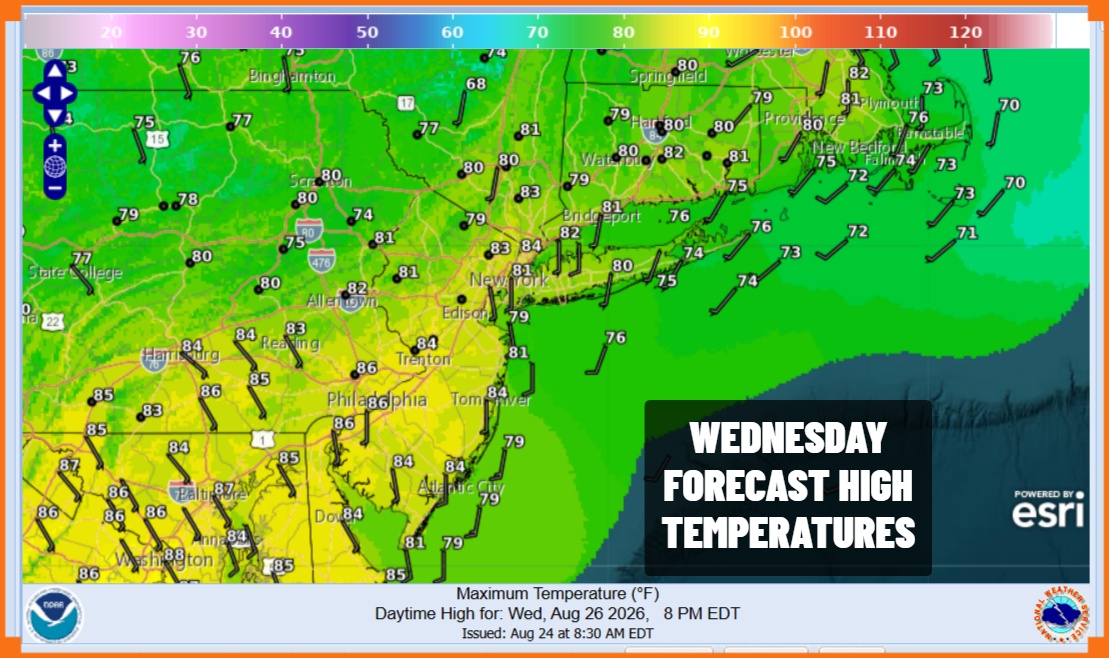
High pressure is hanging on along the East Coast for one more day and that gives us a day with plenty of sunshine. Some high clouds could come into the mix later today but overall it is a nice Wednesday of weather. No showers or thunderstorms are in the forecast today and look for high temperatures will reach the lower 80s in most places. Dew points are starting out in the upper 50s to near 60 or so this morning and they will likely hover at these levels until late today when they will start inching up a bit. Overnight we are looking at clear skies giving way to some some late night clouds as a warm front approaches. Lows will be in the 60s to around 70 degrees by Thursday morning.
SATELLITE WITH LIGHTNING STRIKES
WEATHER RADAR
Looking ahead to Thursday we are watching another warm front cold front combination approaching from the Great Lakes and Ohio Valley. Ahead of the warm front some of you will see showers and thunderstorms move through Thursday morning, and then followed by the approaching cold front and perhaps another round later in the day into Thursday evening.
We have seen so many of these setups this summer. This one is no different as the Storm Prediction Center is indicating a severe weather risk from Virginia to Western New England and a slight risk in Central and Northeastern Pennsylvania northeast to the Catskills and Central New York. We also have a slight risk or a 15 to 40 percent chance for some localized flash flooding.
Thursday temperatures will reach into the 80s and then settle back once showers and storms move through. We expect the cold front to move along so most if not all the activity should be done between 9pm and midnight from west to east. Weather conditions will improve Friday with clouds and some sunshine. The air behind this front is not particularly dry so it will remain humid Friday with highs in the low to mid 80s. There could be a brief shower or thunderstorm around midday or in the afternoon but chances are on the low side. The weekend is shaping up to be warm and humid with only low chances for any showers or storms. Highs both Saturday and Sunday will be in the low to middle 80s.
MANY THANKS TO TROPICAL TIDBITS FOR THE USE OF MAPS
Please note that with regards to any severe weather, tropical storms, or hurricanes, should a storm be threatening, please consult your local National Weather Service office or your local government officials about what action you should be taking to protect life and property.