Coastal Low Threat For Next Week
We are still watching the possibility of a coastal low threating the Mid Atlantic and Northeast for early next week but as usual models offer no consensus on speed, timing, depth, and location. As usual all the major models are different and it has to do with the 2 split jets and how they interact (or don’t interact) with each other.
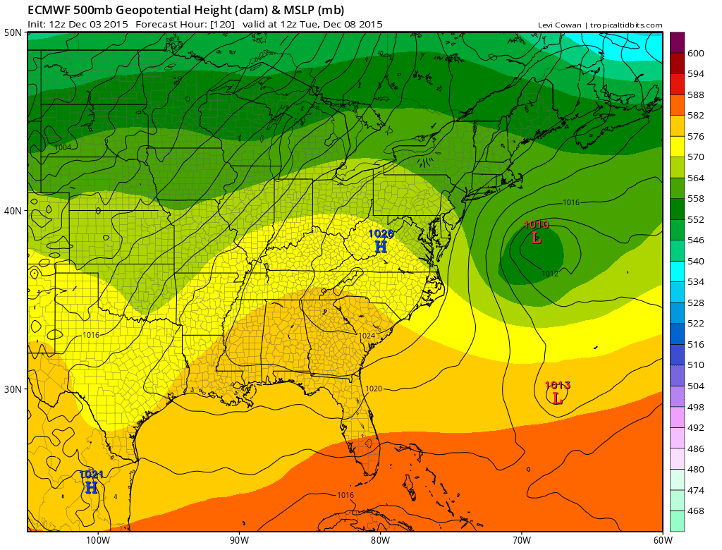
The European model has weakened the overall look considerably in the southern split and shows nothing more than a week low offshore that moves out to the east with no issues at all.
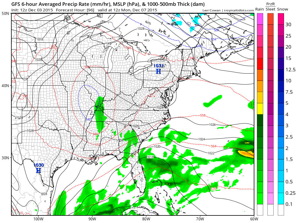
The southern system just stays weak and moves right along from west to east and goodbye. The Canadian model is the fastest and winds up with the deepest low of the 3. The southern stream upper low lifts northeastward making it a closer call for rain along the coast.
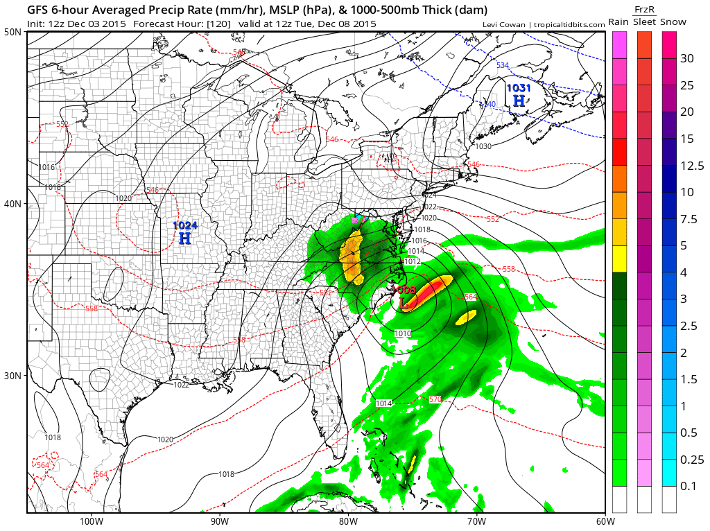
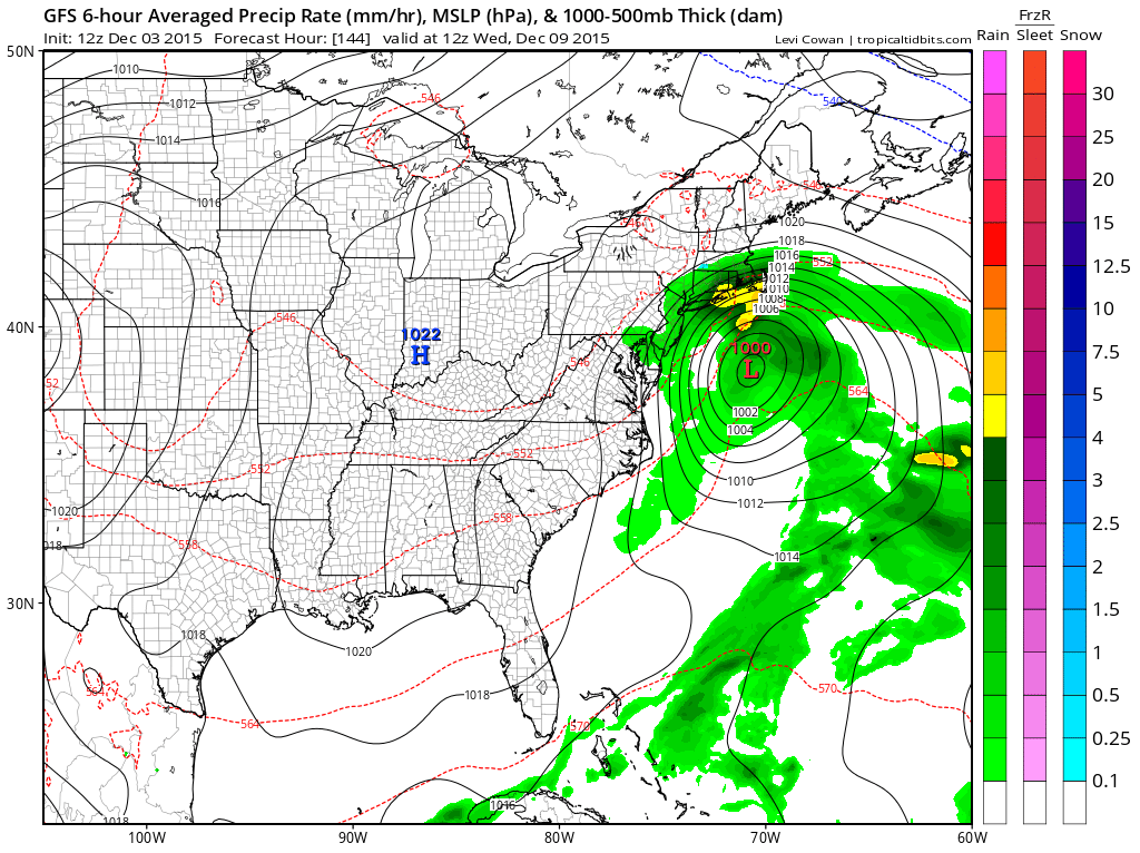
The GFS of course is slowest of the three models as it splits the flow completely and allows the southern stream to do its own thing. This allows the gfs to lift things further left but it is about a full day slower again.
Earlier today in case you missed it JOESTRADAMUS did some long range and winter 2015-2016 commentary so check the JOESTRADAMUS WINTER UPDATE 2015-2016
SHORT RANGE FORECAST NEW YORK, NEW JERSEY, CONNECTICUT, PENNSYLVANIA
JOESTRADAMUS VIDEO ANALYSIS FROM TUESDAY
JOESTRADAMUS LONG RANGE POST TUESDAY
JOESTRADAMUS LONG RANGE POST FROM MONDAY
JOESTRADAMUS WINTER FORECAST 2015-2016