DOWNLOAD MY NEW FREE JOESTRADAMUS WEATHER APP FOR ALL DEVICES
THE APP IS ABSOLUTELY FREE TO ALL BUT CONSIDERING SUBSCRIBING TO PATREON FOR A WEATHER EXPERIENCE FREE OF ADS, EXCLUSIVE VIDEOS FOR MEMBERS ONLY AND MUCH MORE…STARTS AT $2 A MONTH..MESSAGE ME AT ANY TIME
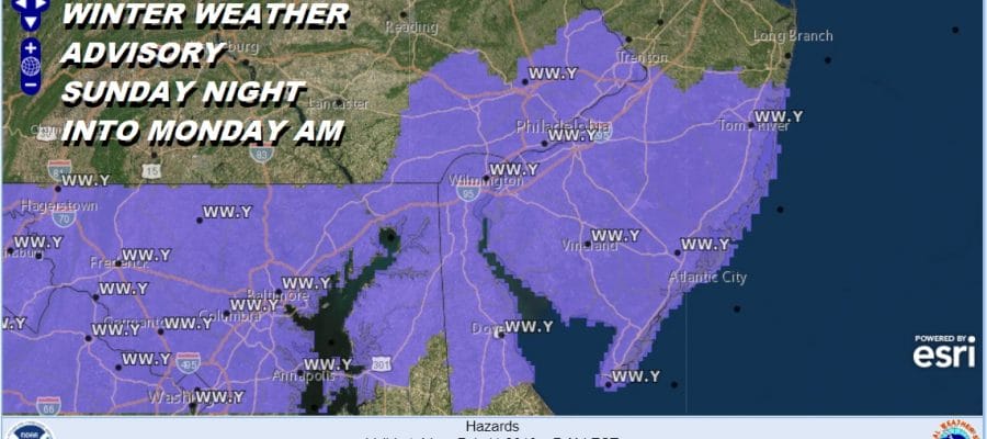
Winter Weather Advisory South Jersey Southeast Pennsylvania Tonight into Monday
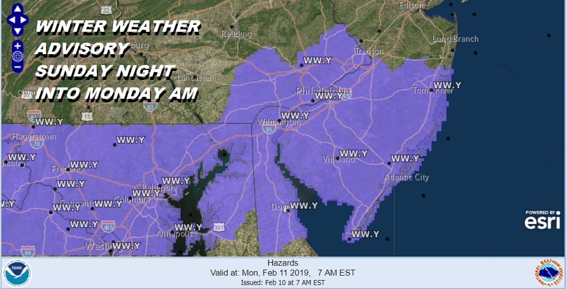
The first of 2 weather systems will be moving through tonight into Monday morning and we are treating both systems separately. This system will bring snow tonight (after 7pm) into Monday morning and it should be mostly done by daybreak. Winter Weather Advisories are posted for for South Jersey south of 195, Southeast Pennsylvania including Philadelphia, and Maryland including Baltimore and Washington DC.
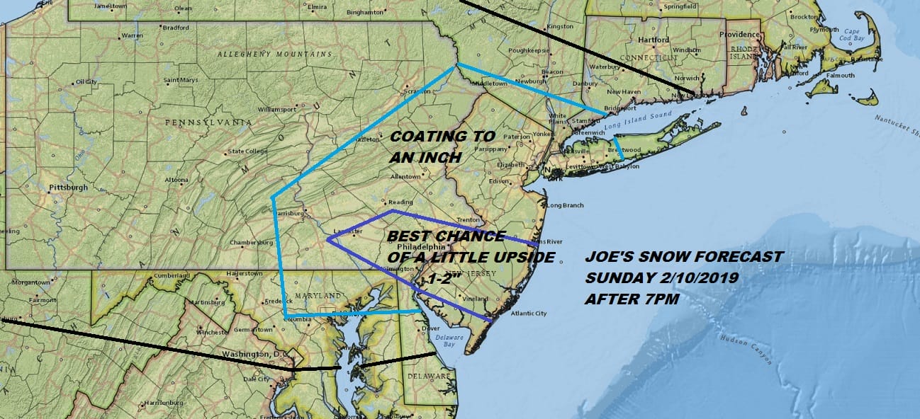
I made this forecast a few days ago and am going to leave things alone though I would say that there is room for some upside here in all areas especially in that 1 to 2 inch zone. I would not be at all surprised to see some isolated 3 inch amounts in a few places. To repeat this is the first of 2 weather systems which will have impact between 7pm tonight and 7am Monday. In the meantime not much is happening on the satellite or regional radar at the moment. The day side part of today remains fine with sunshine giving way to increasing clouds with highs into the 30s.
EASTERN SATELLITE

REGIONAL RADAR

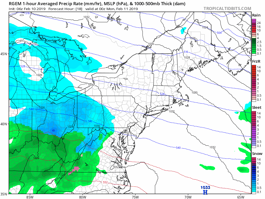
After 7pm we get into some snow and the northern fringe of the snow will briefly make it to about Route 80 in New Jersey to along and south of 287 in the Hudson Valley and perhaps into Southwest Connecticut and Western Long Island. The snow in the northern most extent of the snow should only see snow for a few hours at most while the further south you go in New Jersey south of 195 or in Pennsylvania along and south of Route 76 it could go most of the night. The map below is the simulated radar off the RGEM model between 7pm tonight and 1pm Monday.
The second system is for Monday night and Tuesday and it is the stronger of the two. This is going to bring snow sleet freezing rain and rain to the area and we will address that separately in order to avoid confusion.
MANY THANKS TO TROPICAL TIDBITS FOR THE USE OF MAPS
Please note that with regards to any tropical storms or hurricanes, should a storm be threatening, please consult your local National Weather Service office or your local government officials about what action you should be taking to protect life and property.


