Winter Weather Advisory Eastern Pennsylvania Northern NJ Hudson Valley NYC
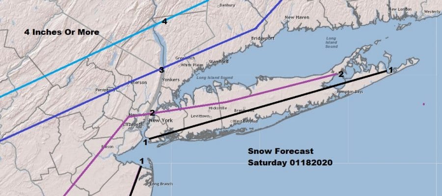
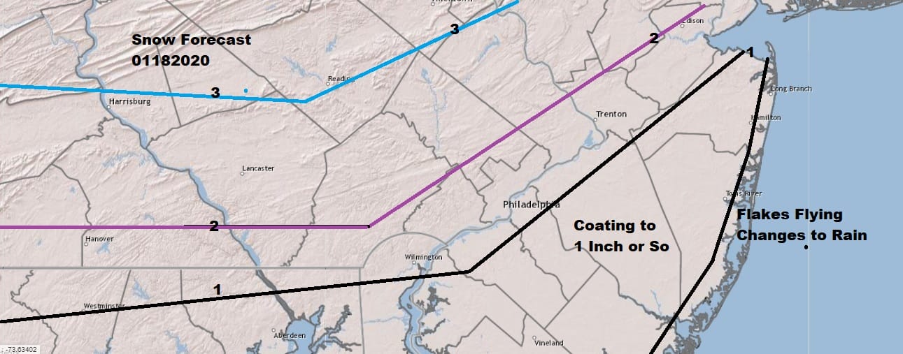
Connecticut & Long Island Latest Snow Forecast Maps
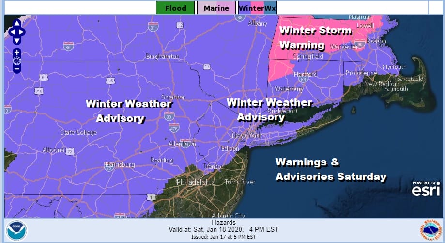
Everything is playing according to plan. Winter Weather Advisory continues for the areas shown above on the map with Winter Storm Warnings for Northwest Connecticut northward into Massachusetts. There have been no additions or subtractions overnight. We also made some minor adjustments to our snow forecast maps. We nudged amounts up a little higher, while NWS either kept their numbers the same or lowered the numbers around NYC. I argued yesterday they were too high to begin with and they look okay in my view for the time being.
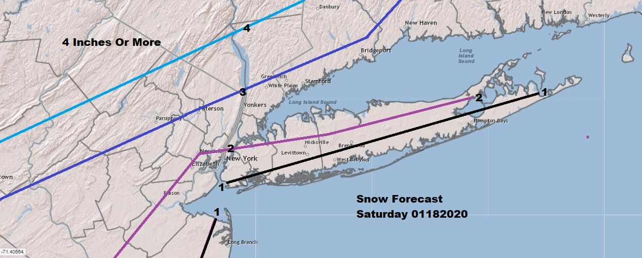
I basically just nudged the 2 inch snow line a little further south into Long Island and NYC. That was really the only important change i made today. i also nudge a few lines around in Southeastern Pa. The changes were really minor in nature.
Clouds have already moved in across the Northeast and Middle Atlantic states which will slow the pace of any warming that will occur today. The core of the cold air is overhead and sliding east and offshore. Temperatures bottomed in the teens to near 20 this morning which is making for a solid set up for accumulating snow this afternoon.
SATELLITE

REGIONAL RADAR

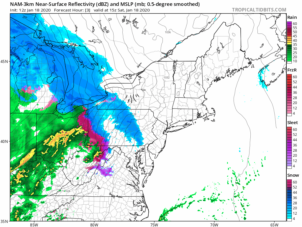
Regional radar shows snow advancing eastward. What we have to keep an eye on is the banded nature of the lead area of snow. Some of that is aloft but it is reaching the ground where you see the green areas. The gap in between needs to fill in this afternoon as the snow area moves east. This will certinaly bring the snow accumulation amounts that are being indicated. Local radars are picking up on the approaching snow and should increase in coverage considerably this afternoon.
LOCAL RADAR NEW YORK CITY

LOCAL RADAR PHILADELPHIA


This is basically a fast 6 to 8 hour event from start to finish. Snow to sleet and then rain. We get what we get. Weather models move everything along. We see no reason to go against this idea. We are using the new 3KM NAM model that runs from 10am to 10pm today and you can see how it sees the radars regarding the snow and rain.
This is fast. It all ends from west to east early tonight. Weather conditions improve on Sunday with some sunshine, a gusty breeze and highs in the 30s to near 40. Colder air returns Sunday night with Monday morning lows in the teens to near 20. Look for some sunshine and cold weather in Monday with highs in the 20s to near 30 in most places. Much of next week is dry and cold with the next storm system threat likely next weekend.
BE SURE TO DOWNLOAD THE FREE METEOROLOGIST JOE CIOFFI WEATHER APP &
ANGRY BEN’S FREE WEATHER APP “THE ANGRY WEATHERMAN!
MANY THANKS TO TROPICAL TIDBITS FOR THE USE OF MAPS
Please note that with regards to any severe weather, tropical storms, or hurricanes, should a storm be threatening, please consult your local National Weather Service office or your local government officials about what action you should be taking to protect life and property.


