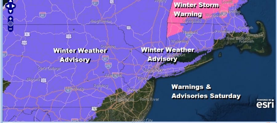
Winter Weather Advisories Eastern Pennsylvania Northern New Jersey
NYC Hudson Valley Long Island Connecticut
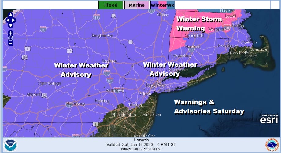
Winter Weather Advisories have been expanded this afternoon by the National Weather Service for all of Pennsylvania except the southeast and southwest, most of the northern half of New Jersey, NYC, most of Long Island, the Hudson Valley and most of Connecticut with Winter Storm Warnings in NY Connecticut. Also snow amounts have been raised by the NWS in some coastal areas while leaving them the same in others.
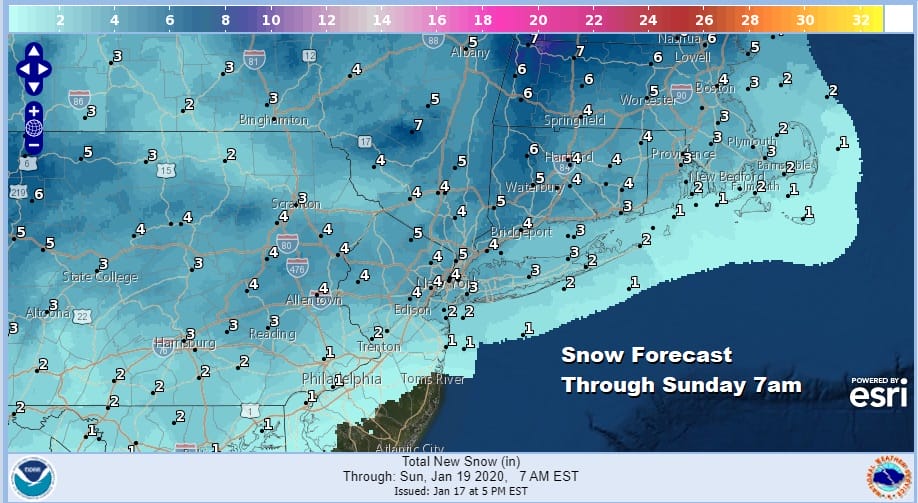
This is where we have some disagreement in the forecasts. I have not changed my final call from yesterday. While weather models have become a little more bullish regarding snow totals and the atmosphere is colder for an extra hour or two, I didn’t feel there was enough here to nudge numbers higher along the coast at least for now.
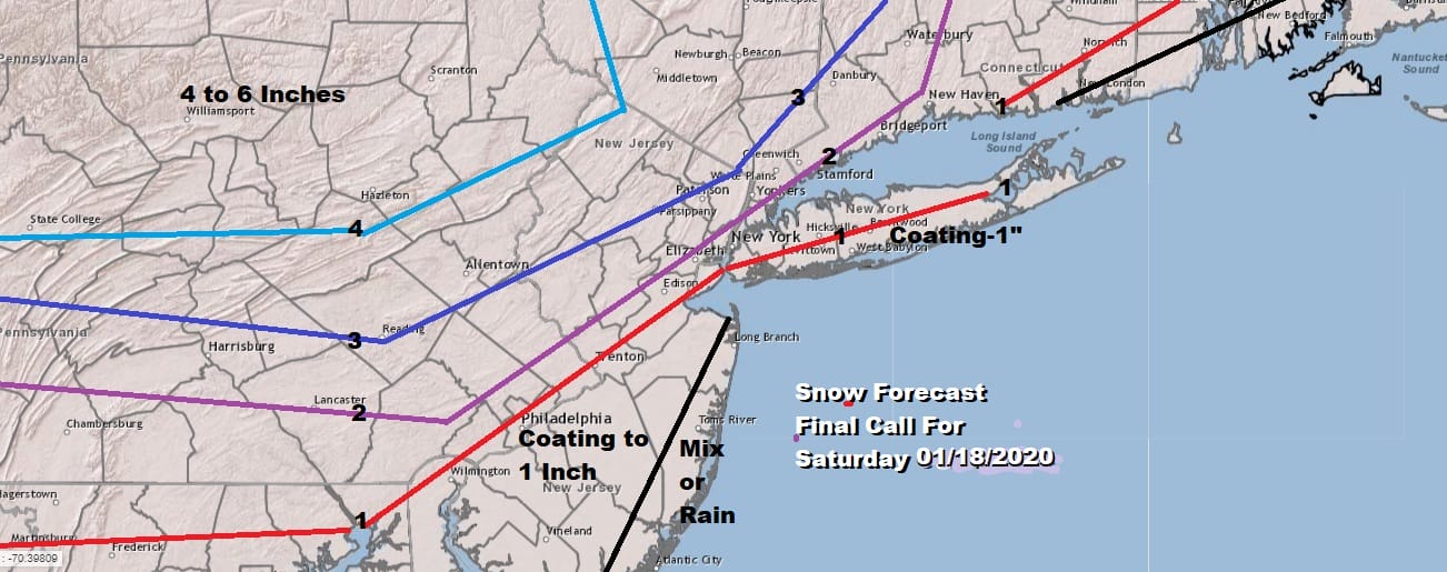
My reasoning is due to the nature of the precipitation as depicted on the radar views of the weather models this afternoon. While they show an area of snow approaching early in the afternoon there is a gap in between. Also there is the issue of dry air tonight into tomorrow morning that may cause some drying up of the precipitation. I will wait until tomorrow morning to see how the radars look. If they come in more impressive then I will nudge my amounts higher.
SATELLITE

In the meantime it was a very cold day today with highs just in the 20s and tonight will be very cold. Morning lows will be in the teens to single digits just about everywhere. Skies will be clear most of the night with clouds arriving tomorrow morning and thickening up rather quickly into the afternoon. There is nothing anywhere close on the radars at this time.
REGIONAL RADAR

Snow starts tomorrow around late morning in Eastern Pennsylvania reaching NYC around 1pm and eastern areas around 2 or 3pm. Note on the HRRR loop the gap that lies in between the first shot of snow and the second area to the west.
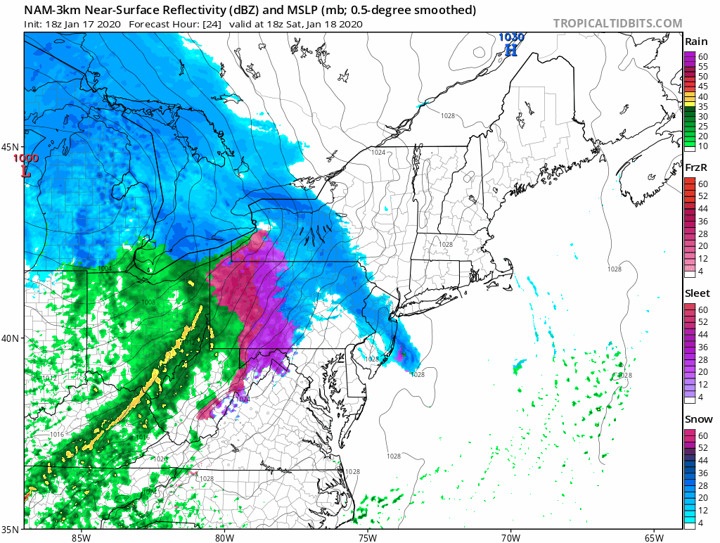
If the gap in between the two areas fills in faster then amounts could go higher however we are talking about 5 to 6 hours of snow here so I would think the upside is limited. Warm fronts are funny things in the winter time and sometimes they can surprise in a big way. Eyes will be on the radar presentation tomorrow morning as the final deciding factor. Snow changes to rain from southwest to northeast before it ends late in the evening. Sunday will be dry and breezy with some sunshine with highs in the 30s. Cold air will carry us through much of next week.
BE SURE TO DOWNLOAD THE FREE METEOROLOGIST JOE CIOFFI WEATHER APP &
ANGRY BEN’S FREE WEATHER APP “THE ANGRY WEATHERMAN!
MANY THANKS TO TROPICAL TIDBITS FOR THE USE OF MAPS
Please note that with regards to any severe weather, tropical storms, or hurricanes, should a storm be threatening, please consult your local National Weather Service office or your local government officials about what action you should be taking to protect life and property.


