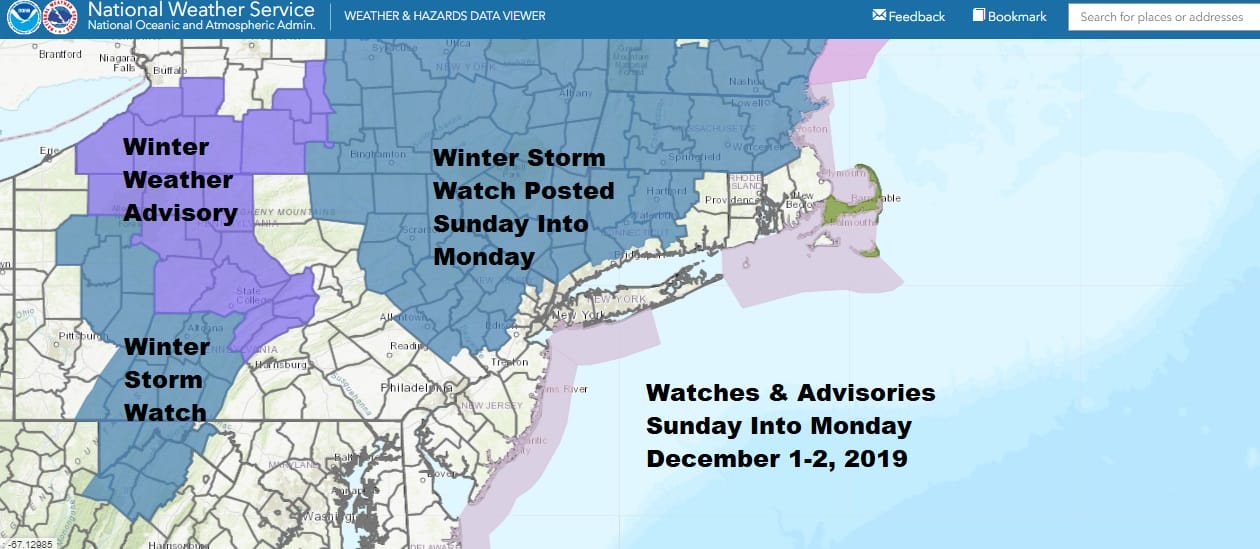
Winter Storm Watch Northern New Jersey, Much of Northeastern Pennsylvania North of Route 78, Catskills, Hudson Valley North of Route 287, and Northwest Connecticut. Counties in New Jersey include Sussex-Warren-Passaic-Morris-Hunterdon-Somerset
With the long holiday weekend and after going through all the afternoon weather models it is no shocker that the National Weather Service has opted for Winter Storm Watches for areas north and west of the coast. Winter Weather Advisories are also posted inland. More than likely we will see these areas expanded on Saturday as we draw closer to this two day storm system.
Two rounds of precipitation are expected. The first will be during Sunday morning gradually developing from west to east and moving northeastward as the day wears on. This is likely to produce a coating to a few inches with some icing issues likey in some areas.
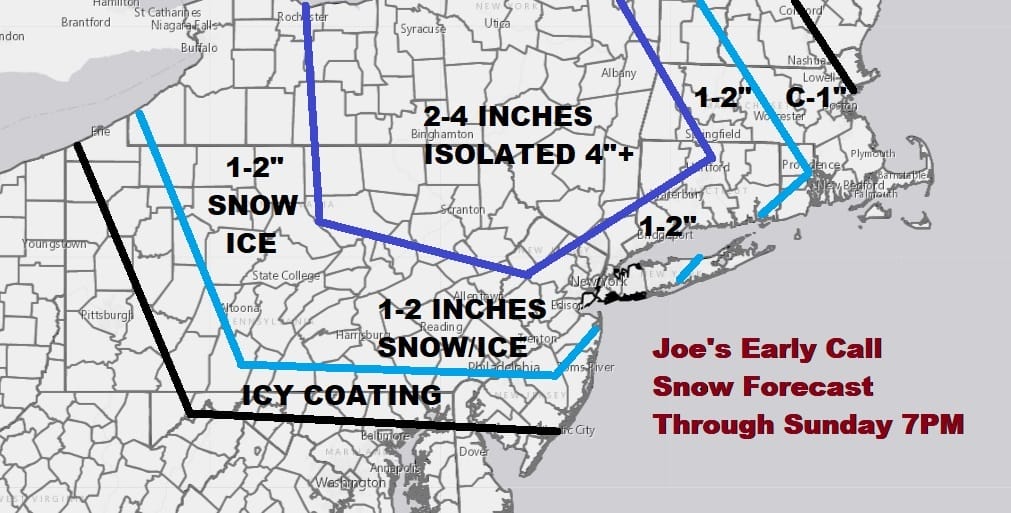
We are going to hold on to my original early call snow forecast for the time being. The northern areas north and northwest of NYC look okay. Some adjustments may need to be made in areas to the south. We opted for the cautious route here. The first round will be ending from southwest to northeast later Sunday afternoon and evening. Then we wait for a second round for Monday which could put down a more sizable accumualtion of snow or sleet changing over to snow.
SATELLITE

REGIONAL RADAR

There are no weather issues this evening or overnight to worry about as it will be a clear cold night with still a bit of a wind in play. Lows by morning will be in the 20s everywhere. Saturday look for some sunshine giving way to arriving high clouds with highs in the upper 30s and lower 40s.
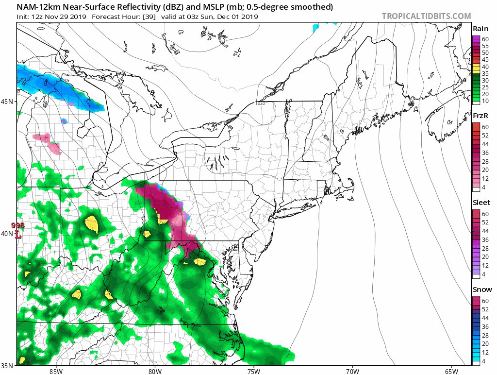
Part 1 begins Sunday morning with freezing rain sleet and then snow moving from west to east rather quickly. It is a relatively fast shot here of a coating to a couple of inches. Areas across Pennsylvania will have icing issues to deal with here while we see the late afternoon NAM model develop a rather solid area of snow on the front end that moves through. Also up to a couple of inches here with higher amounts as you head north.
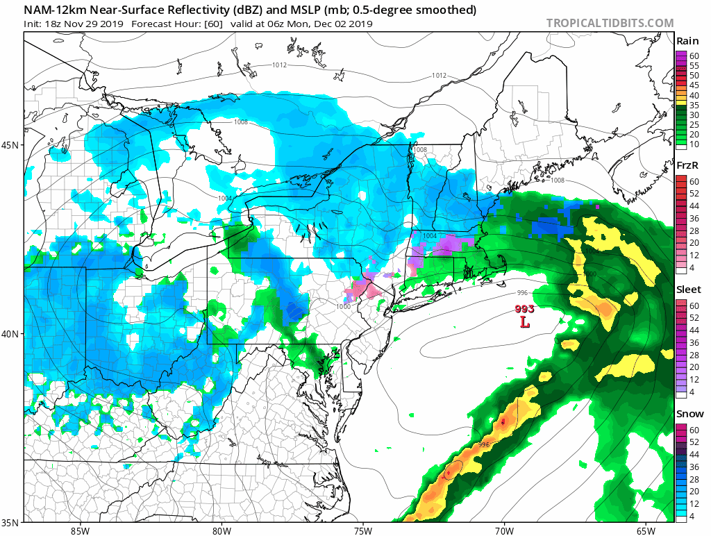
Round 2 comes on Monday as the low offshore intensifies and stalls out as a strong upper air storm moves overhead. This has to be watched closely as upper air lows can and have produced surprises in the past and sometimes in a big way.
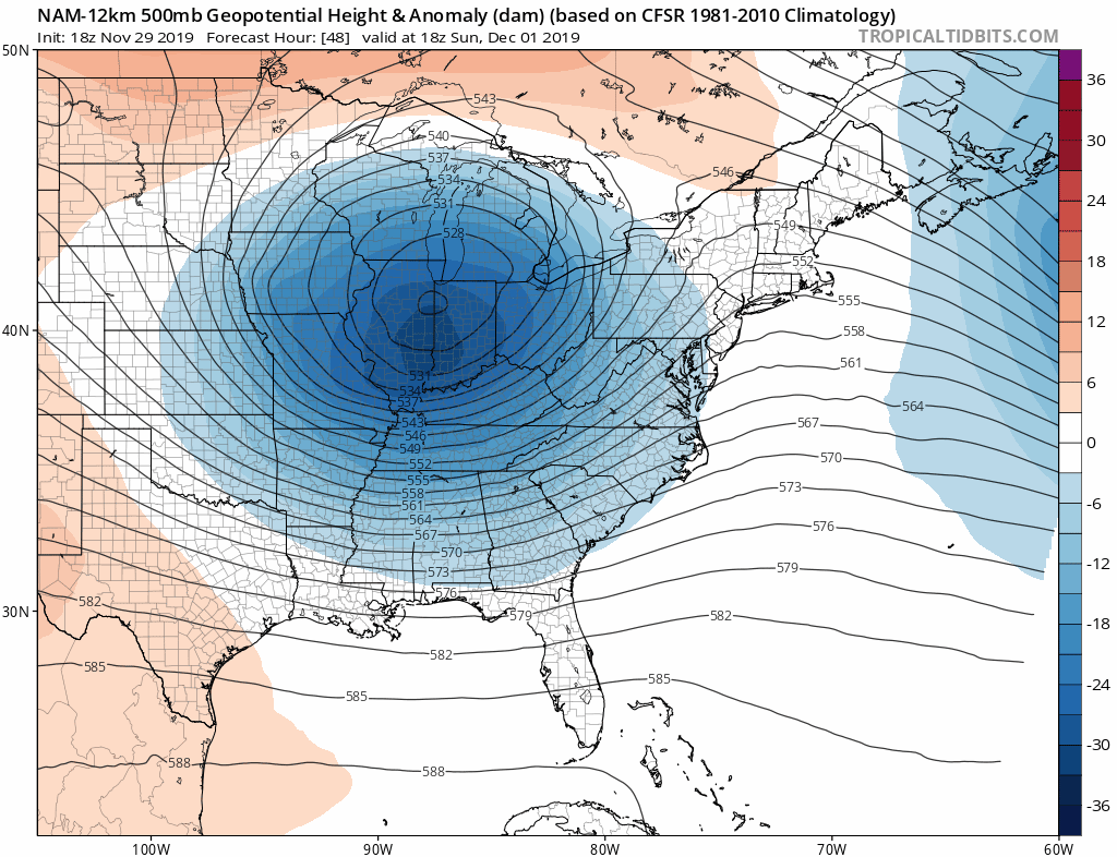
This is a very dynamic system aloft and often times we see heavy snow bands develop northwest of the track of the upper low. The track here is just offshore and very close to the surface low which becomes vertically stacked one on top of the other. We will be watching this factor closely over the weekend.

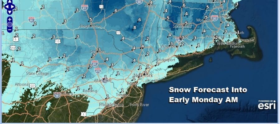
Here is the latest updated National Weather Service snow forecast map for much of the Northern Middle Atlantic States to New England. It only goes to early Monday morning and does not include what follows Monday afternoon into Monday night. Amounts have been raised somewhat over inland areas.

Ice will be a problem across much of Central Pennsylvania and even in parts of Southeastern Pennsylvania where up to a quarter of an inch of ice build up is possible in some areas. This is going to hinge on how much cold air wedges in from the northeast on Sunday.
App users can see the specific maps for all areas by scrolling down below.
BE SURE TO DOWNLOAD THE FREE METEOROLOGIST JOE CIOFFI WEATHER APP &
ANGRY BEN’S FREE WEATHER APP “THE ANGRY WEATHERMAN!
MANY THANKS TO TROPICAL TIDBITS FOR THE USE OF MAPS
Please note that with regards to any severe weather, tropical storms, or hurricanes, should a storm be threatening, please consult your local National Weather Service office or your local government officials about what action you should be taking to protect life and property.


