Winter Storm Warning Winter Weather Advisory Noreaster 3 Snow Forecast
Winter Storm Warning Winter Weather Advisory Noreaster 3 Snow Forecast
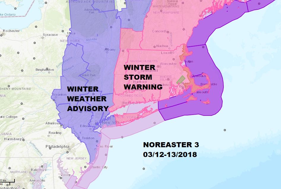
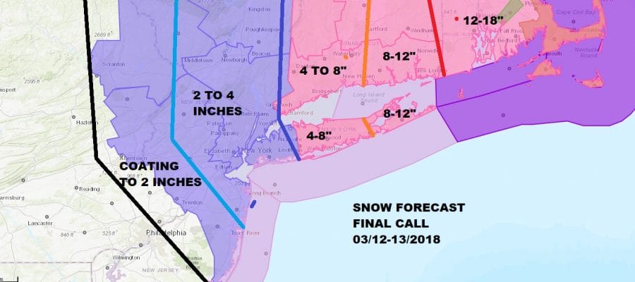
We have the outline of advisories and warnings. Weather models have been nudging eastward for the last couple of runs. Winter Storm Warnings will fly from Connecticut and Suffolk County on Long Island eastward while Winter Weather Advisories are up to the west from NYC to Northeastern Pennsylvania southward to Central New Jersey. Southern New Jersey and Southeastern Pennsylvania seem to be out of it at this point as the further east track limits snow on the southwest side. I have also come out with my snow forecast map final call.
JOE’S SNOW FORECAST MAP FINAL CALL
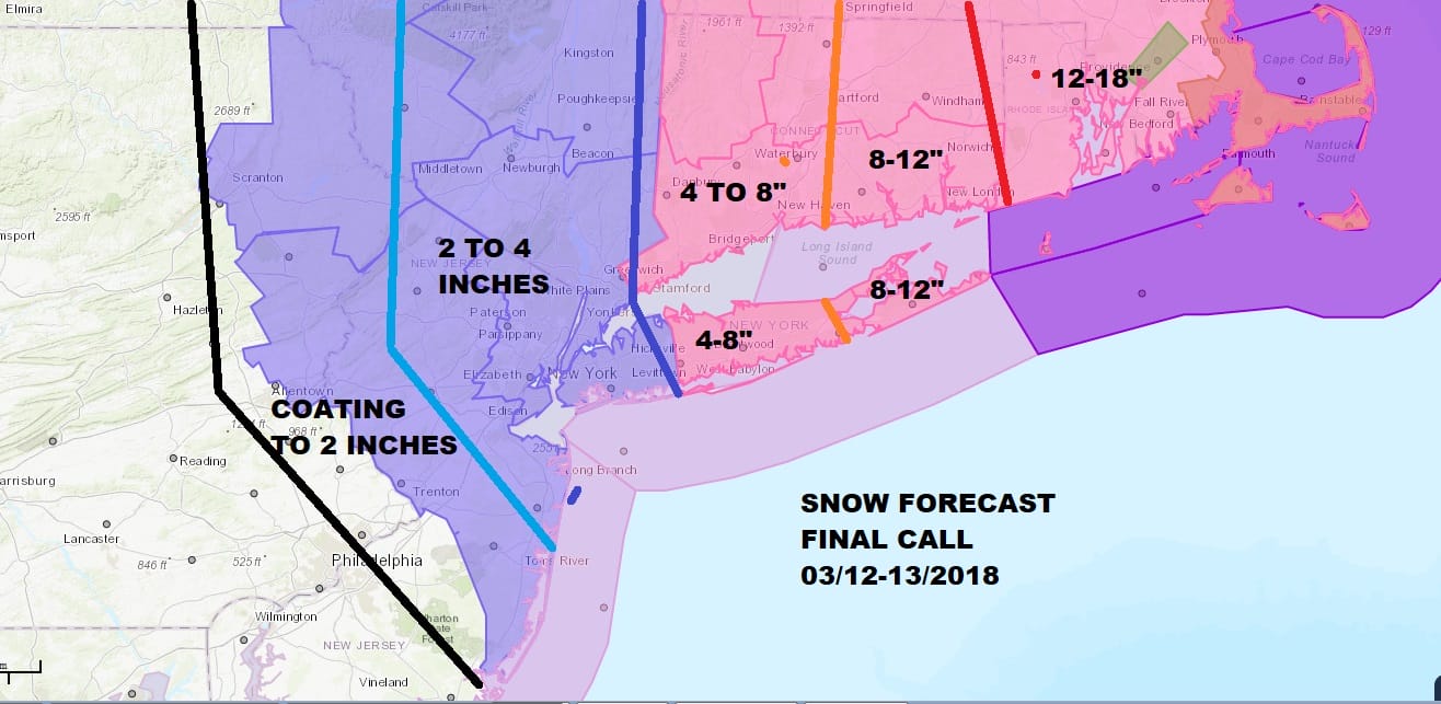
The highest amounts with this are to the east. Southeastern New England could see 12 to 18 inches out of this but amounts do tail off to the west and south.
This morning we can begin to see clouds arriving from the west as energy swings across the Tennessee Valley. The regional radar is beginning to load up to the south and west though nothing has come in range on the local radars at this time. Nothing should happen until tonight as the storm develops offshore and snow begins to back in from the southeast. Temperatures today will be in the 40s.
US SATELLITE

REGIONAL RADAR

LOCAL RADAR NEW YORK CITY

LOCAL RADAR PHILADELPHIA


Snow develops tonight and continues into the start of the morning commute. The back edge of the snow should be at about NYC around 8-9am and it should exit Eastern Long Island and Eastern Connecticut by early afternoon. To the west snow should end in Western and Central New Jersey around daybreak. Winds along the coast will be strong and gusty to 40 to 50 mph but the strongest winds will be offshore. Coastal flooding should not be a big problem this time around. Weather conditions begin to improve from west to east Tuesday afternoon and evening and it is back to sunshine on Wednesday with highs in the 40s.
NATIONAL WEATHER SERVICE SNOW FORECAST MAPS ARE POSTED AND UPDATED
 GET JOE A CIGAR IF YOU LIKE

FiOS1 News Weather Forecast For Long Island
FiOS1 News Weather Forecast For New Jersey
FiOS1 News Weather Forecast For Hudson Valley
NATIONAL WEATHER SERVICE SNOW FORECASTS
LATEST JOESTRADAMUS ON THE LONG RANGE
in


