Winter Storm Warning Tonight Thursday
Winter Storm Warning Tonight Thursday

Winter Storm Warning will go into effect tonight as we continue to watch the progress of a developing wave to the west. You can already begin to see the radar echos across the Midwest pushing eastward. Weather models overnight seem to have come into a general consensus on how this play out. This to me looks like a 5 to 8 inch snowstorm on average with some amounts above 8 inches across Connecticut and Long Island. The fast movement prevents this from becoming anything too major.
WINTER STORM WARNING JOE’S SNOW FORECAST MAP UPDATED
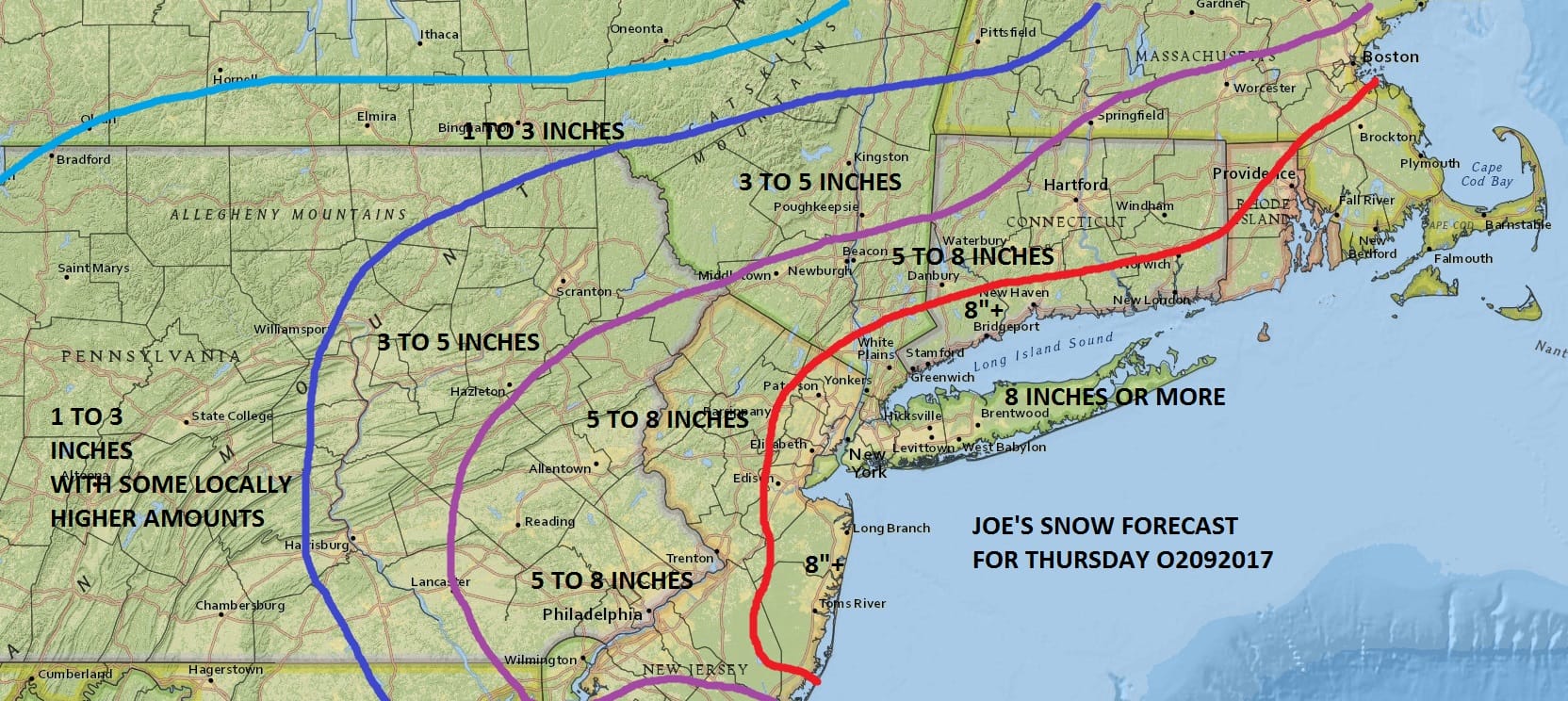
This is going to be in quick and out quick and there is a good chance we will see some thundersnow with this given the strong energy moving overhead and the tremendous lift and vertical motion being forecast by the models. Some places could see snow on the order of 2 to 3 inch an hour rates or more for a brief period of time. The prime time for all this will be from 4am to about 1pm before it ends from west to east. Areas to the east could last a little while longer before the low races to the northeast toward Nova Scotia.


After the storm clears temperatures will drop to the single digits and teens by Friday morning as cold air comes in behind this system Friday will be very cold with sunshine and arriving clouds later in the day. Highs just in the 20s to near 30. There could some some light snow or flurries Friday night as a warm front sets up to the south and the cold air mass pulls out. This should not amount to much if anything at all. Then we will see temperatures begin to rebound over the weekend with highs heading back into the 40s.
The maps below are the National Weather Service forecast snow maps with the most likely snowfall prediction.