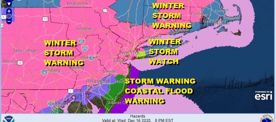
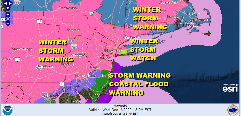
Winter Storm Warning Eastern Pennsylvania to Northern New Jersey,
NYC, Hudson Valley Parts of Long Island

Weather in 5/Joe & Joe Weather Show Latest Podcast
Winter Storm Warning Eastern Pennsylvania to Northern New Jersey,
NYC, Hudson Valley Parts of Long Island
Winter Storm Warnings have been issued now for the Hudson Valley, the remainder of Northern New Jersey and parts of Central New Jersey away from the ocean. Winter Storm Warnings are posted for Southern New England. NYC and Nassau County are also under a warning while Suffolk County remains under a Winter Storm Watch as is Southeastern New England.
Setting up this winter storm is cold air that has arrived today and you can feel it outside with temperatures today that didn’t get out of the mid to upper 30s. The satellite picture shows a mix of clear skies and some high clouds and most of tonight should at least be partially clear. Temperatures by morning will be in the teens to near 20 inland and lower 20s everywhere else.
SATELLITE

REGIONAL RADAR

Clouds thicken on Wednesday with temperatures struggling in the 20s most of the day. Snow develops in the afternoon from south to north, spreading across New Jersey and reaching NYC by sundown or shortly afterwards. For the New Jersey coastal counties especially east of the Garden State Parkway it will start mostly as rain.
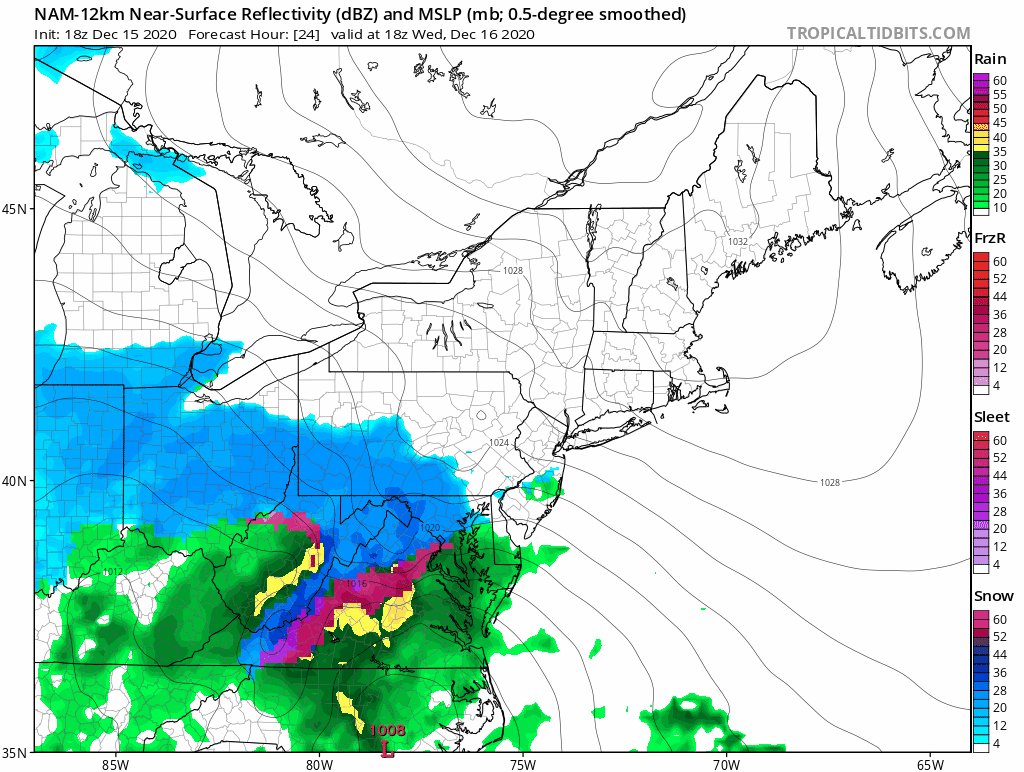
The issue is warm air aloft. Cold air at the surface will be very stubborn to leave, if it leaves at all. How much of that warm air intrudes is an issue for coastal areas from NYC eastward and perhaps even for inland areas. This will lead to a change over to sleet after a solid thumping of snow. The NAM model shows it clearly regarding the areas where this happens. Once the low pulls offshore winds will turn northerly and a change back to snow for several hours is likely Thursday morning.
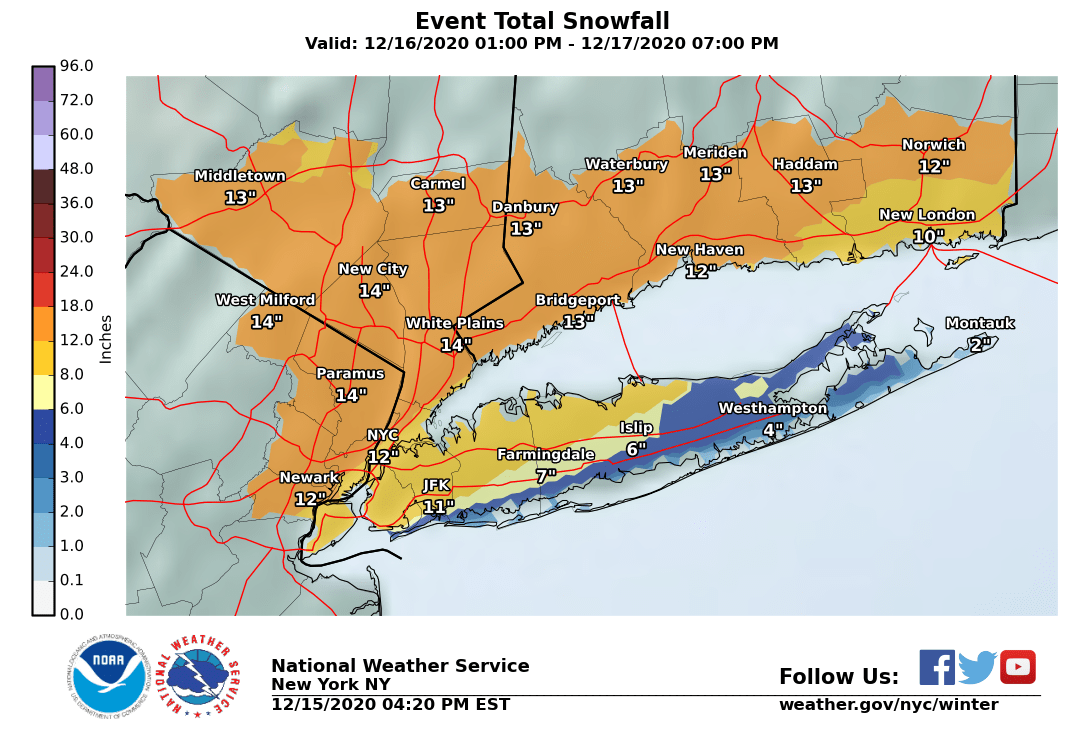
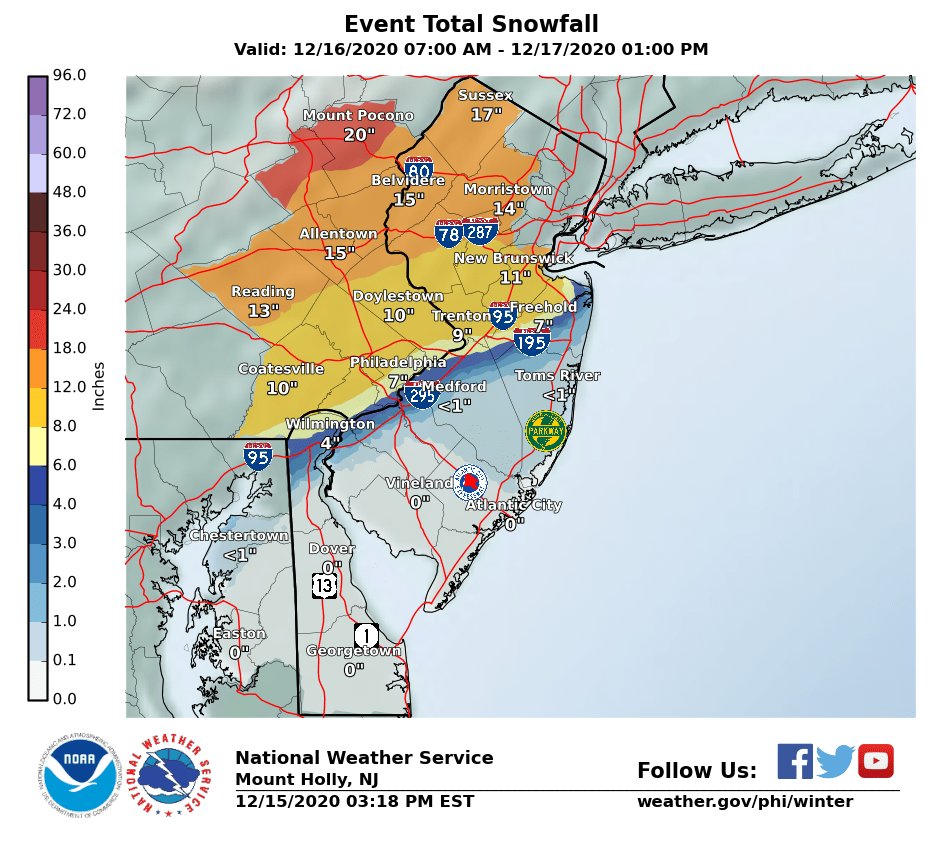
National Weather Service numbers have been lowered in coastal areas due to the sleet mixing issues that are likely to develop. Inland numbers remain robust with some places getting 12 inches or more. Some more adjustments in numbers are likely early Wednesday before the storm gets underway. Also we should mention that we have Coastal Flood Warnings and Storm Warnings in effect for the coast and coastal waters. Winds could gust to near 50 mph at the beaches Wednesday night as the low moves offshore.
My final call snow forecast is up on my weather platform on Patreon.
BE SURE TO DOWNLOAD THE FREE METEOROLOGIST JOE CIOFFI WEATHER APP &
ANGRY BEN’S FREE WEATHER APP “THE ANGRY WEATHERMAN!
MANY THANKS TO TROPICAL TIDBITS FOR THE USE OF MAPS
Please note that with regards to any severe weather, tropical storms, or hurricanes, should a storm be threatening, please consult your local National Weather Service office or your local government officials about what action you should be taking to protect life and property.


