
Winter Predictions: Pattern Change Looms
Over the last several days the GFS Ensemble Group among other forecast models has been showing the important North Atlantic Oscillation and the Atlantic Oscillation and the Atlantic Oscillation going negative. The ensemble is a group of GFS weather forecasting models. Each has a slightly different set of parameters in it which gives you a broad perspective of what the model is doing. Sometimes it can give an indication of something different from what the operational model does (the one you get to see). Today the ensembles show a strong negative trend developing in the index which is pointing to a pattern change beginning in about a week to 10 days. Now what that means in the longer term remains to be seen because there are other factors that are going to play into this as well.


Looking at these charts, they measure the index. When they go negative blocking is indicated. The red lines of both Oscillations turn downward after peaking in a few days. How far they get below the zero line is going to be the big question and how long they stay negative is going to be another big question we will have to answer. Also as we said before. The el nino hasn’t gone away. It is still going strong. Short term water temperature trends show that there has been another spike up in water temperatures after a strong downtrend developed in the important eastern zone near the coast of South America. This could be signs that the El Nino is heading for a secondary peak but we will have to keep an eye on this over the coming weeks.
Now with regards to this afternoon’s model runs I have to say I am decidedly underwhelmed at this point but it is hard to get specific beyond 10 days. The upper air look to me didn’t really excite me at this point.
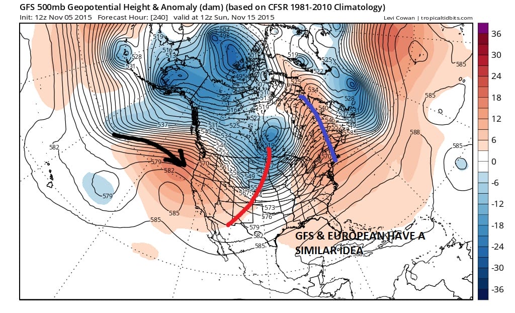

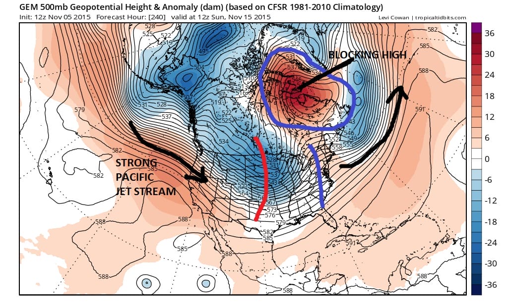
Of the three models out to day 10 which is when the NAO/AO begins to approach neutral and about to go negative, the GFS and European models are not that different. Both have a slightly colder look to the overall pattern. Nothing crazy here mind you but it is a cooler look. Still there are lots of issues regarding how cold air gets delivered. The coldest air remains cut off with the polar vortex in the Arctic north of Alaska. The Canadian has the “blockiest” look of the three as it develops an upper high over Greenland and migrates it westward. Assuming this trend is correct then we will continue to monitor future runs to see how all this evolves. I was not that impressed with the gfs beyond day 10 but that really doesn’t mean too much at this point. Again I’m not looking at specifics here but rather the overall flavor of the pattern beyond mid month. This is going to definitely be a work in progress.
Look back to my winter predictions when I issued my winter forecast back on Sunday, one of the key points that I made was that the season would experience much more variability than past winters. The NAO/AO oscillation is something that changes every few weeks so this may be the beginning of one of those variability periods that I am forecasting.