Winter 2016 Not Done Yet

If you think the winter is over with, think again. The mark of this winter has been the incredible volatility swinging from one extreme to another. Among all the swings in temperature and precipitation extremes, let’s add to that list the recent ride from below zero to temperatures in the 50s with an ice storm, heavy rains and thunderstorms. Longer range we are going to see a very short term relaxation for the rest of the week and the weekend but then the pattern flexes its muscles once again.
Winter 2016 not done yet European Model Late This Week
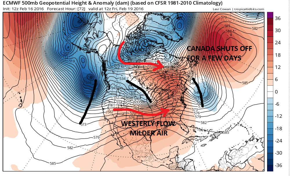
The European model shows the developing pattern very well. The jet stream relaxes as it likes to do from time to time. The cold flow from Canada shuts off late this week for a few days which allows a westerly flow of air to take over. This means milder air is coming for the east this weekend. Weather systems embedded in this flow look to be weak and other than some showers later on Saturday, the weather looks relatively quiet.
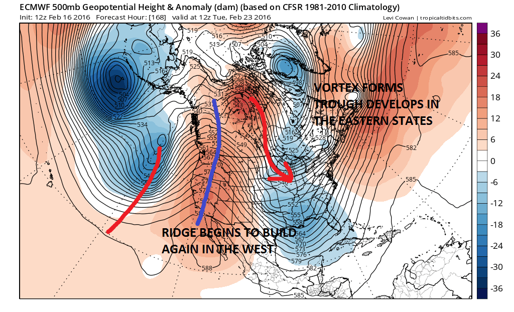
This relaxation however is only temporary as the pattern begins another realignment. The deep storms in the Pacific eventually force another big ridge to build in the west all the way up into Northwest Canada. By next Tuesday the stage is being set for storminess in the east yet again. A vortex forms in Northern Canada and cold air will begin to descend and spread out across the Great Lakes and Northeast.
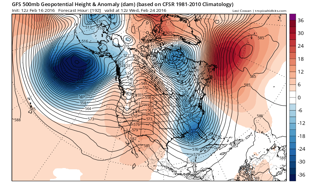
Winter 2016 not done yet European Vs GFS for Next Tuesday 02/23/2016
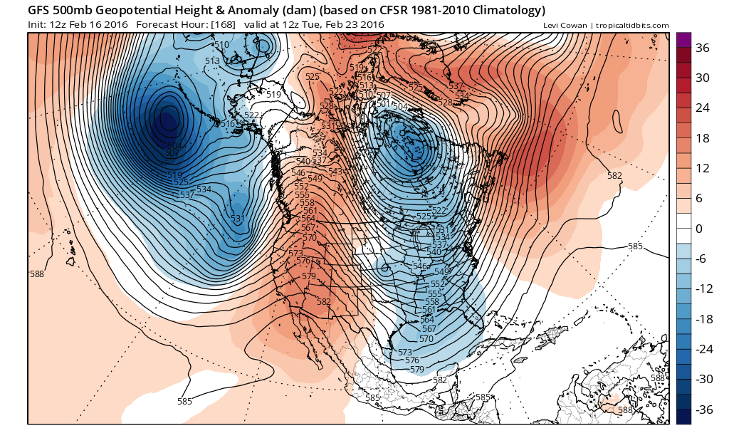
The GFS has a similar idea through hour 168 and actually has the same idea as the European going forward into the middle of next week. The difference is that today’s run has a much more dynamic look on the European for Wednesday and Thursday. The differences going forward from here is that the European drives the entire energy complex into the Ohio Valley while the GFS keeps things separate and less developed.
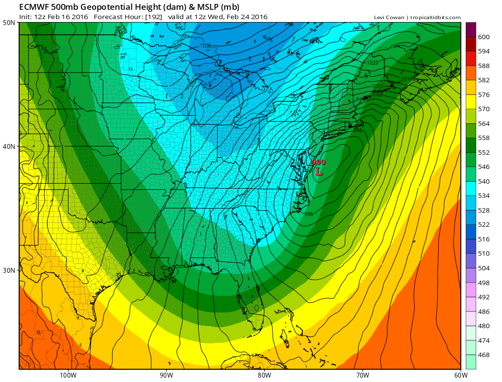
Winter 2016 not done yet European vs GFS 02/24/2016
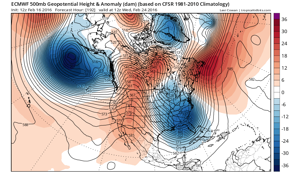
Both models develop a storm offshore with the European deepest and furthest left while the GFS keeps all the development offshore. You can see the upper air jet stream pattern in the different colors behind the surface overlay. The European has a very strong trough tilted from the Great Lakes to the southeast coast while the GFS is more progressive and not as deep. Clearly how the upper air evolves here is going to be key to whether another winter storm is going to set up for the Eastern United States next week.
Winter 2016 not done yet European vs GFS Surface Next Wednesday 02/24/2016

Ensembles of all models continue to flash storm signals of varying degrees but at this stage of the game, we are a week away and much can happen to support results in all sorts of directions. The key to this will be how dynamic the patter will be once this relaxation period ends over the weekend. Clearly winter 2016 not done yet
VIDEO ANALYSIS OF LONG RANGE GFS MODEL FROM 02172016
NATIONAL WEATHER SERVICE SNOW FORECASTS
LATEST JOESTRADAMUS ON THE LONG RANGE
Weather App

Winter is here! Don’t be without Meteorologist Joe Cioffi’s weather app. It is a complete weather app to suit your forecast needs. All the weather information you need is right on your phone. Android or I-phone, use it to keep track of all the latest weather information and forecasts. This weather app is also free of advertising so you don’t have to worry about security issues with your device. An accurate forecast and no worries that your device is being compromised.
Use it in conjunction with my website and my facebook and twitterand you have complete weather coverage of all the latest weather and the long range outlook. The website has been redone and upgraded. Its easy to use and everything is archived so you can see how well Joe does or doesn’t do when it comes to forecasts and outlooks.
Just click on the google play button or the apple store button on the sidebar for my app which is onMy Weather Concierge. Download the app for free. Subscribe to my forecasts on an ad free environment for just 99 cents a month.
Get my forecasts in the palm of your hand for less than the cost of a cup of Joe!
![]()