Wind Advisory Until Midnight Red Flag Warning Continues Monday
Bone Dry Conditions

Weather in 5/Joe & Joe Weather Show Latest Podcast
Wind Advisory Until Midnight Red Flag Warning Continues Monday Bone Dry Conditions
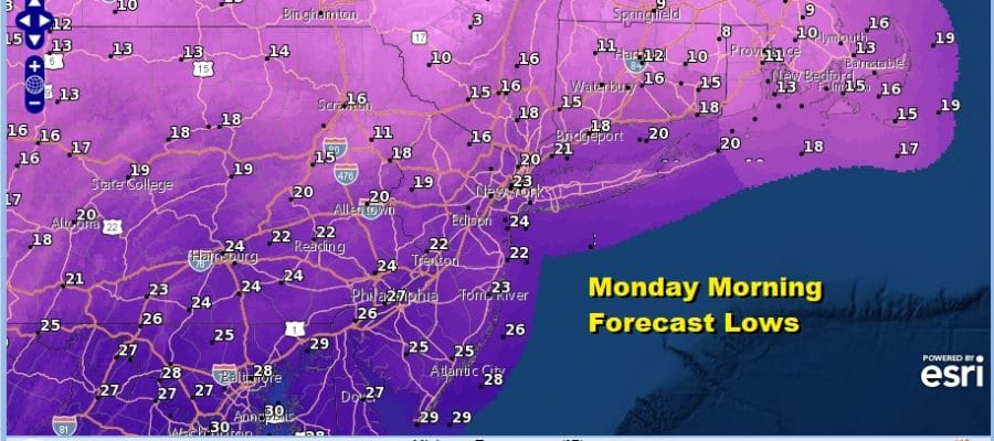
We continue to see wind advisories up until midnight in most places from Northern New Jersey to New England. An upper trough is moving through this evening. Some areas are seeing a few quick rain showers. Inland in Upstate NY some snow showers and snow squalls have been reported. The bottom line is we have a shot of harsh cold air with lows by morning in the mid teens to low 20s in most places. Wind chills will be in the single digits. Skies will clear overnight.
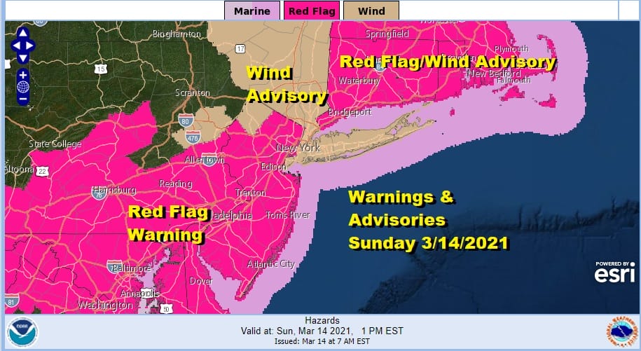
The red flag warning continues on Monday. Dew points are going to be in the low single digits to near zero Monday. Temperatures will top in the 30s. Some areas north and west of the coast and the big cities may have a tough time getting above freezing. This is certainly a very cold day for mid March.
SATELLITE

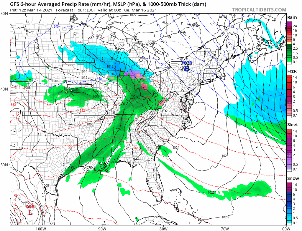
We are watching snow and rain showers on the regional radar moving southeast all as the upper trough moves through. There are a few heavier squalls in Upstate NY and New England. This should all wind down later this evening.
F5 WEATHER RADARS


Moving along through this week, the Colorado snowstorm reaches peak intensity this evening and will move east and rapidly weaken. Clouds will be here Tuesday and there could be a few rain or snow showers Tuesday night into Wednesday morning. I don’t think it amounts to much. Temperatures Tuesday will be just into the 40s in most places.
Wednesday looks quiet but cloudy as we wait for the next storm system. This one will not fall apart like the first one but it also will have some issues as it moves east. The flow from Canada is still strong and will attempt to suppress this southward. Some rain is likely Thursday but the northern flank doesn’t make it much further north than the lower Hudson Valley. There is the chance we could see a little snow on the northern flank Thursday night but if this happens it won’t amount to much from what I can see. Weather should improve later Friday and the weekend looks dry and on the chilly side of normal.
BE SURE TO DOWNLOAD THE FREE METEOROLOGIST JOE CIOFFI WEATHER APP &
ANGRY BEN’S FREE WEATHER APP “THE ANGRY WEATHERMAN!

MANY THANKS TO TROPICAL TIDBITS & F5 WEATHER FOR THE USE OF MAPS
Please note that with regards to any severe weather, tropical storms, or hurricanes, should a storm be threatening, please consult your local National Weather Service office or your local government officials about what action you should be taking to protect life and property.


