Wind Advisory Tonight Showers Thunderstorms Wet Snow Likely Wednesday

Wind Advisory Tonight Showers Thunderstorms Wet Snow Likely Wednesday
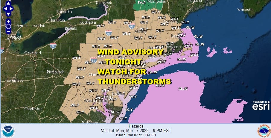
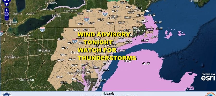
We have Wind Advisories up for tonight for all the area from Eastern Pennsylvania to Southern New England southward into Virginia which includes New Jersey. Delaware and Maryland. Gusts of 40 to 50 mph are likely as a cold front approaches and moves through.

Thanks to all the daytime heating that took temperatures to the mid and upper 70s from NYC south and west we have elevated severe weather risk with slight risk reaching up from Virginia into Northern New Jersey to NYC and a marginal risk to the north in New England. Temperatures are likely to rise east and northeast of NYC this evening as winds turn more southwest and this is the reason for the marginal risk area being indicated to the north. Wind is the primary issue with these thunderstorms.
SATELLITE

We are seeing showers and some heavier downpours developing around much of the area but the main line of thunderstorms is still in Western Pennsylvania and won’t arrive here until sometime tonight. You can expect that line sometime between 9pm and 11pm from west to east. Once the line passes and the cold front moves offshore, weather conditions will improve and lows by morning will be in the mid to upper 30s.
WEATHER RADAR

Tuesday will be significantly colder with some places seeing 30 degrees or more of temperature change from today. We will see some sunshine but most highs will be in the 40s. Then Tuesday night clouds will increase from the south as low pressure moves northward through the Carolinas. Lows will be in the low to mid 30s. Some wet snow/rain will develop before daybreak across Maryland and Southern Pennsylvania and then move northward.
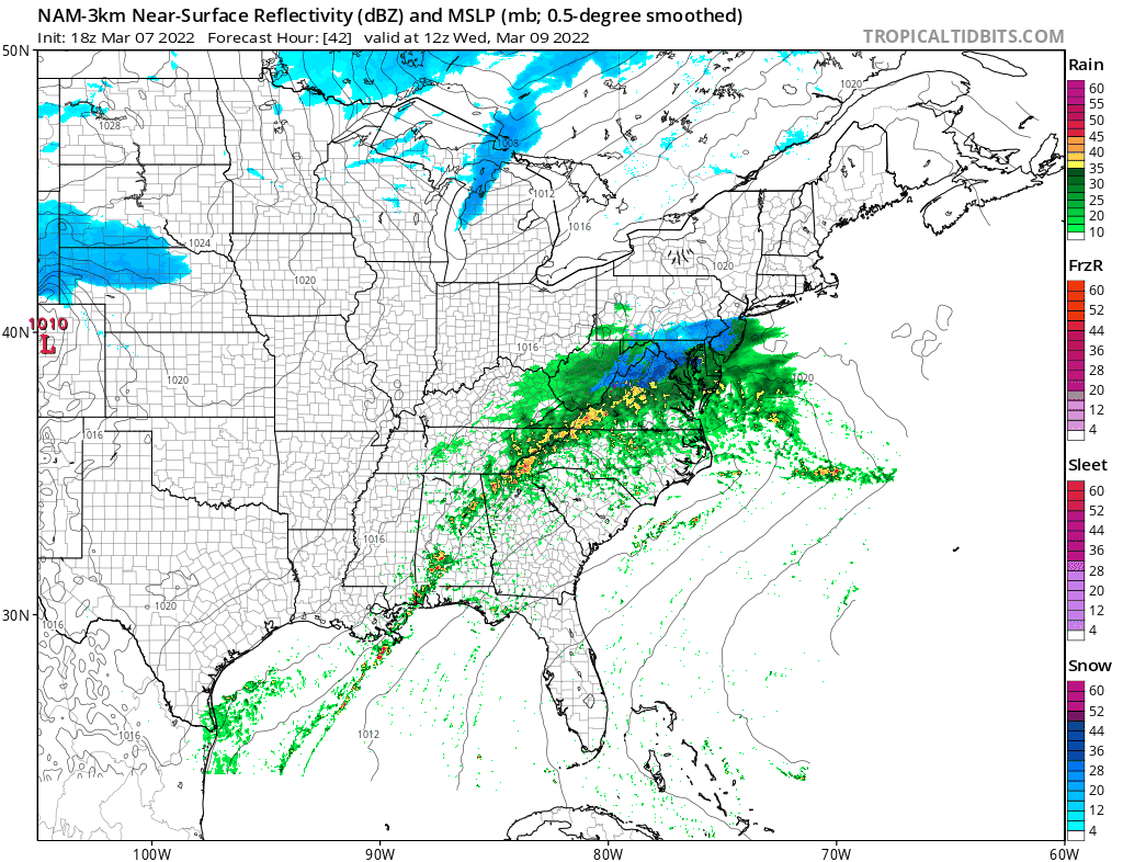
There are factors that will prevent this from becoming and issue. First off is that the snow will fall during the daytime. Second is the temperature profile with marginal cold air. We will see readings between 32 and 34 all day depending on intensity. As long as the snow falls with less than moderate intensity, paved surfaces should be okay and mostly wet. There might be a few inches that accumulates on colder surfaces especially in elevated areas. The sun angle helps the cause and keeps snow from accumuting. So in spite of some weather models showing several inches or more we will use these factors regarding our forecast. Above 1000 feet accumulations could be more significant. This all ends from west to east late afternoon and evening as the low moves away and we transition over to better weather Thursday into Friday before we deal with the next storm system
 Friday night into Saturday an arctic boundary will head east to the coast and low pressure developing on it will become a major storm as it heads up into New England. Rain will develop later Friday night and there is a chance that we could see a change to snow before it ends, especially inland. The bigger issue will likely be the wind Saturday into Sunday thanks to an extremely tight pressure gradient. Today’s models are still on course for this to happen and we could see another stretch where we deal with wind advisories and possibly high wind warnings. Model tracks were a little further east today and we will see if that continues over the next day or two as that will be the driver for a change to snow before it ends. Again wind will be the bigger issue with this. More on this and of course our current weather tonight on the Joe & Joe Weather Show at 7:30pm.
BE SURE TO DOWNLOAD THE FREE METEOROLOGIST JOE CIOFFI WEATHER APP &
ANGRY BEN’S FREE WEATHER APP “THE ANGRY WEATHERMAN!
MANY THANKS TO TROPICAL TIDBITS & F5 WEATHER FOR THE USE OF MAPS
Please note that with regards to any severe weather, tropical storms, or hurricanes, should a storm be threatening, please consult your local National Weather Service office or your local government officials about what action you should be taking to protect life and property.


