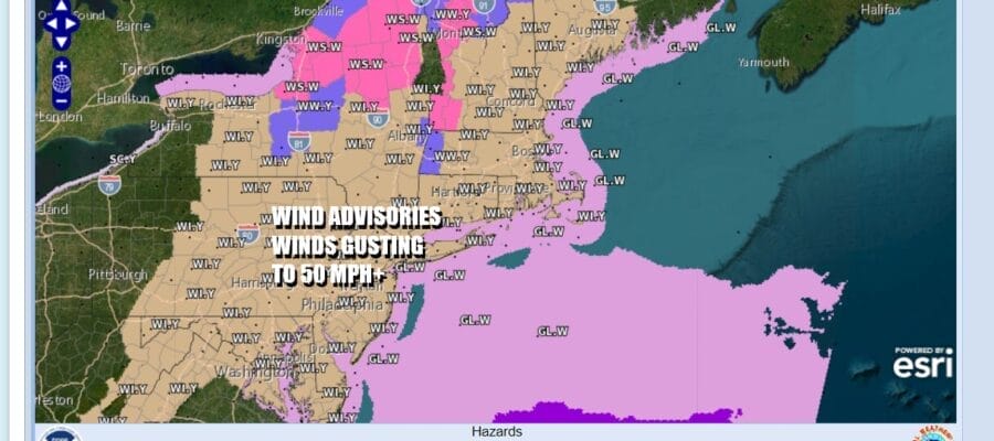
Wind Advisory Strong Winds Gusting to 50 mph
Warming Up Tuesday Through Friday

Wind Advisory Strong Winds Gusting to 50 mph
Warming Up Tuesday Through Friday

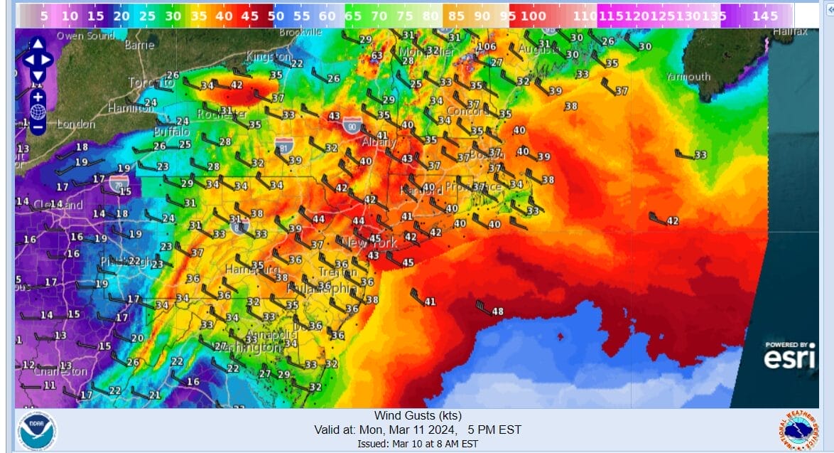
We are basically blow away today in a standard March windy day. Low pressure is spinning away in Atlantic Canada and we have high pressure to the southwest making for a very tight pressure gradient. Add to that cold air aloft and some daytime heating we are going to see strong winds. Wind Advisories are posted from Maryland northeast through New England. Winds from the northwest will be gusting to 50 mph or more with the peak winds from 11am to 6pm. Above we have the forecast gusts for 12noon and below for 5pm
Once the daytime heating shuts off, winds will start to slowly ease overnight but it will still be rather windy for while. Meanwhile today we are looking at clouds and some sunshine. We are on the western edge of the circulation of this storm offshore. There is still some snow going on in parts of Upstate NY and Northern New England and we still some areas under Winter Storm Warnings and Winter Weather advisories.

As far as temperatures are concerned, the air is cold aloft but it is not all that cold at the surface. Highs this afternoon will be mostly in the upper 40s and lower 50s which is about where we should be for this time of the year. Look for cloud cover decrease and the amount of sunshine to slowly increase as the day goes on though clouds will still be on the stubborn side to the east of NYC.
SATELLITE WITH LIGHTNING STRIKES

WEATHER RADAR

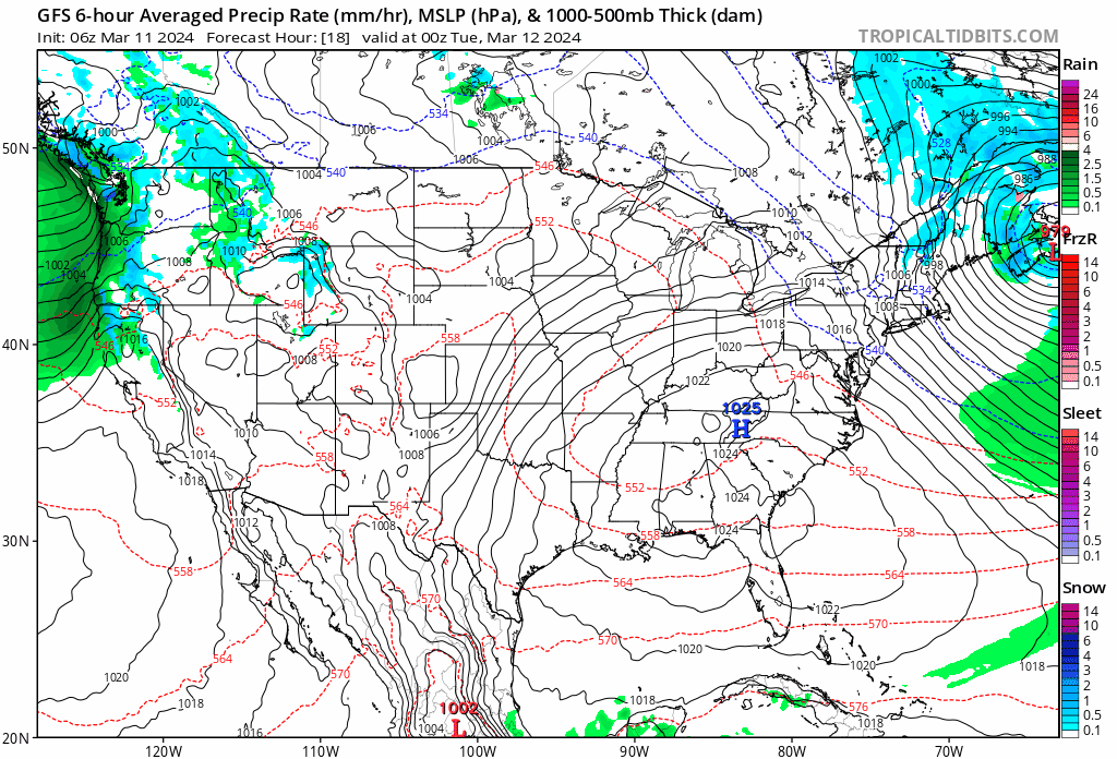
This is fast regarding the coldest air moving out as well as the oceans storm moving away. There is no cold air to speak of anywhere and in fact we see lots of warmer air coming into the Mississippi and Ohio Valley as well as the Southern US beginning today and that warmer air spreads to the Eastern US rather fast. Skies will be clear tonight with most lows will be in the 30s.
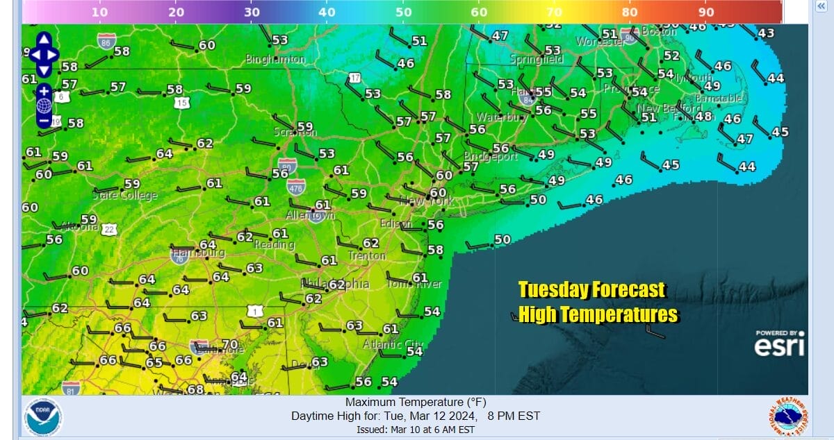 Tuesday we will see temperatures bounce rapidly higher and with a west or northwest wind still hanging on, we will have sunshine taking highs into the upper 50s and lower 60s just about everywhere including the coast. It might still be a bit breezy early in the day but winds should continue to slowly drop off. The warm up continues Wednesday.
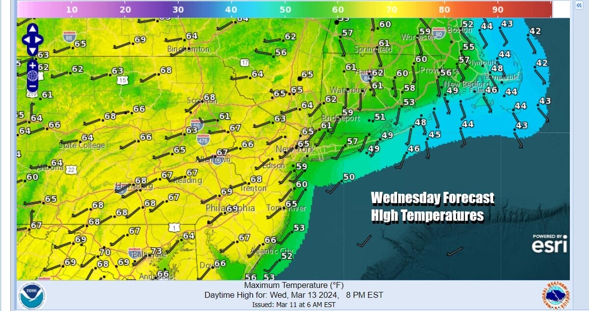
Wednesday temperatures depending on the wind direction, should reach the mid to upper 60s and even some lower 70s are not impossible in warmer posts to the west and south of the coast as long as we have a fair amount of sunshine. This is a time of year where we can see temperatures moving higher than advertised. New England and Long Island should make it into the 60s away from the ocean. Thursday we will have more of a south wind so highs could reach 70 or better inland but it will be cooler from NYC east as well as south and east facing shore lines.
As far as rain is concerned we are getting a much deserved break from the endless parade of storm systems, at least for most of this week. Later in the week we energy from a storm in the Western US coming east across the Plains and then east from there. Rain and severe weather will likely spread from the Southern Plains eastward but not until late Thursday into Friday. We could see a cold front and some wave development late Friday into early Saturday bringing a shot of rain in, however as long as everything moves along, we should see improving weather over the weekend.
BE SURE TO DOWNLOAD THE FREE METEOROLOGIST JOE CIOFFI WEATHER APP &
ANGRY BEN’S FREE WEATHER APP “THE ANGRY WEATHERMAN!
MANY THANKS TO TROPICAL TIDBITS FOR THE USE OF MAPS
Please note that with regards to any severe weather, tropical storms, or hurricanes, should a storm be threatening, please consult your local National Weather Service office or your local government officials about what action you should be taking to protect life and property.
(Amazon is an affilate of Meteorologist Joe Cioffi & earns commissions on sales.)


