
Wind Advisory Overnight

There is a Wind Advisory Overnight & Tuesday for our entire area. We will see northwest winds increasing to 20 to 30 mph with some gusts into the 40s. Satellite loop shows low pressure moving out of the Eastern Great Lakes and into Northern New England. Dry air is rapidly sweeping in from the west and that should clear out the clouds in short order. Temperatures will drop into the 30s tonight but the wind will make it feel like it is in the 20s.
Wind Advisory Overnight NAM MODEL OVERNIGHT
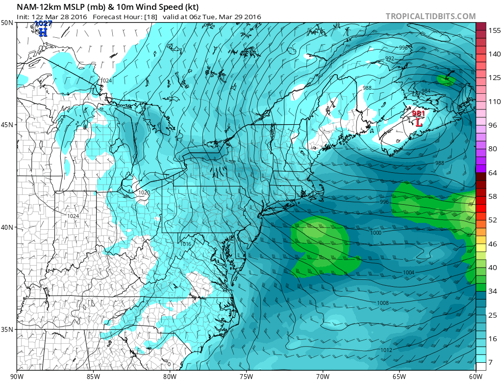
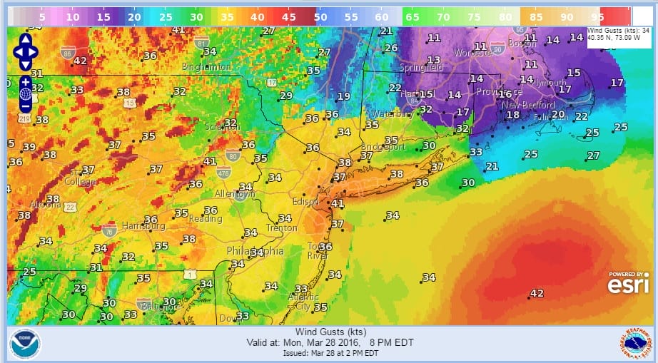
The NAM model isn’t overally strong on the sustained wind forecast but given the time of year it always winds up a little windier. Gusts might be strong enough to take down a few branches and the odd dead tree here and there. Im not overly concerned about this. The map below shows forecast wind gusts and some areas will reach the 40 mph range.
Wind Advisory Overnight FORECAST WIND GUSTS OVERNIGHT
At least everything seems to be moving along and the next 2 days we will be in a nice dry air mass which will mean plenty of sunshine with just some passing clouds. Temperatures however will be in the cool side with highs just in the low to mid 50s. Some inland areas will probably struggle to get back to 50.
Wind Advisory Overnight Satellite Loop

Wind Advisory Overnight Local Radar Loops


Radars will be calming down and clearing out. No rain is forecast until late Thursday when clouds and showers will arrive late in the day. Highs Thursday will be at least in the 60s with some highs approaching 70. More showers are possible Friday and then it turns much colder over the weekend as Canada delivers a cold air mass into the Midwest and Northeast. More on this on my long range outlook later today.
FiOS1 News Weather Forecast For Long Island
FiOS1 News Weather Forecast For New Jersey
FiOS1 News Weather Forecast For Hudson Valley
NATIONAL WEATHER SERVICE SNOW FORECASTS
LATEST JOESTRADAMUS ON THE LONG RANGE
Weather App

Don’t be without Meteorologist Joe Cioffi’s weather app. It is really a meteorologist app because you get my forecasts and my analysis and not some automated computer generated forecast based on the GFS model. This is why your app forecast changes every 6 hours. It is model driven with no human input at all. It gives you an icon, a temperature and no insight whatsoever.
It is a complete weather app to suit your forecast needs. All the weather information you need is right on your phone. Android or I-phone, use it to keep track of all the latest weather information and forecasts. This weather app is also free of advertising so you don’t have to worry about security issues with your device. An accurate forecast and no worries that your device is being compromised.
Use it in conjunction with my website and my facebook and twitter and you have complete weather coverage of all the latest weather and the long range outlook. The website has been redone and upgraded. Its easy to use and everything is archived so you can see how well Joe does or doesn’t do when it comes to forecasts and outlooks.
Just click on the google play button or the apple store button on the sidebar for my app which is on My Weather Concierge. Download the app for free. Subscribe to my forecasts on an ad free environment for just 99 cents a month.
Get my forecasts in the palm of your hand for less than the cost of a cup of Joe!
![]()
![]()

MENTION JOE CIOFFI AND GET A 5% DISCOUNT
1c4b9d53297bb795ded2e510a2f8fe684691992e134bd1cf84


