Wind Advisory Colder Air Arriving New Week Begins Cold

Weather in 5/Joe & Joe Weather Show Latest Podcast
Wind Advisory Colder Air Arriving New Week Begins Cold
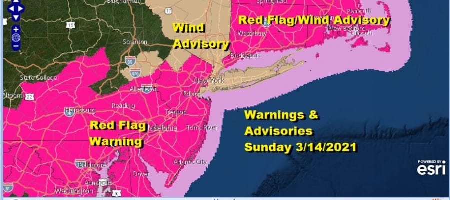
Another cold front is moving through today as a strong cold high from Eastern Canada builds into the Northeast for the next few days. A wind advisory is posted from Northern New Jersey to Upstate NY, Southern New England, NYC, and Long Island.
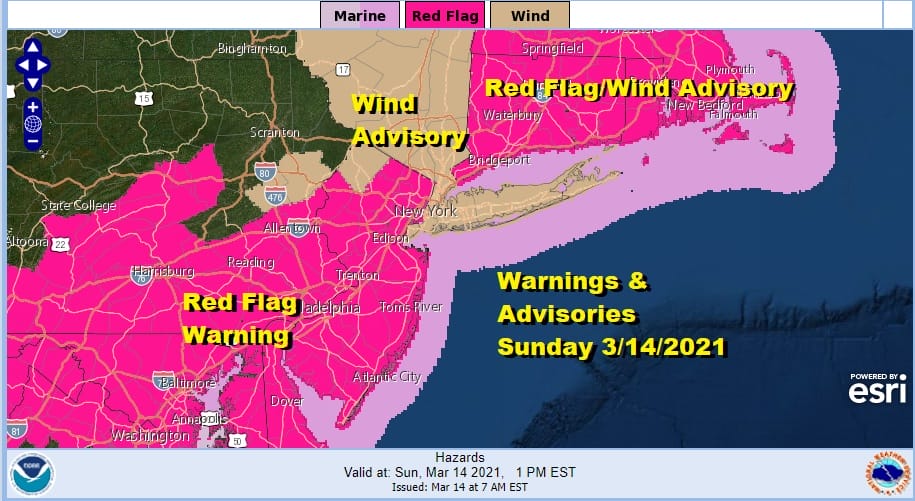
In addition we have a Red Flag Warning in effect due to the very dry conditions with very low humidity. This increases the risk for brush fires to develop so be extra cautious outdoors with any flammable materials. Winds will gust 40 to 50 mph at times through this afternoon and into tonight. We will see sunshine today but temperatures will top in the upper 40s and lower 50s and then ease some later in the day.
SATELLITE

There isn’t much going on regarding the Eastern US satellite view and the regional radars are mostly on the quiet side save for a few snow showers in parts of upstate NY and New England.
F5 WEATHER RADARS


Get ready for a very cold night ahead under clear skies and gusty winds. By Monday most lows will be in the upper teens to lower 20s. Add the winds to the equation and we are talking wind chills in the single digits.
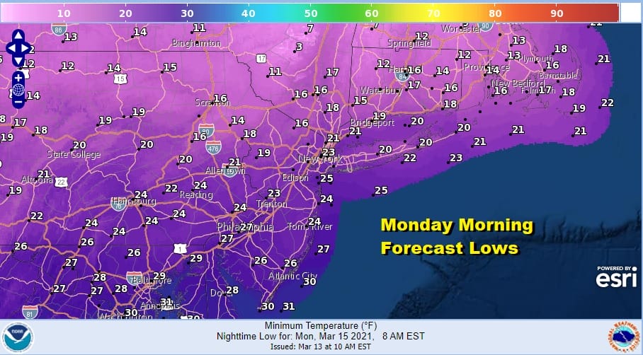
Monday is going to be a cold day indeed with sunshine but many areas will not be getting out of the 30s. Some places north of NYC will have a tough time getting above freezing while from Philadelphia and Southern New Jersey south and west we could see highs reach into the lower 40s. Either way it is a cold day for mid March with temperatures 5 to 10 degrees below average.
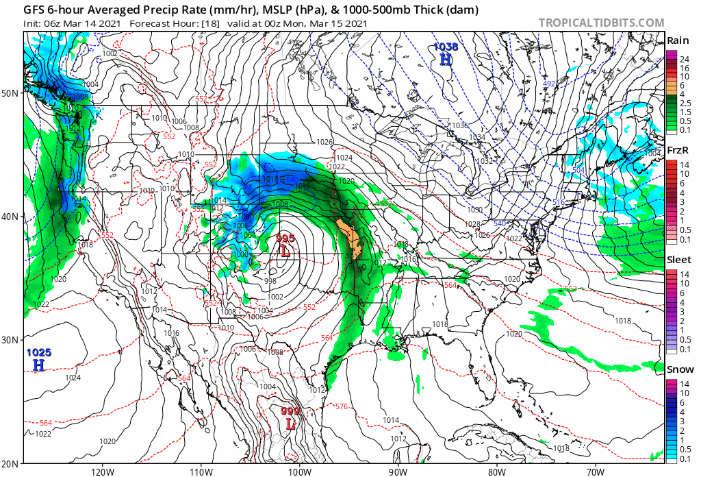
Two weather systems lie in waiting for this week. The first one is the major snow storm going on today in parts of the Central Rockies. That moves east and it weakens rather quickly as it approaches us on Tuesday. We will have lots of clouds with temperatures reaching the low and mid 40s. There could be a few scattered rain or snow showers Tuesday night but this lead system is going to fall apart due to a strong trough to the east suppressing this storm. The second one approaches Thursday and another cold high builds to our north. Wednesday will be dry but then look for a cold raw rainy Thursday into Thursday night as the low passes to our south. Dry chilly conditions will be with us Friday and into next weekend as spring arrives.
BE SURE TO DOWNLOAD THE FREE METEOROLOGIST JOE CIOFFI WEATHER APP &
ANGRY BEN’S FREE WEATHER APP “THE ANGRY WEATHERMAN!

MANY THANKS TO TROPICAL TIDBITS & F5 WEATHER FOR THE USE OF MAPS
Please note that with regards to any severe weather, tropical storms, or hurricanes, should a storm be threatening, please consult your local National Weather Service office or your local government officials about what action you should be taking to protect life and property.


