DOWNLOAD MY NEW FREE JOESTRADAMUS WEATHER APP FOR ANDROID
THE APP IS ABSOLUTELY FREE TO ALL BUT CONSIDERING SUBSCRIBING TO PATREON FOR A WEATHER EXPERIENCE FREE OF ADS, EXCLUSIVE VIDEOS FOR MEMBERS ONLY AND MUCH MORE…STARTS AT $2 A MONTH..MESSAGE ME AT ANY TIME

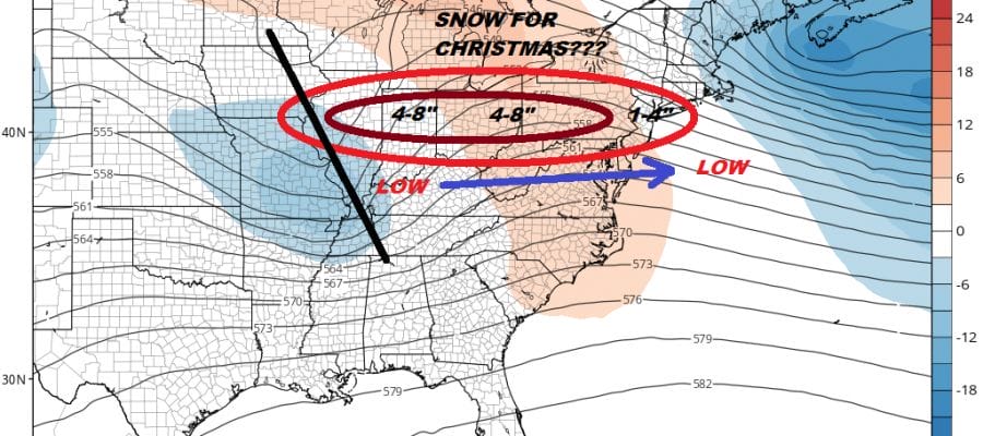
White Christmas European Model
Once we get beyond Friday’s storm we will be calming down this weekend and next week would start out dry and cold. Christmas Eve and Christmas Day would be two nice days with seasonal temperatures and nothing more than the outside chance of perhaps a few flurries Sunday night into Monday morning. However for the last 5 days the European model has been juggling around several disturbances in the upper atmosphere that the other models are doing nothing with. Today’s model run is insistent that snow could be here later in the day on Christmas.
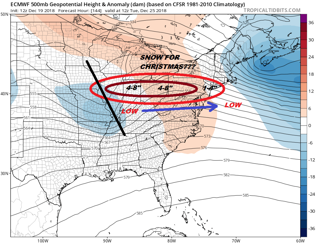
Today’s European model has a disturbance Tuesday morning sitting in Western Illinois to Western Tennessee. This would create a band of snow from the Illinois to New Jersey. Heavier snow would fall from Western Pennsylvania westward as the model does weaken this system somewhat as it heads to the coast.
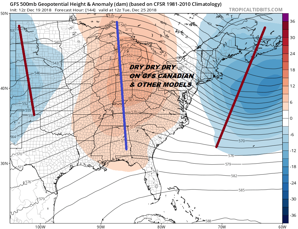
The problem is not only that we have no other model even remotely showing what the European has, we have models actually doing exactly the opposite. The GFS model for instance has no system at all. It doesn’t even have a hint of it. Where the European has a short wave trough and a surface low with a cold high across Southern Canada wrapping around it, The GFS has nothing but high pressure and dry air!

All we can do at the moment is shrug our shoulders. The European seems to be picking up on all sorts of energy running around in the upper atmosphere which the other models either don’t see it or are just wiping them out before they cause any trouble. It would be nice if we had another model showing some support here so we remain doubtful about all this until we see some confirmation. Since it is for Christmas it would nice to see a light snowfall on Christmas Day so from that angle I remain hopeful.
MANY THANKS TO TROPICAL TIDBITS FOR THE USE OF MAPS
Please note that with regards to any tropical storms or hurricanes, should a storm be threatening, please consult your local National Weather Service office or your local government officials about what action you should be taking to protect life and property.