Weekend Sunshine Next Storm Mainly Offshore
Weekend Sunshine Next Storm Mainly Offshore
We are starting out the weekend pretty much the same way we finished yesterday with a storm sitting over Nova Scotia & New Foundland and a northwest flow chilly unstable air. We think that we will see clouds develop at some point today but it should be no worse than partly sunny. There are some snow showers on the regional radars while on the local radars they are quiet this morning. Snow showers have been running around the last few days. They should be few and far between today.
US SATELLITE

REGIONAL RADAR

LOCAL RADAR NEW YORK CITY

LOCAL RADAR PHILADELPHIA


Temperatures are going to be chilly for this time of year with highs generally in the low to mid 40s. Skies will be clear tonight with lows in the mid 20s to lower 30s. Sunday looks nice and sunny with highs in the 40s. Then we look south as the next (and hopefully) last in a series of storms comes out of the Gulf States and attempts a move up the East Coast.
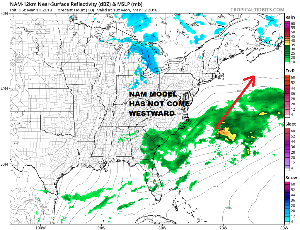
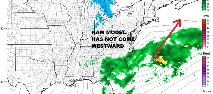
Overnight weather models didnt come back west very much though a few are still holding on to the chance of something Monday night into Tuesday for coastal areas. The upper air trough could also produce a few snowers inland on Tuesday as it maneuvers through. Right now this does not look as if a third noreaster is pending and even if it does come closer, its main impacts will be along the immediate coast and not very far inland. We will see if this offshore trend continies later today. Meanwhile enjoy the weekend.
 GET JOE A CIGAR IF YOU LIKE

FiOS1 News Weather Forecast For Long Island
FiOS1 News Weather Forecast For New Jersey
FiOS1 News Weather Forecast For Hudson Valley
NATIONAL WEATHER SERVICE SNOW FORECASTS
LATEST JOESTRADAMUS ON THE LONG RANGE


